Very important video this morning as we focus on 2 storm systems in the next 5-6 days…both posing a severe weather threat. Plus, another one behind it next week. Besides the severe threat, the best news is the potential rain. We need it. I will walk you through the time line of the twin storm systems, plus the latest outlooks from the Storm Prediction Center, and more. It’s a very interesting edition of your Wednesday morning personal weather briefing.
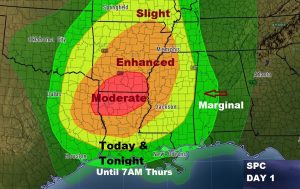
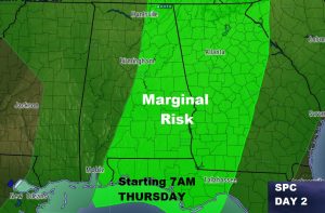
Significant severe weather threat in the lower Mississippi valley today, spreading eastward to west Alabama late tonight. The Day 2 severe weather outlook, picks up with the severe weather threat, starting at 7AM, covering much of east and southeast Alabama.
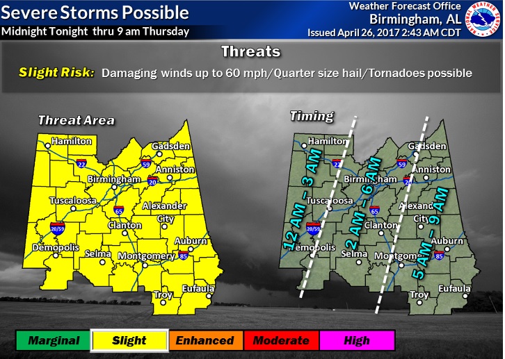
Time line shows the severe threat through the very early morning hour of Thursday, as the line of storms moves eastward. Although damaging winds is the main threat, tornadoes can not be ruled out.
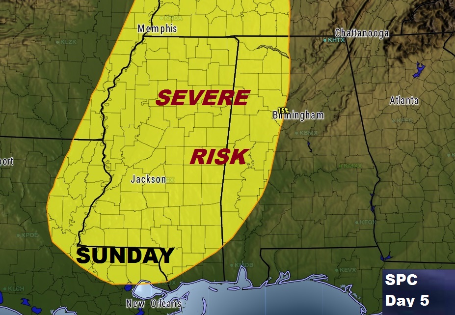
The nest Severe Risk arrives late Sunday/Sunday night as a potent storm system begins affecting Alabama. It’s certainly possible this will be a more potent severe weather threat to the state.
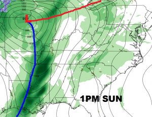
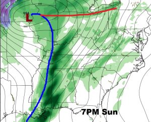
Even this far out, the Storm Prediction Center has extended a severe weather risk into west Alabama for Sunday. It’s likely this will have to be extended eastward.
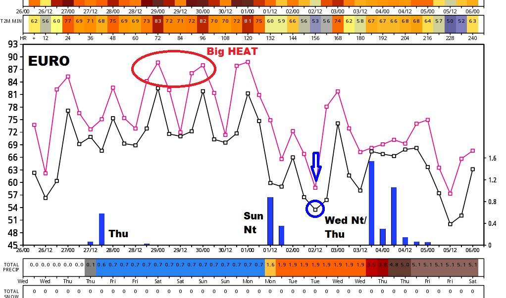
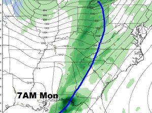
The BEST news about these storm systems involved the potential for some decent rainfall totals.
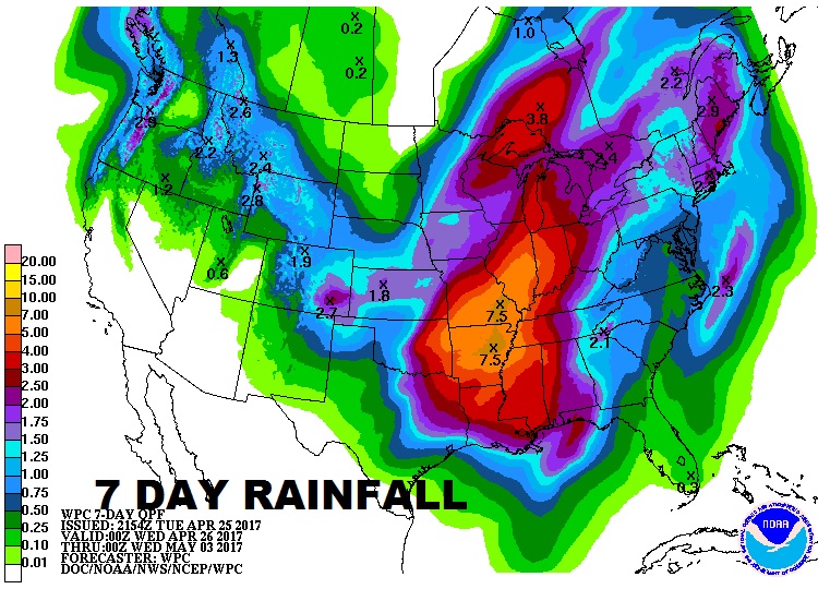
Maybe a third storm system by the middle of next week.