May the Fourth Be With You. Early morning widespread soaking rain.. But, later this afternoon, ahead of the strong cold front, a line of storms will develop, with maybe some stronger storms. I have the updated severe risk from SPC and future radar. And, get ready. Dramatically cooler air will rush in behind the front. You’ll need jackets at times next few days, especially nights and mornings. I have the updated numbers for the weekend, plus a look at Talladega and the Beach outlook.
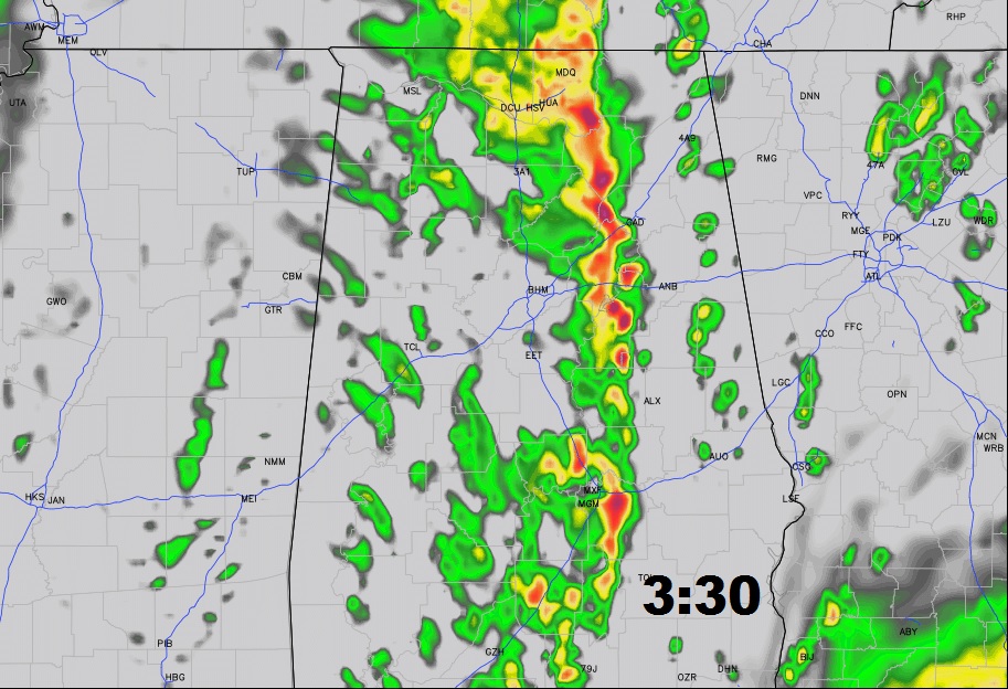
After the morning rain shield, a line of thunderstorms will re-develop early this afternoon and move eastward. Here’s a future radar snapshot. Some models are quicker on the timing of the line with an earlier arrival.

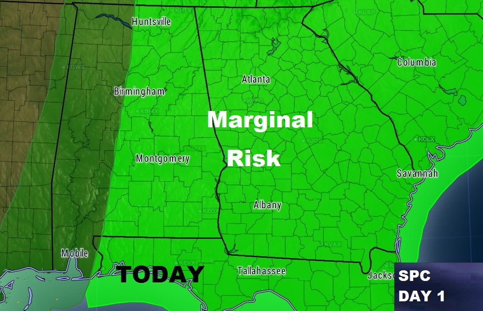
The Storm Prediction Center says it’s possible some storms in the line could reach severe limits. They have a Marginal Severe Risk for a large section of east and Central Alabama today.

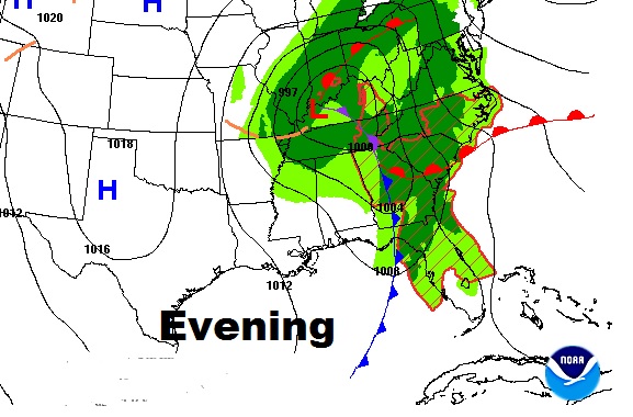
It will turn windy and sharply cooler behind the front by this evening and tonight.

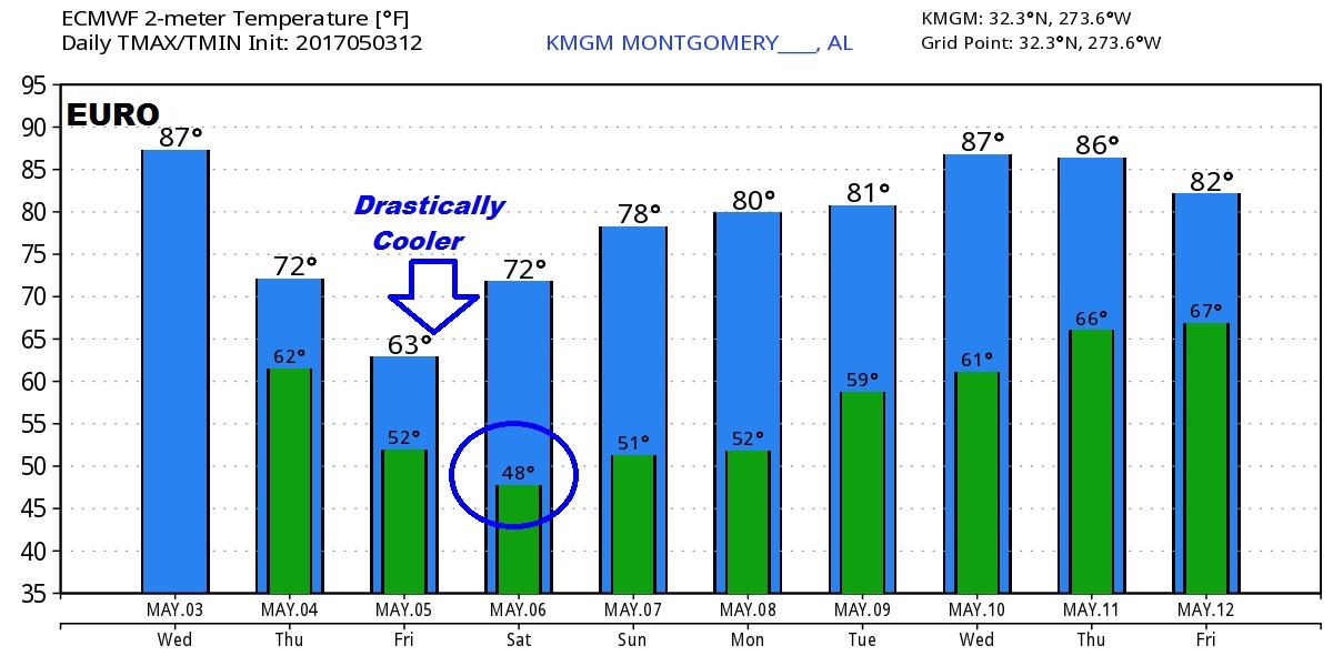
The Euro model temp guidance shows the extent of the sharp cool-down on the way.

