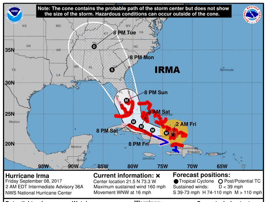
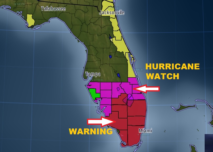
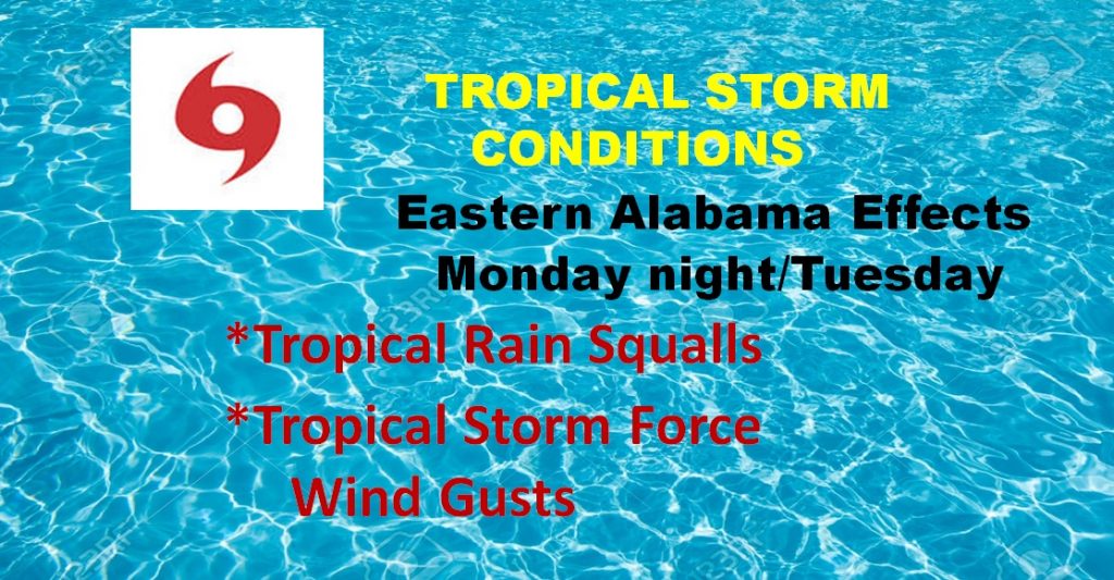
EXTREMELY DANGEROUS FLORIDA HEADS FOR FLORIDA – TRACK EDGES WEST Potentially catastrophic Irma heads for Florida. The track, which has edged westward is more of a worst case scenario for most of Florida. And, now the forecast cone cover mush of Alabama. I have the latest forecast from the hurricane center. I’ll walk you through the day by day details and the potential Tropical Storm impact here in Alabama. Please take a moment to watch this special Friday Morning Hurricane Briefing.
4AM CDT Advisory from the the the National Hurricane Center. Irma still Cat 5, with winds of 160 mph.
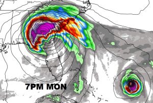
This is the highly respected Euro model showing Irma’s progress northward through Florida during the weekend and then it’s affects on Georgia and Alabama by Monday.


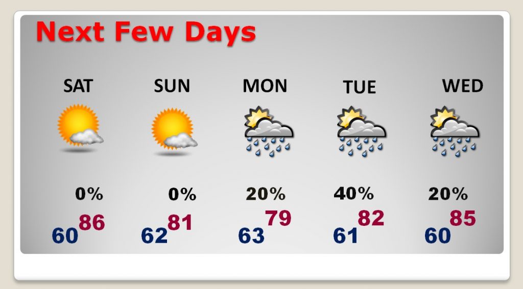
Alabama could see some fringe Tropical Storm affects by Monday night into Tuesday.
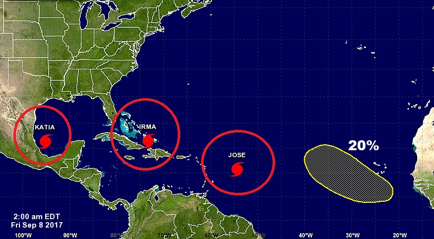
Besides Irma, there is major Hurricane Jose with 120 mph winds, which will curve into the Atlantic, but could threaten some northern Leeward Islands that were devastated by Irma. Katia is an 85 mph hurricane in the SW Gulf headed backwards toward Mexico, New area to watch off Africa.