Soaking rain is on the way especially tonight and Monday morning. The timetable for arrival is faster, and the rain will exit quicker. Probably most of the rain will be out of the state by Noon Monday. Widespread rainfall totals of 1.5 to 3” are expected. While a few strong storms are possible. Marginal Severe weather risk now covers most of south Alabama. Damaging wind gusts are possible. Sharply cooler air will follow the rain. The coolest day will be Wednesday. The coolest morning will be Thursday. Now the details on how it will unfold.
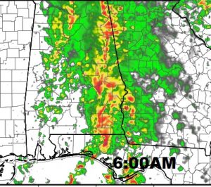
RAIN ARRIVAL TIME: Warm & humid day ahead, with an increasing chance of rain, first in the western counties by the afternoon and spreading eastward through the I-65 corridor by mid evening. Here’s some future radar snapshots.
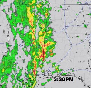
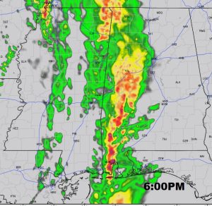
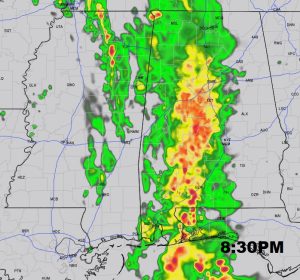
DRENCHING RAIN TONIGHT AND MONDAY MORNING: If you like rain when you sleep, you’re in luck. The biggest rainfall totals will occur overnight tonight and Monday morning. Be prepared for an unpleasant morning commute. Could be some thunder overnight, too. Most of the rain will be out of the state by about Noon.
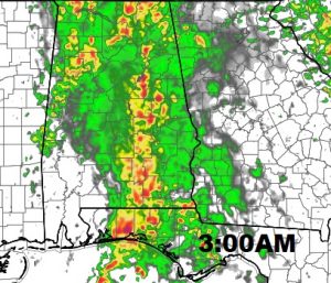
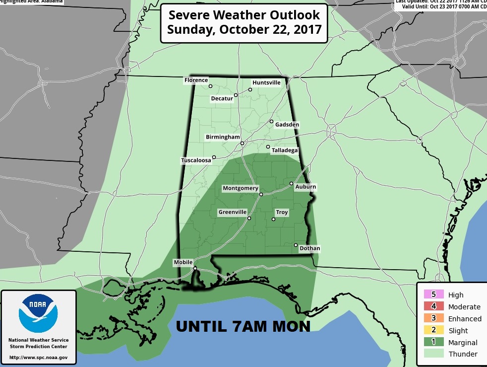
SEVERE THREAT?: UPDATE: Storm Prediction Center expands the Marginal Severe Risk area to include much of Central, and south Alabama, almost as far north as Talladega, for this evening/tonight. Damaging wind is the main threat. . Tornado threat would be very low.
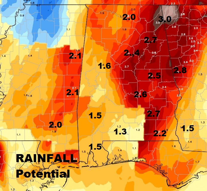
HOW MUCH RAIN?: Soaking rains. Widespread totals will be in the generous 1.5 to 3” range, according to model projections.
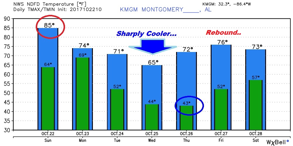
SHARPLY COOLER AFTER THE RAIN: The sharp cool down that follows the rain, will be rather brief in nature. It will be rather cool Tuesday through Thursday. The coolest day will be Wednesday, with highs only in the 60’s. Coldest morning Wednesday & Thursday mornings with lower 40’s.
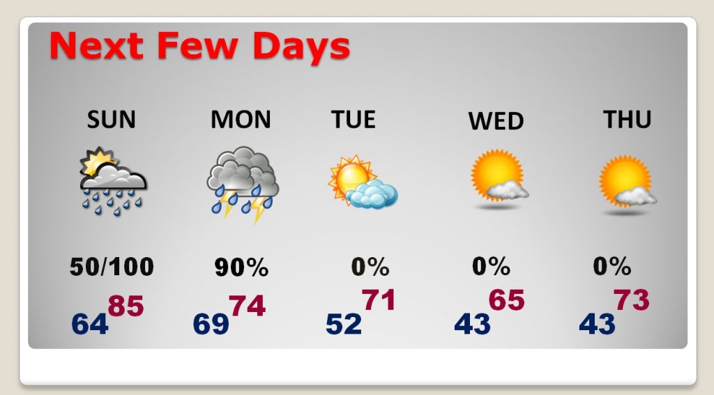
Temperatures will rebound late week. Back to the mid 70’s on Friday as the Alabama National Fair opens in Montgomery.
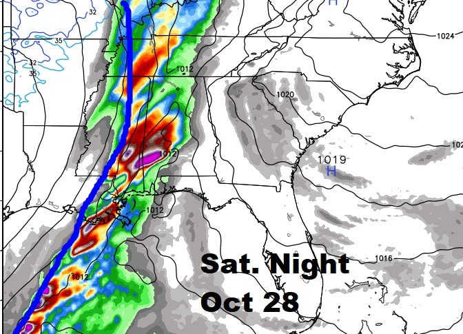
THE NEXT COLD FRONT: Models disagree on timing, but the next front should sweep through next weekend with showers ahead of it. We are watching the timetable closely because of the Fair in town. Right now it appears the Cold Front moves through Saturday night, then sharply cooler again.
—
I’ll be tweeting additional information during the day. Please join my twitter feed: @RichThomasWx. There will be a complete video update for you bright and early, online by about 4:45AM. Have a nice Sunday!
–Rich
