
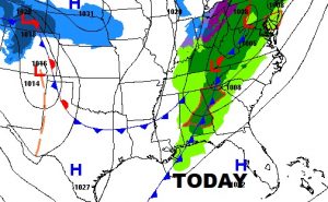
That cold front we have been expecting has entered northwest Alabama and will sweep across the state today. There is a line of showers and thunderstorms ahead of the front . Early this morning our temperature is near 70. We will be in the lower 70’s this morning before the front moves through around mid-day. Then, the temperature will drop. We will be in the upper 50’s by afternoon and down to 43 tonight. We will get progressively colder tomorrow on Christmas Eve Day and then turning much colder, and rather breezy Christmas Eve night. More on the change to colder ahead. The map below shows where the front’s expected position at Noon.
The Cold front in NW Alabama this morning will reach central Alabama around lunchtime and southeast Alabama. A few of the storms across north Alabama could be strong this morning.
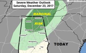
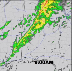
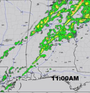
FUTURE RADAR: The band or line of showers, and a few thunderstorms, will progress southeast through the morning, reaching the Montgomery area, perhaps right before noon, before advancing into SE Alabama this afternoon. We are not expecting any severe weather here in central Alabama, with the arrival of the line of showers. Falling temperatures behind the front.
 hrr
hrr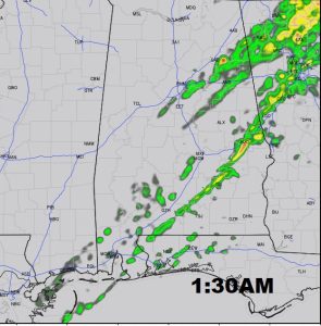
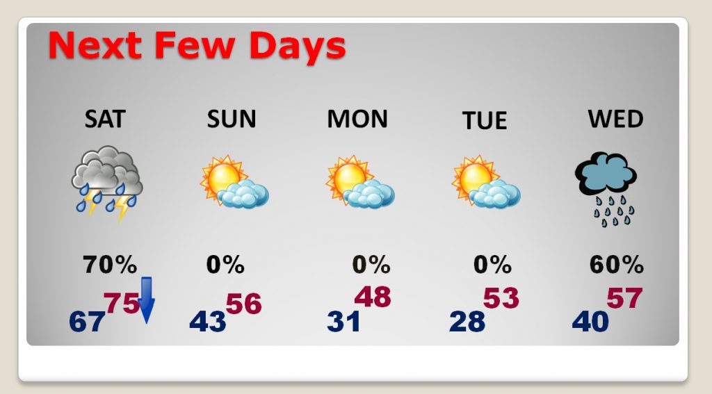
NEXT FEW DAYS: Again today’s high will be this morning, mid 70’s. We will fall to the 50’s this afternoon. Sunday’s high will be in the mid 50’s. Even colder air arrives Sunday night, just in time for Santa’s visit. We will only be in the 40’s Christmas Day. The next rain threat arrives Wednesday.
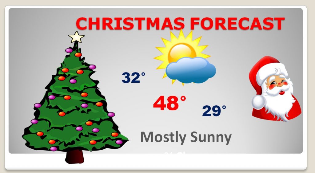
CHRISTMAS DAY: The pre-dawn hours on Christmas morning will be breezy and cold. I didn’t have to tweak the forecast much at all. I have us near freezing at dawn Christmas morning. Highs in the 40’s, and the low Christmas night will reach the upper 20’s. This Christmas will be a far cry from last year when we had a record high of 82.
- –
I hope you have a wonderful Christmas Weekend. I will have another update for you Sunday morning. Merry Christmas!
–Rich