Big weather changes are on the way. A storm system in Texas & Oklahoma will spread showers into the state tonight. Monday will be a wet day, but nothing severe. Then, get ready for a big warm-up. Temperatures will soar into the 60’s. Another storm system arrives Thursday night & Friday, with showers and thunderstorms. Another sharp temperature drop is in the cards for next weekend. Those are the headlines….details below. There’s more to this story.
TODAY: Increasing clouds. Not quite as cold…high 51. Cloudy tonight. Chance of rain late tonight, in the overnight hours. Low 39.
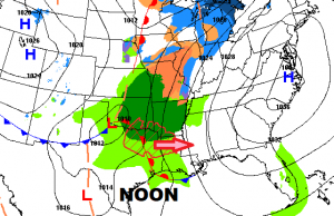
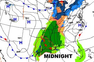
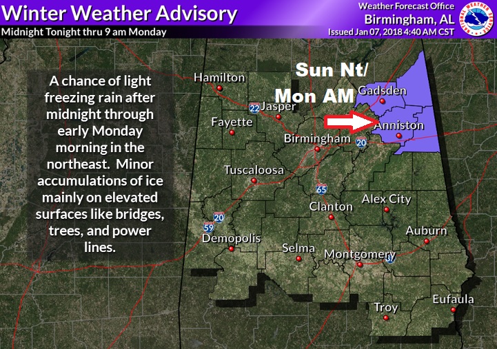
WINTER WEATHER ADVISORY: Northeast Alabama and western Georgia could see a light freezing rain later tonight and early Monday morning. There is enough of a threat of a thin ice coating…a Winter Weather Advisory has been issued. Travelers be aware.
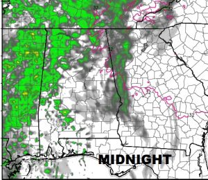
FUTURE RADAR: Showers/rain overspreads the state tonight and Monday. Looks like a very wet Monday AM commute. Rain shifts into SE Alabama Monday evening and the rain ends Monday night. No thunderstorms are expected.
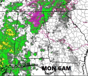
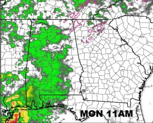
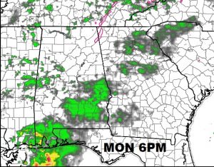
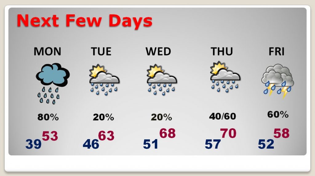
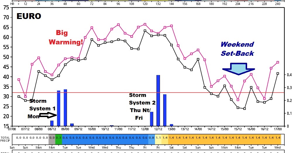
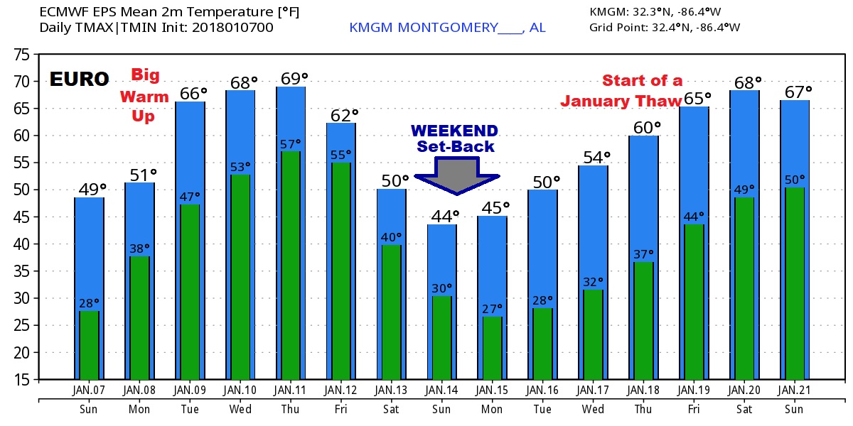
NEXT FEW DAYS: After a wet Monday, big warming is on the way. Temperatures will soar into the 60’s Tuesday & Wednesday, and perhaps near 70 by Thursday. Another storm system will bring in a round of showers and thunderstorms Thursday night into Friday. It’s a little too early to say if we will have any severe weather. Sharply cooler air flows in Friday, followed by colder air next weekend.
A WORD ABOUT ATLANTA WEATHER: Attention travelers: Possible winter weather issues in Atlanta late Sunday night in through the morning Monday (through 11AM). Rain or freezing rain, or perhaps sleet is possible. After Mid morning, just rain is in the forecast, with a high Monday of 42. The rain threat continues Monday, through the game. Low 37. Keep that in mind if you are heading to ATL for the big game.
LOOKING AHEAD: I’m going to use the Euro model to tell the story of the next 10-15 days. There is much drama. I think this graph tells the story very well. Two storm systems in the week ahead: Monday & Friday. A significant warm-up Monday through Thursday, followed by another big weekend temperature set-back. Then, looking at the 15 day guidance, we see the start of a pronounced “January Thaw”. There is growing evidence of this in more than one global model. Fingers crossed.
STREAK ENDS THIS MORNING: It’s cold this morning. We are in the 20’s yet again. But, in this current Arctic Outbreak cold streak, this will be the final freezing morning. This is our 10th freeze in a row, and the 12th since Christmas Day. Coldest mornings were 18 on the 2nd and 5th. Coldest high temp. was 33 on New Years Day. Let the warming trend begin!
–
I’m back to normal now! (I hope the flu does not visit your house! It’s pretty bad). I will have a complete VIDEO for you tomorrow morning, bright and early. My alarm goes off at 1:50AM, your video will be online by 4:45AM. Have a great Sunday!
–Rich
