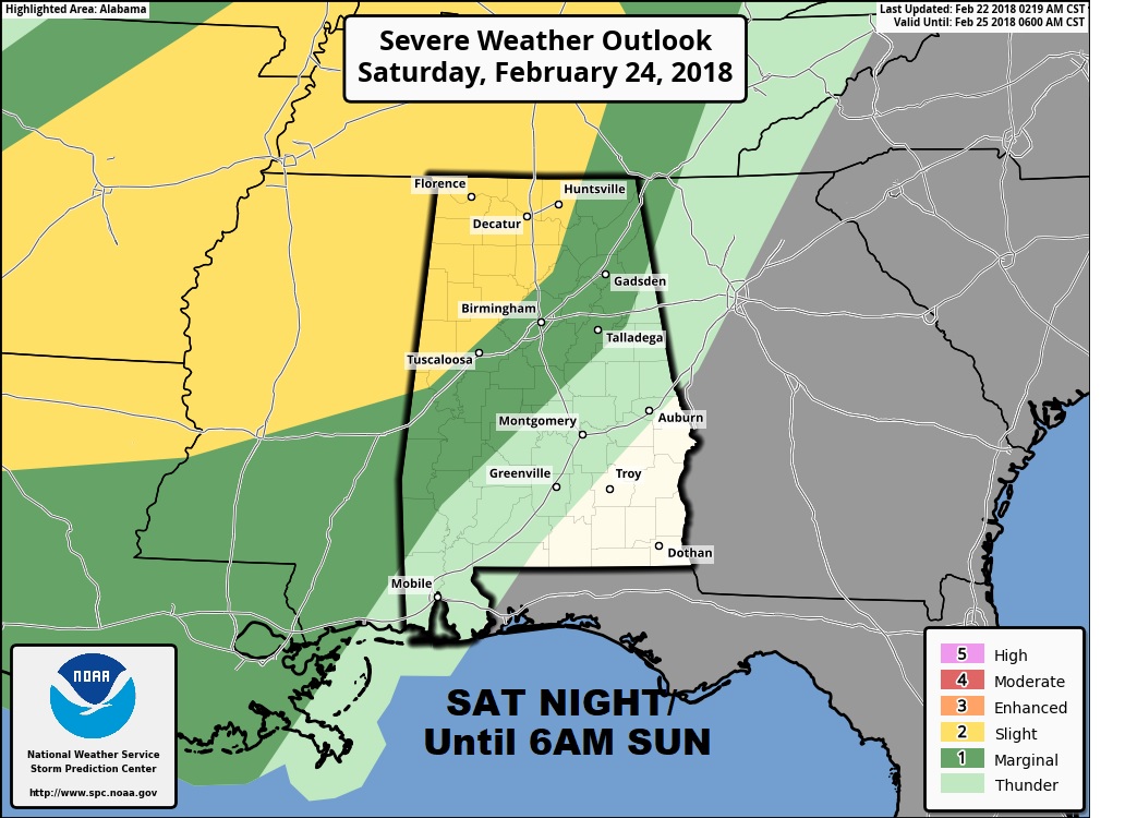
Good Morning! After 85° yesterday, our string of record highs is not over yet. We could set or threaten records for 3 days. But, on this video, I’ll tell you about a weekend front which will bring an end to the streak. Showers and thunderstorms will precede the front. The Storm Prediction Center says parts of our state could see some severe weather. I have the latest on timing and what we can expect. Are we done with winter? Maybe not. I’ll show you a big temperature slide as we approach the first week of March. I’ll run it all down in a couple of minutes on your Thursday morning personal weather briefing.
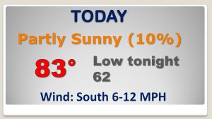
Today, although the rain chances are not Zero, then are relatively small as that huge high pressure bubble of high pressure continues as a strong protective dome. We should easily break today’;s record high of 80 from 1897 by several degrees.
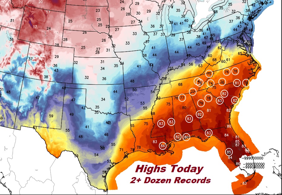
Over 2 dozen record highs could fall across the southeast US again today!
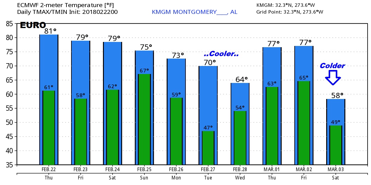
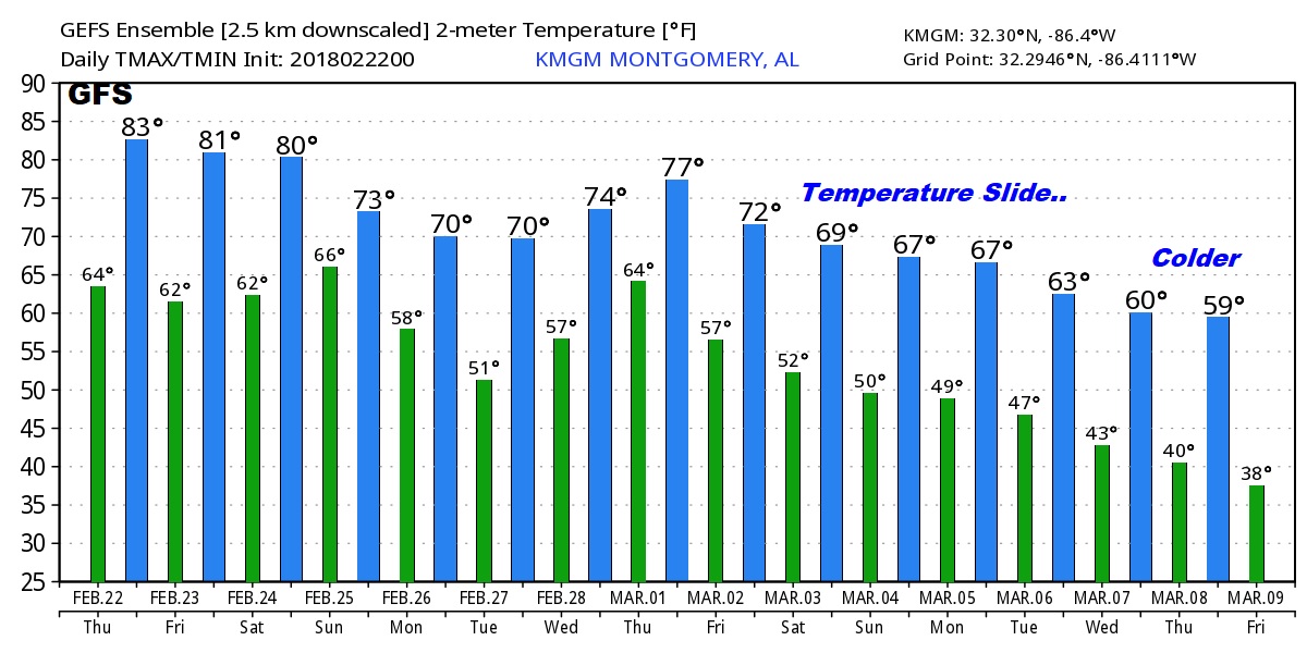
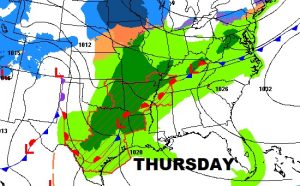
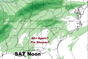
We will be 80+ for three more days, before a weekend front brings in showers and maybe some stronger storms Saturday night into Sunday, and more showers early next week as temperatures slide.
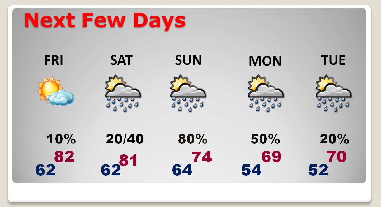
Strongest line of storms will enter NW Alabama late Saturday night, through the overnight hours in through Sunday morning.
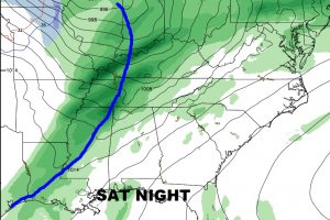
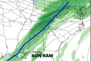
The Storm Prediction Center says some storms could be severe Saturday night through the overnight lows into Sunday morning. ‘Tis the season.
Global models continue to show a big temperature downward slide as we get closer to the first week of March.