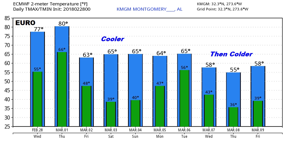
Good Morning..on the last day of Meteorological Winter. (Dec 1-Feb 28 on the weather calendar) The first of 2 fronts affects the state with scattered showers today. The second front tomorrow, the cold front could bring strong storms to parts of our state. I’ll have the latest outlook from the Storm Prediction Center. Much cooler air is on the way. I’ll show you the temperatures for that first weekend of March, which will feature some chilly nights. Plus, we will peek into the middle of March. The temperature slide will continue.
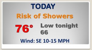
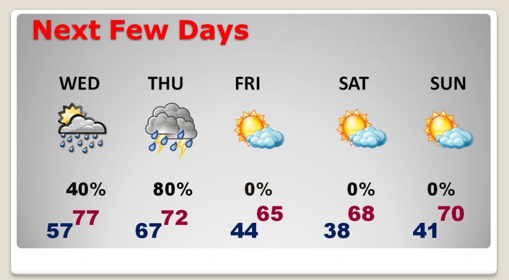
The most concentrated rain will be across north Alabama today, but all of us will see a risk of showers with a northward moving warm front.
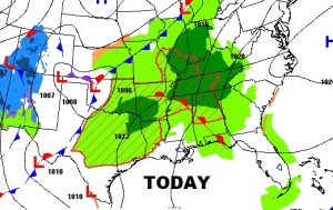
The big weather maker tomorrow is the cold front which will slide southeastward with a line of showers and storms ahead of it. Warmest temp will be in the morning, with falling temperatures by afternoon.
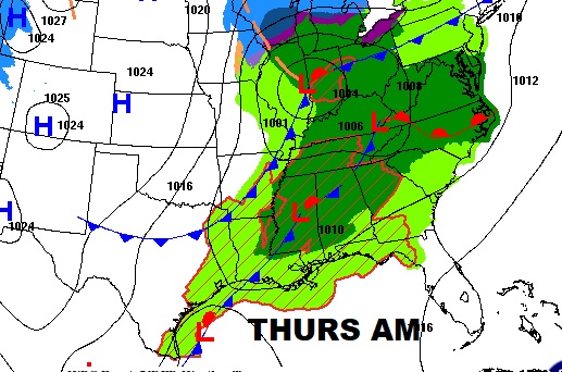
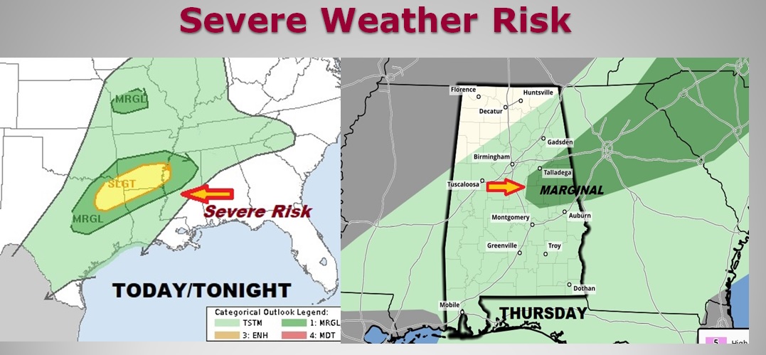
Today the severe threat is mostly west of our state from north MS to the Arklatex region, through 7AM Thursday. The Thursday shows parts of east Central AL in the Marginal Severe Risk area. A new outlook will be issued by SPC at 11:30 and this area could be expaqnded.
After the Cold Front moves through Thursday, the stage is set for a nice first weekend of March with cool days and chilly nights.
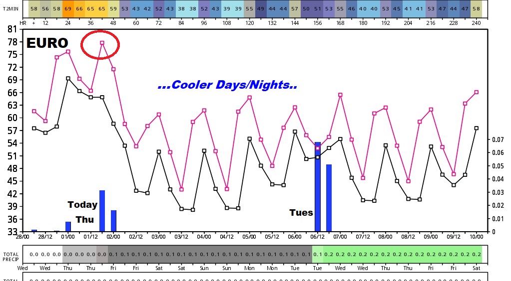
The Euro shows 2 storm systems over the next 6-7 days, and it shows a trend to cooler, than colder next 10 days.
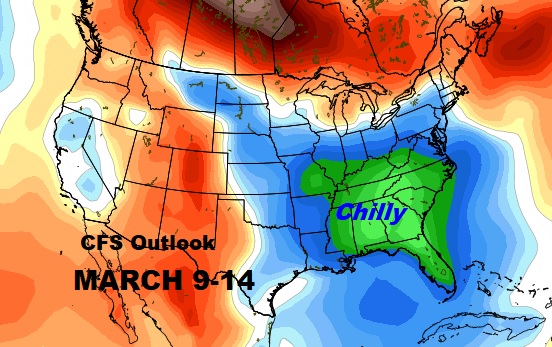
The extended outlook from the Climate Forecast System (CFS), shows the temperature slide continues as we get deeper into the month of March.
