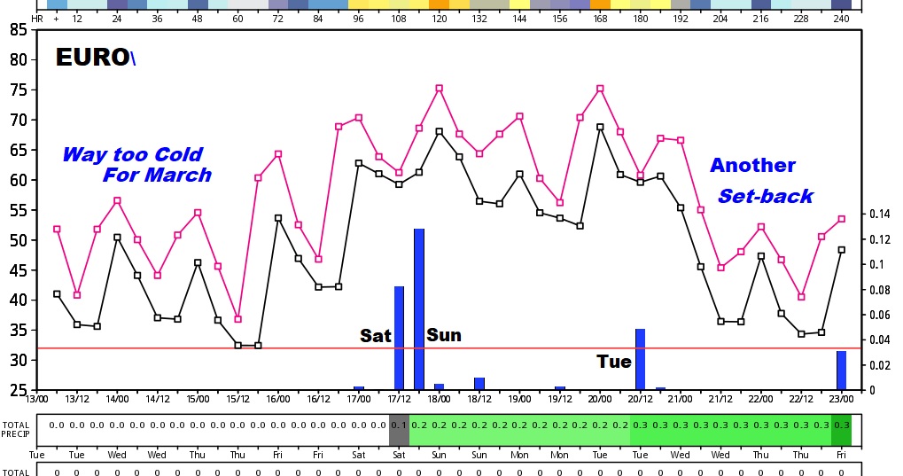
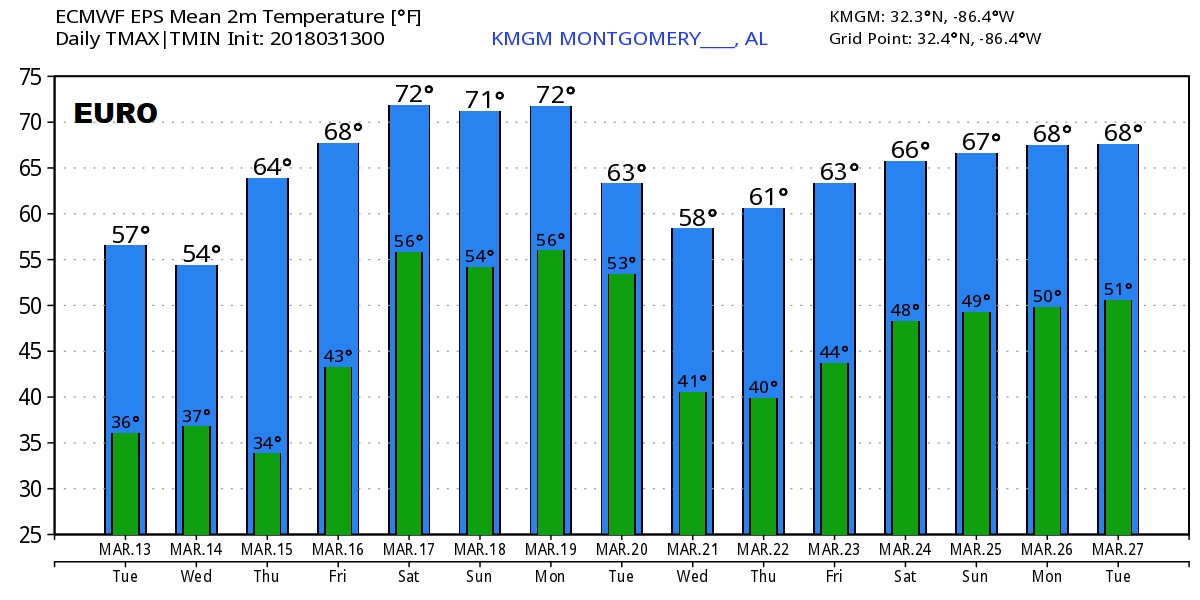
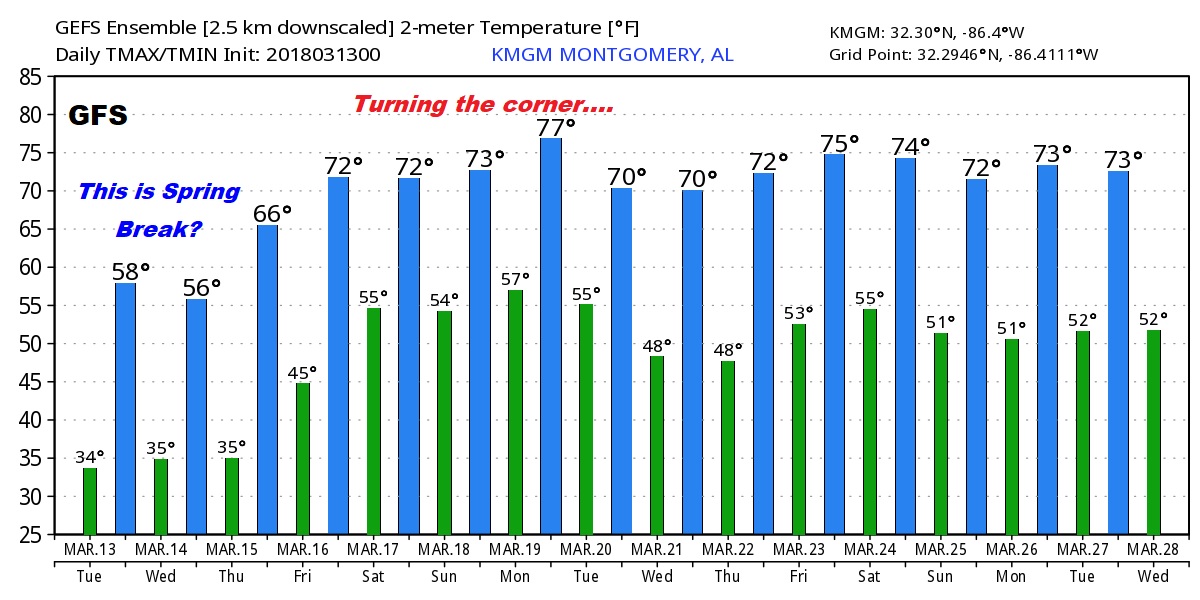
Good Morning, on what will likely be a frosty morning for many. Our much Cooler than normal March Days and Cold nights continue. Sure doesn’t feel like Spring Break. We will be near or at freezing on Wednesday & Thursday morning. I’ll show the new numbers. We’ll look ahead to some late week warming, plus the latest on another weekend storm system which will come in two parts. I’ll run it all down on your Tuesday morning personal weather briefing.
Frost Advisory this morning and again tonight. We may not make it out of the 50’s today and we’ll be close to the freeze mark near dawn tomorrow morning.
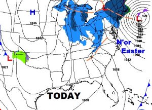
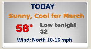
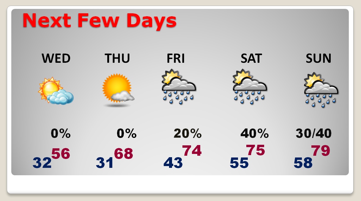
After the chilly days and COLD nights, we’ll see late week warming. Freeze threat Wednesday, and especially Thursday morning. Weekend storm system. Scattered showers and thundershowers.
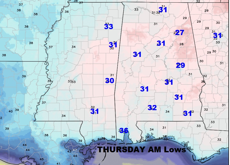
Thursday morning projected lows.
Here’s a peek at the Global Model Guidance. TOO cold for March next couple of days. Two mornings near freezing. Late week warming, weekend storm system. But, GFS, especially, shows us really turning the corner. This might be the last freeze threat of the season.
