Important updated information on this important Sunday morning video, on two severe weather rounds, today & particularly Monday afternoon & evening. We’ll look at the threat levels, and risks, plus the timeline. Feel free to share this post. Please take a minute or two for this update. Have a nice Sunday. Make you sure you have our weather app downloaded.
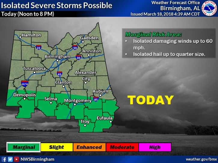
The greatest Severe threat today will be across about there southern half of the state. MARGINAL Risk. Isolated Wind gusts to 60+ mph. Isolated large hail threat to quarter size. Mainly Noon to 8PM. Tornado threat relatively low today.

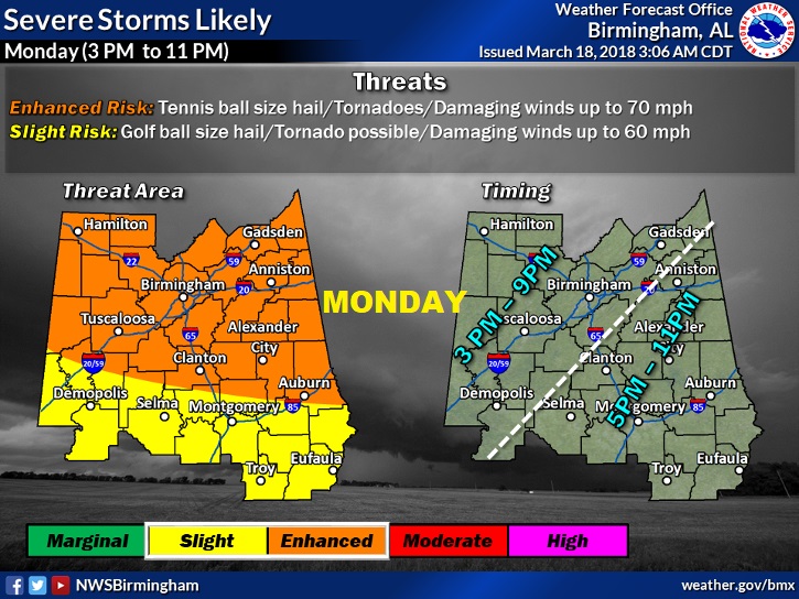
Tomorrow a more significant risk. ENHANCED RISK for north and central Alabama. Severe weather likely. Tornado, hail up to Tennis ball size, Damaging winds to 70+ mph. Farther south, from about the I-85 corridor southward, a lower “slight” risk. Tornadoes possible. Hail up to golf ball size, damaging winds 60+ mph. Mostly afternoon & evening.

