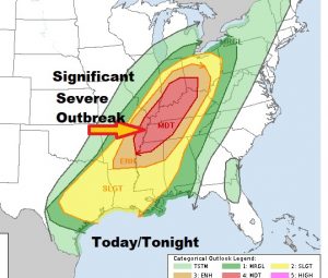
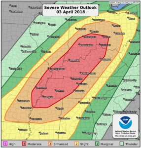
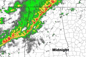
UPDATE AT NOON: SPC has upgraded parts of Ohio and Mid Miss. Valley to a Moderate Severe Risk for today & tonight. An Enhanced Risk extends into NW Alabama, Slight Risk western AL and Moderate Risk for most of the rest of the state through the overnight hours tonight. #alwx
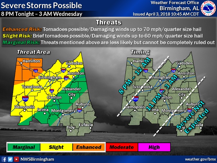
I have so much to tell you on today’s video, starting with the approach of a strong cold front. A line of strong to severe storms will enter our state late tonight. I’ll update the potential severe weather risk for our part of the state. Then, we’ll talk about a big late season temperature plunge, which will take us into the 30’s at least one morning. Got weekend plans? You’ll want to hear about the second storm system which could have a big affect on a lot of outdoor events. Strap yourself in. We have a bumpy ride for you to cover on your Tuesday morning personal weather briefing.
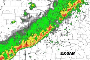
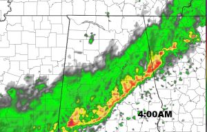
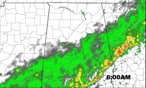
Strong storms in the overnight hours tonight along a squall line. Some could be severe, especially north of the I-20/I-59 corridor. The line will tend to weekend as it gets closer to the I-85 corridor in the wee hours of the morning.
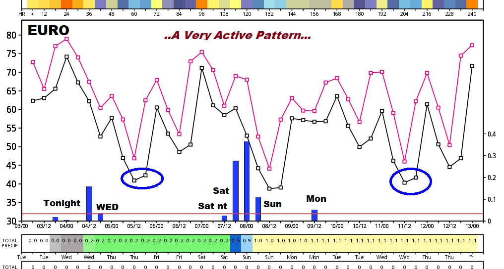
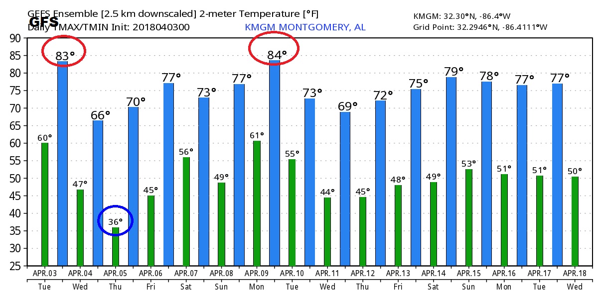
Plunging temperatures could take us down to the 30’s by Thursday morning. Warmer late week. Then a weekend storm system.
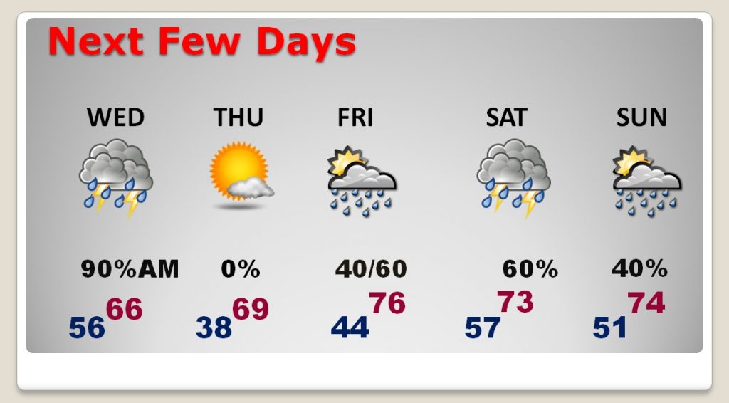
Storm system number two could affect a lot of weekend plans.
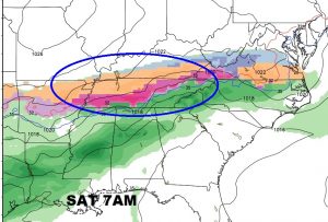
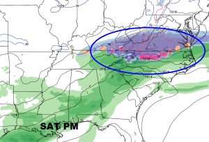
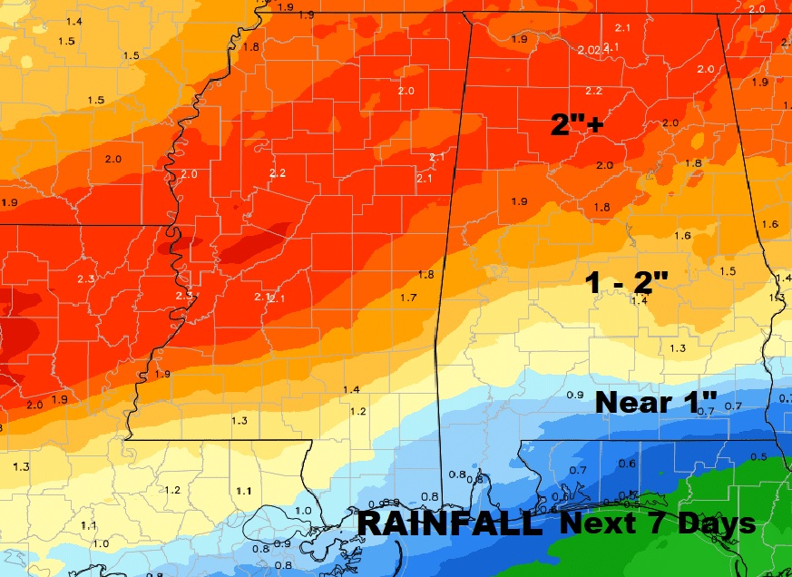
The Global models indicate a wild bumpy ride over the next several days. Severe weather possible Monday.