
Good Morning from Birmingham! As expected, it is a very chilly mid 40 degree Friday morning. But, the good news is, we have a couple of simply beautiful days ahead before a slow-moving “soaker” arrives, beginning Sunday, but continuing Monday, and maybe every a few left over showers Tuesday, as an “upper Low” slowly lumbers eastward across our area. So far, I continue to think that the severe weather potential is very small, but not quite zero. Mainly rain. Not a lot of thunder either. If you have outdoor plans today and Saturday, though, the weather should be great.
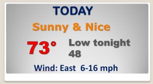
TODAY: Sunny and nice. High in the lower 70’s. A little breezy. East wind 6 to 16. Not as cold tonight. Low in the upper 40’s.
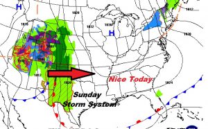
NEXT FEW DAYS: Nice today and Saturday. The storm system dominates Sunday/Monday, with lingering showers Tuesday. Then nicer weather begins mid-week.
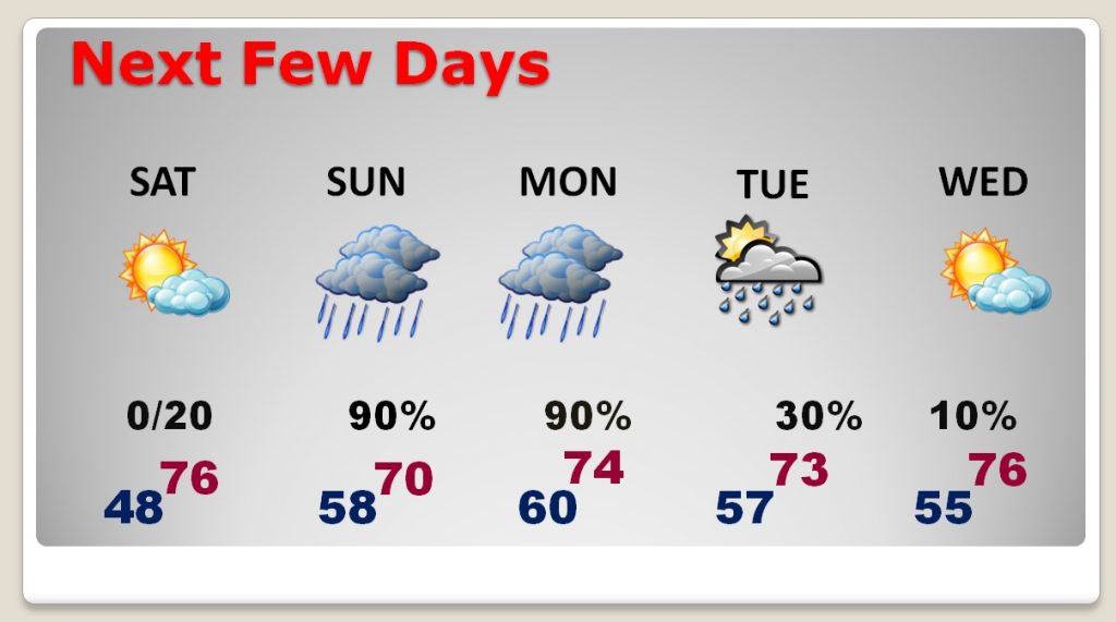
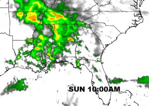
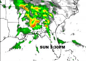
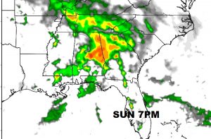
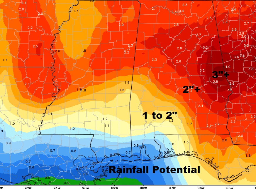
SUNDAY FUTURE RADAR AND RAINFALL POTENTIAL: The first batch of showers could begin in the overnight hours Saturday, but the bulk of the rain will spread from west to east on Sunday morning, and continue through Sunday night and Monday. Wet commute Monday morning. Rainfall will be heavy in spots. Many areas could easily see 1.5 to 2.5” totals. But, some parts of eastern Alabama may see over 3” as the storm system begins to further slow down by Sunday night. This will help to totally eliminate the remaining drought conditions. River levels will have to be watched.
Have a nice day!. Please forgive the abbreviated nature, and later post time of this blog update. It was a late night here in Birmingham with the Eagles concert. I will have additional Blog updates for you near Dawn on Saturday and Sunday. Enjoy your day!
Rich