Good Morning! Today the tropical downpours, finally, start to thin out in number. We’ll talk about a trend to fewer storms and hotter days. What about the weekend? A new wrinkle has developed. I had to adjust the rain chances. On this video I’ll tell you what to expect for here and the Gulf Coast beaches. And, could an approaching front deliver some lower humidity and nicer days in the not too distant future. Here’s your Thursday morning personal weather briefing.
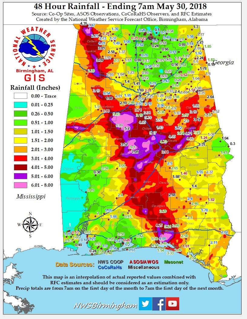
This amazing map shows the prolific rainfall amounts that Alberto brought to Alabama over a 48 hour period ending Wednesday morning at 7AM. Widespread areas of 6-8″ rainfall in parts of central Alabama brought considerable flooding. Can you see the track Alberto took from the Florida beach to NW Alabama? The computer models we’re right on the Alberto rainfall forecast.
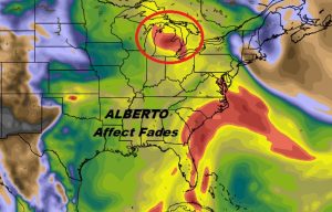
Alberto’s “tail”, and the associated tropical plume connection fades today as storms thin out in number.
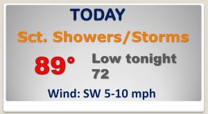
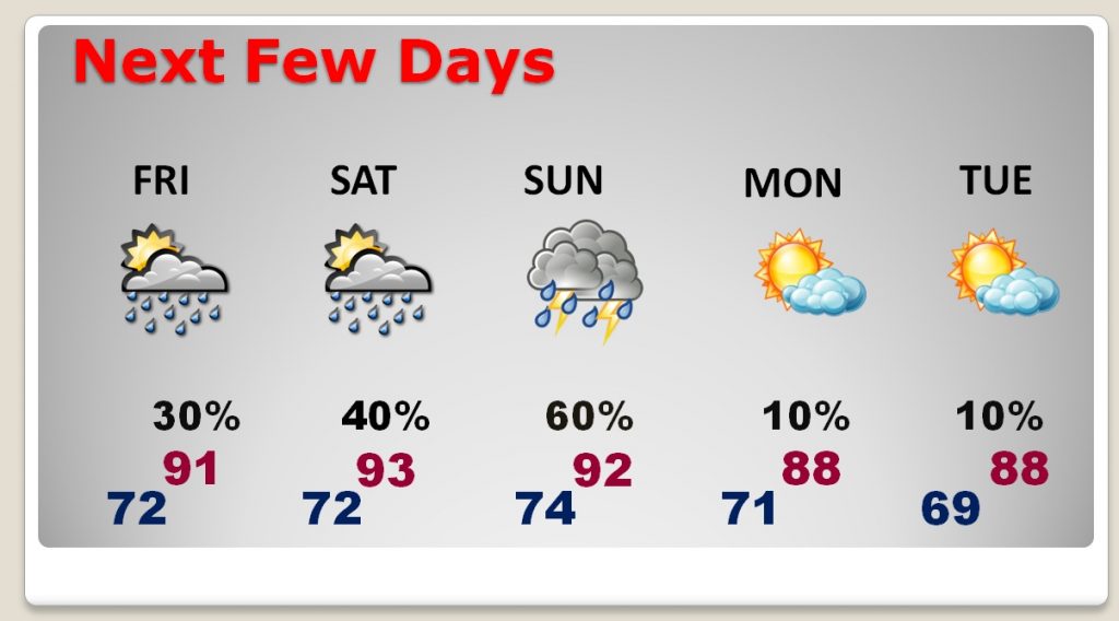
Storms will be fewer in number on Friday and Saturday, and “hit or miss” in nature. The number of storms increase Sunday, as a front approaches, IF that front makes it all the way through, Monday and Tuesday would have lower humidity and more comfortable temperatures. Fingers crossed!
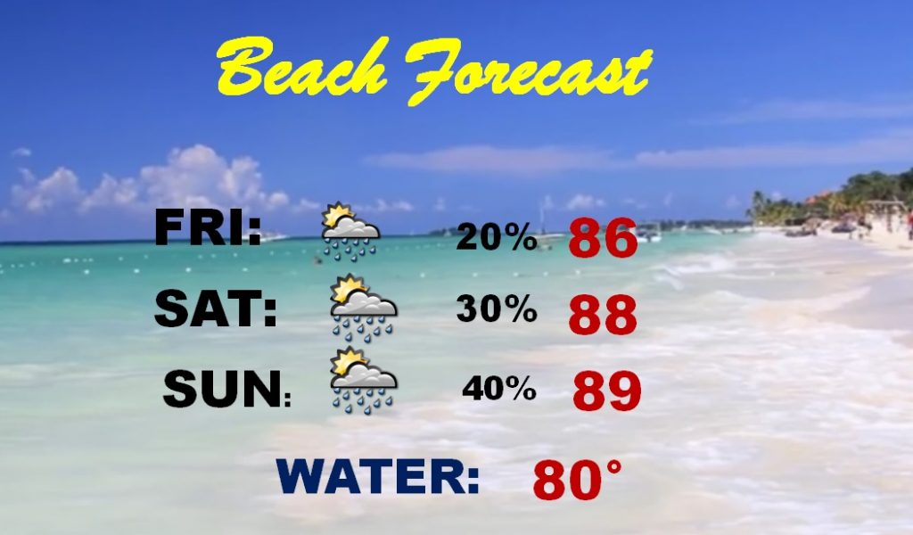
A pretty routine Beach Forecast and MUCH better than last weekend!