UPDATE: 5:30PM
GOOD NEWS: NWS cancels Severe Thunderstorm Watch for Autauga, Bibb, Chambers, Chilton, Clay, Coosa, Elmore, Greene, Hale, Lee, Macon, Perry, Pickens, Randolph, Shelby, Talladega, Tallapoosa, Tuscaloosa counties
MORNING VIDEO
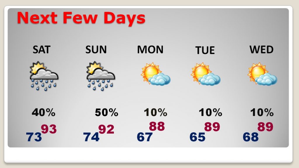
HEAT and HUMIDITY at very high levels through the the weekend with triple digit heat indices. Rain chances will be best on Sunday, as an important front approaches. That front will lower humidity and bring in some very comfortable air for the early and middle part of next week. NICE AIR!
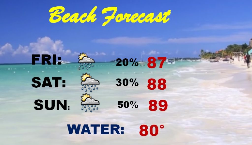
Rain chances are “routine” at the beach today and tomorrow, but a little better Sunday as that front approaches.
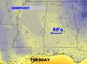
With brutal Dewpoints in the middle 70’s today, it’s exciting to think about this nice air which will be in place behind that next front. This is Tuesday. Dewpoints in the 50’s Get excited! This will be a nice change.
Welcome to hurricane season. The season starts today and continues until November 30th. Is your name on this year’s list? We’ve already used one name. Could we see Beryl by mid June?