More heat & humidity today and tomorrow and there could be a few random potent storms roaming around here and there. The Heat index will be into the triple digit range again, but stand by. A frontal system moves through the state Sunday. Behind it on Monday and Tuesday, get ready for some nice relief. Lower humidity. No storms on the radar. A nice change is coming soon, at least for a little while.
TODAY: Another hot humid day, today, with a high around 92. It think the heat index will be near of above 100. Lots of instability will lead to scattered storms developing by mid-day and afternoon. A few storms could be quite potent. (see below for details). Storms will thin out by later this evening and tonight. Low 73.
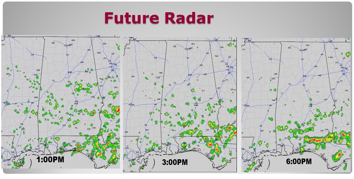
FUTURE RADAR…FEW STRONG STORMS?: The prime real-estate for the most numerous storms today will be across the southern half of the state. Coverage today will be about 50% along the I-85/US 80 corridor, but more like 60% in south Alabama. A few potent storms are a good bet. (see severe risk below.) Here’s some future radar snapshots. Never take future radar literally, especially in the summer.

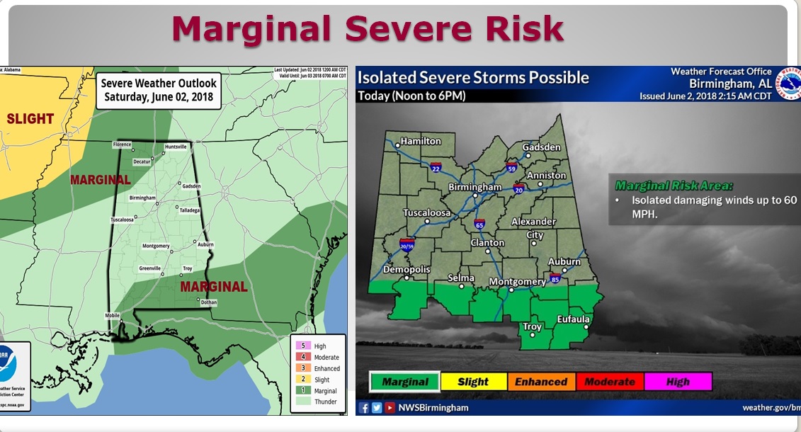
A few storms could reach Severe Limits. The main risk will be damaging wind gusts 60+ mph, and quarter size hail or larger. I can’t rule out a microburst or two. The Storm Prediction Center highlights the southern strip of counties for a Marginal Severe Risk. The Birmingham NWS says the Marginal Threat will be along and south of the I-85/US Corridor from Noon to 6PM. Our weather app will come in handy with Interactive radar, which includes the lightning layer. Plus, if there are any warnings, our app will alert you instantly, wherever you are.

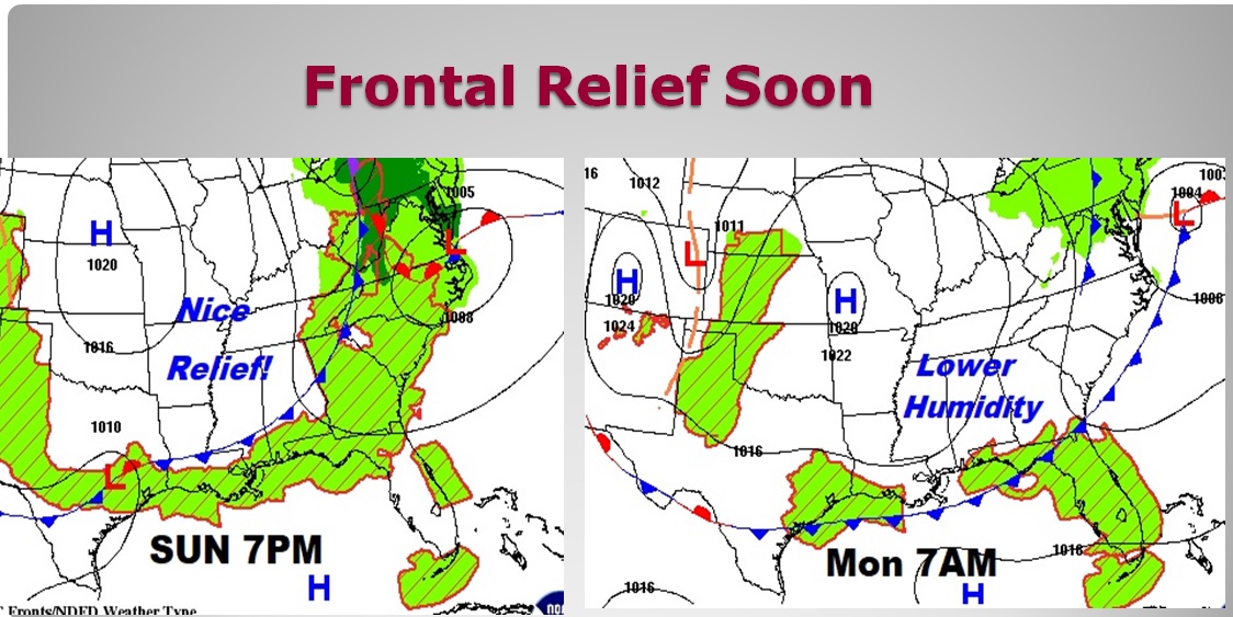
NICE RELIEF SOON: On Sunday, as a frontal system cuts through the state, there could be a few strong/severe storms along the front, especially in the afternoon. Behind the front, get ready for some much nicer air! Relief. Lower humidity. Comfortable days, cooler nights at least for about 2 or 3 days early next week.

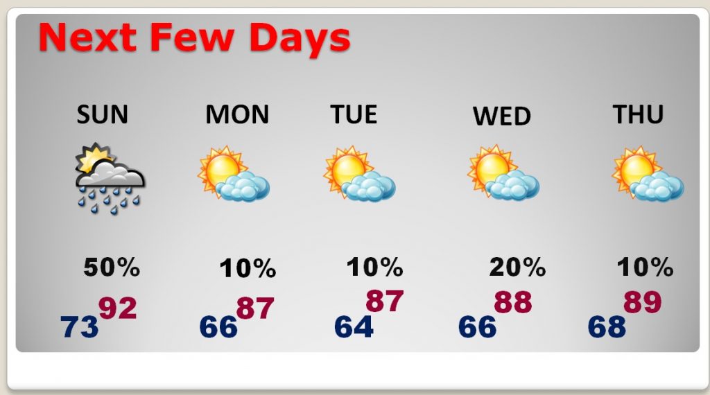
NEXT FEW DAYS: A Hot and humid weekend, with a few potent storms, but then comes the nice relief we’ve been waiting for. A big change. Dewpoints by Monday afternoon into Tuesday will be in the 50’s. That’s nice air. (Today’s dewpoints will be in the low to mid 70’s) Humidity will return in all it’s glory late next week. Much of next week will be dry.

—
I’ll be the Emcee at Riverwalk Park this afternoon for the Centennial Bash from 2 to 5PM as the City of Montgomery commemorates the 100th anniversary of Maxwell Air Force Base. There will be music, food, arts and crafts, activities for the kids and much more. Should be fun!
—
Set your DVR for “Safe From The Storm – Hurricane Edition” tonight at 6 on CBS8 and ABC32. I’ll have a segment on the show, too with Chief Meteorologist Shane Butler. It’s part of our new partnership with Alabama News Network.
—
I’ll have another Blog update first thing in the morning. Have a nice weekend!
Rich
