Summer officially begins in 11 days, but classic summer heat & humidity is in place, and is hear to stay, far into the future. Looks like we are headed to the low mid 90’s again today. Yesterday’s high was 95. Radar will come alive. Look for better coverage on this random afternoon & evening storms for each of the next several days. But, you know the drill. Not every town will get wet.
TODAY: With dewpoints in the upper 60’s to near 70, I expect the heat index to be near or above 100 later today. The actual high will be in the low to mid 90’s Random scattered hit or miss storms will dot the radar screen, and the coverage will be greater than yesterday. Tonight’s low will be around 71.
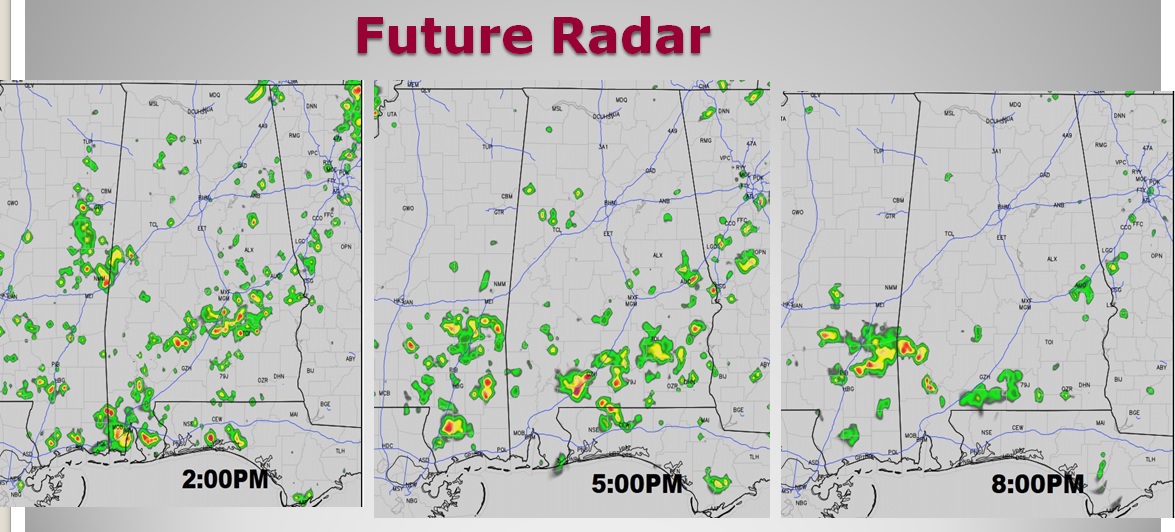
FUTURE RADAR: Radar will come alive, especially in the afternoon heat. Don’t take these radar snapshots literally. The storms will NOT be where they are shown. We are just looking at the coverage level, as the storms increase in afternoon heat and diminish in the evening.

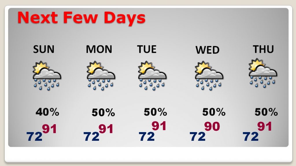
NEXT FEW DAYS: There will be a generous amount of those random storms around each day. Highs will be at or above 90 each day, with lows at night in the lower 70’s There will be little day to day change.

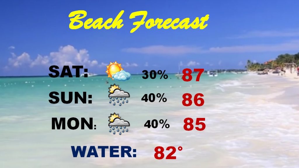
Pretty routine Beach Forecast. Spotty storms will be around. Most of the time dry weather will prevail. Highs will be in the mid to upper 80’s Gulf water temperature is 82. The rip current risk is listed as low for the weekend.

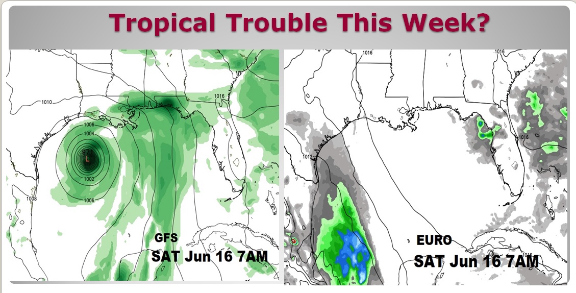
GULF TROPICAL TROUBLE THIS WEEK?: Trouble in the Gulf by late week? Well, frankly, it depends of which model you believe. The GFS takes Hurricane Beryl to near the Louisiana coast by next Saturday morning. The EURO model has nothing. Until I see more model evidence, I am not going to lose any sleep on this. Here’s two model snapshots for next Saturday morning, June 16th at 7AM. Do you see the dilemma?
. 
—
I’ll have another Blog update first thing Sunday morning. Have a nice Weekend!
Rich
