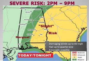
UPDATE: SEVERE RISK ADJUSTED: The greatest risk of severe storms will be along and east of I-65 this afternoon and this evening. The strongest window for possible severe weather will be in the 2PM to 9PM time range. The main threat continues to be a damaging wind threat with 60+ mph winds possible, and up to quarter size hail. The Tornado threat is not zero, but it is small. Generally west of I-65 a Marginal Risk continues….a smaller risk than the Slight Risk Area.

Stay weather aware, especially if you are out in the open, like on a lake or golf course, etc.
FUTURE RADAR: I’ve decided not to show you future radar snapshots, in this particular situation. It would send you the wrong message. I’ve looked at 4 different hi-res models. Each of them is different. The models are also trying to get a handle on this complex situation. It could unfold several different ways. Let’s skip future radar, today.
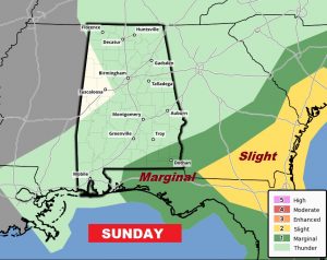
SUNDAY: Today’s frontal boundary affecting the state will slide southeastward, and by Sunday the severe weather threat area slides eastward. The Wiregrass counties in SE Alabama, may have an ongoing severe threat early in the day Sunday, but that threat will shift out of our state during the day.

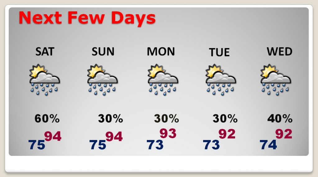
NEXT FEW DAYS: The weather becomes more routine tomorrow and Monday, with “scattered” storms, closer to the 30% risk zone, and highs in the mid 90’s. Not much change is expected Tuesday & Wednesday.

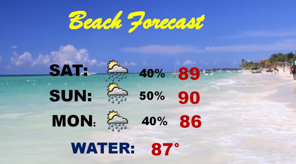
BEACH FORECAST: Although the Beach forecast is only in the 40 to 50% range, a few storms could be strong over the weekend. Heat Alert in effect. It should be noted that the Beach heat index will be in the 103 to 106 range, today and Sunday.

—
Stay Weather aware today I’ll have additional updates during the day as needed. There will also be another blog first thing Sunday morning. Our weather app will be your best friend today. It’ll instantly update you to watches and warnings for your particular location, wherever you are.
Rich
