
Today’s update will be brief, because there are not many changes from yesterday. Get ready for a hot Sunday, Monday & Tuesday. There won’t be many storms around, but a few widely scattered storms may cool down some lucky communities. (Yesterday the Montgomery airport was lucky to pick up .29”, even though there were very few showers on the radar)
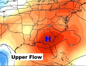
A big upper high pressure heat dome is right over us. (see map) That will keep the rain chances low, and temperatures will soar into the mid 90’s through mid week. Better rain chances return late week. It’s so hard to believe that many school systems begin the school year tomorrow morning!
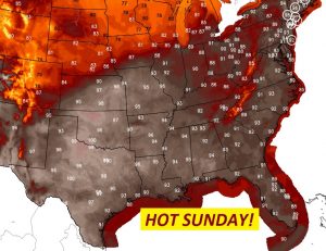
TODAY: A good bit of sun will allow for another mid 90’s day, with the heat index reaching 100-103 this afternoon. Storms will be few and far between. The probability of your town getting wet is about 20%. Low tonight in the mid 70’s. Below, notice that the heat today will be widespread.
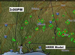
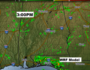
FUTURE RADAR: Storms will be widely separated today. I have chosen to show you two different hi-res model snapshots at 3PM. Don’t take storm locations literally, but notice how few showers will be around. By the way, I looked at one more model (NAM model), and it showed no blips at all.
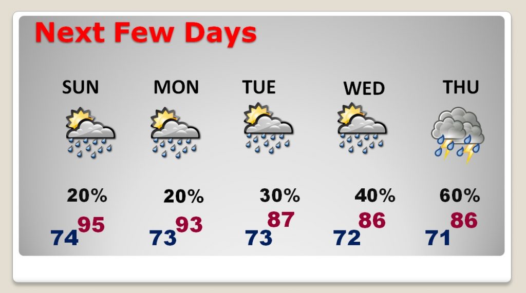
NEXT FEW DAYS: The start of school this week, for many school systems, will begin on a very hot note, with middle 90’s and not many storms. Notice how rain chances get a little better by Wednesday, and a lot better by Thursday. Time to get out the sprinklers.
—
Have a great Sunday! I’ll have a complete video will be Monday morning by 4:45AM, as we dissect the week ahead.
Rich