
Our wet weekend pattern continues. In fact, widespread showers and storms will be common through Tuesday. But, hang on. A rare summer front will bring some nice relief to our state by mid week. In fact, the time table for that front’s arrival is now faster.
TODAY: Today will be much like Saturday. Showers and storms will be widespread, just about anytime. In fact, as I type this well before dawn, widespread showers are still underway. Highs will be held down to the mid 80’s. Low tonight in the mid 70’s Like Saturday, some towns will get locally heavy downpours. Watch out for dangerous cloud to ground lightning.
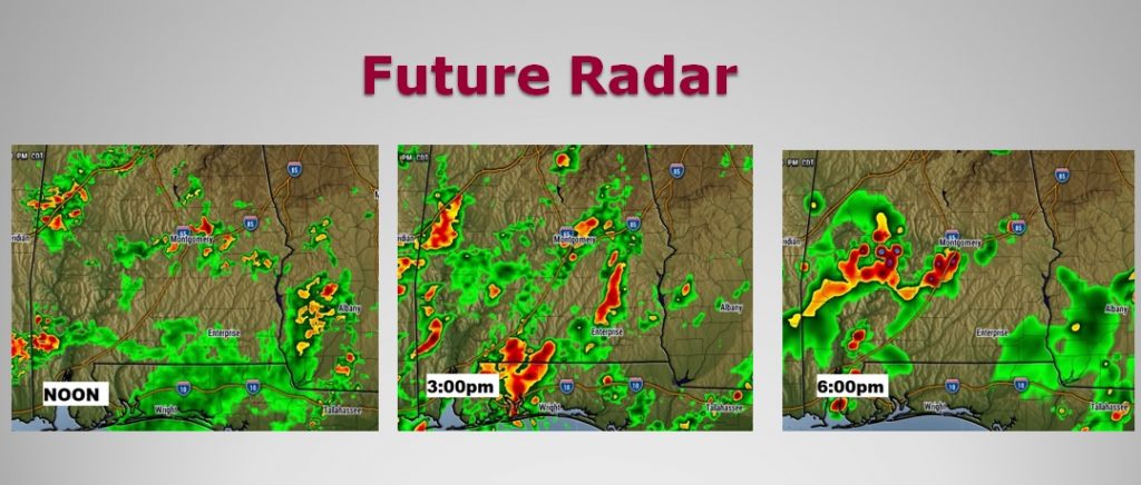
FUTURE RADAR: Remember, never take Future Radar literally, as far as storm placement. I show these just to give you a sense of how widespread the coverage is likely to be at various times of the day. Looks like another busy storm day.
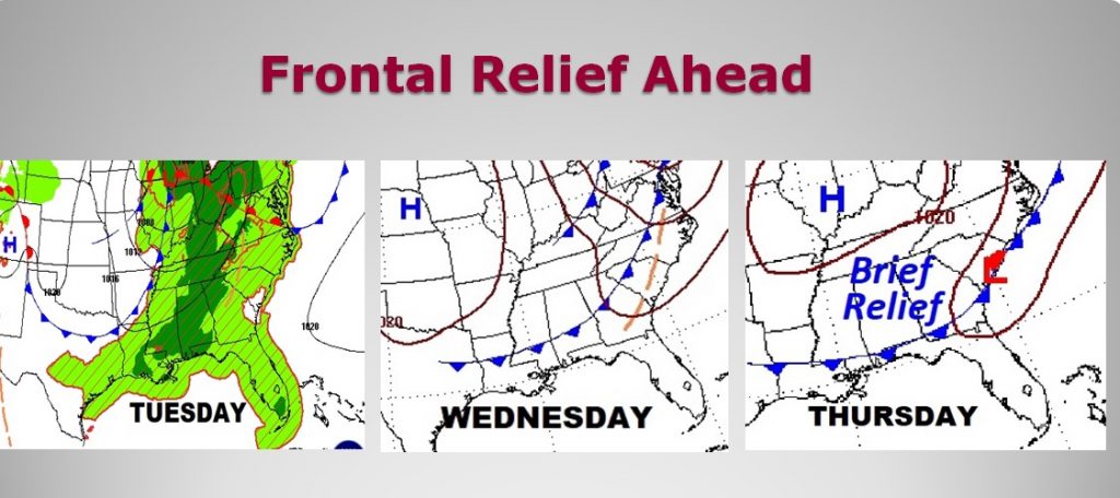
RARE SUMMER FRONT THIS WEEK: The time table of this week’s rare front is now trending faster. Ahead of the front, widespread showers and storms will drench the area Tuesday. The front should reach south of I-85 by first thing Wednesday morning. You will start to feel a nice change in the air on Wednesday, and especially Wednesday night into Thursday. Dewpoints will fall from the 70’s to the dewpoints, and maybe even some upper 50’s. Storms will be almost non-existent Wednesday and Thursday. Moisture tries to creep back into the area from the east on Friday. It will be brief relief, but it will be nice relief and we deserve this!
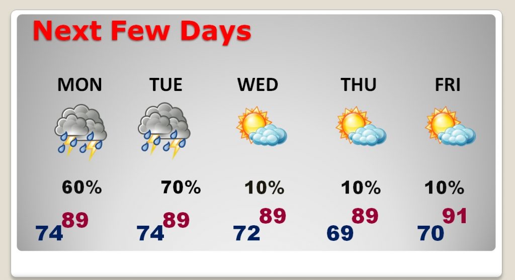
NEXT FEW DAYS: More widespread showers and storms are in the cards tomorrow and Tuesday. But, then, a nice break from storms for a couple of days. Look for some much more tolerable air on Wednesday and Thursday, at least. The nicest night will be Wednesday night. Scattered showers will return next week.
—
Have a great Sunday! I’ll have a complete video will be Monday morning by 4:45AM, as we look at an exciting weather week ahead.
Rich