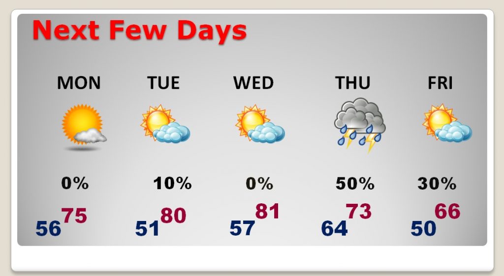
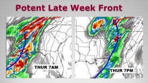
Good Morning! It’s a chilly Sunday morning, but the morning chill will fade out quickly and we’ll see a remarkable warm-up by the afternoon. Temperatures for the next few days will be well above normal through Halloween. But, a potent late week front will bring showers and storms, followed by much cooler air by the Friday and the weekend.
TODAY: Temperatures in the 40’s at Dawn, will warm quickly. Mostly sunny today. We’ll be flirting with the 80 degree mark in central Alabama this afternoon. Southwest winds at 5 to 10 mph. Not as cool tonight. Low tonight mid 50’s.
NEXT FEW DAYS: The first 3 days of the week will be a bit on the warm side, on the last 3 days of October. In fact, I think we will be near 80 again by Tuesday and maybe low 80’s, in spots, on Halloween. Showers and storms will become rather numerous especially after Midnight Wednesday night and through Thursday as a strong cold front approaches. Then, much cooler air will funnel in behind the front just in time for the weekend.

IMPORTANT LATE WEEK FRONT: Models are now coming together on the the timing of the front, which will sweep through the state on Thursday. Some details of how strong the system will be are still uncertain, as far as storm potential. We’ll know more with future model runs. It’s just too early to say if we will see a severe weather or tornado risk with this system. Details will come together as we get closer. This is the time when we start our Fall tornado season. We’ll be watching. Check out my video in the morning.

CLIMATE DATA: Yesterday morning’s low was 48. Afternoon high 68. Normal low 50, normal high 75. Sunrise this morning at 7:00. Sunset 5:58PM.
—
Have a great Sunday! I will have you a complete video update Monday morning online by 4:45AM.
Rich
