Good Morning…. We have a very interesting next 8 days, ahead! Here comes another disturbance with more showers and storms tomorrow. A strong cold front will cross the state Friday evening. MUCH cooler air funnels in for the weekend. But, an even stronger cold front will cross the state Tuesday, ushering in a taste of Arctic Air. On this video, I’ll walk you through the details. We’ll break down the weekend, and I’ll show how cold we may get by mid week. I’ll run it all down in about 3 minutes on a very action packed Thursday Morning personal weather briefing.
More showers and storms at times today and Friday. Another wave of low pressure moves across the state today, and tomorrow the first of two strong cold fronts will have showers out ahead of it, and Much cooler air by late Friday night behind the front.
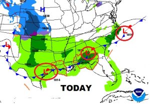
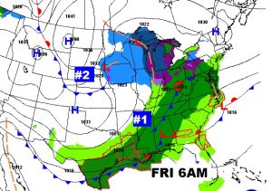
TWO shots of colder air on on the way. The first arrives Late Monday night and into the weekend with some of the coolest air we have seen yet.
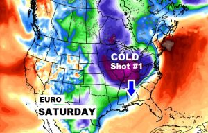
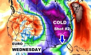
Shot #2 of colder air will be “The Real Deal” kind of change. Get ready for a taste of Arctic air, which starts funneling in during the day Tuesday and really gets established on Wednesday.
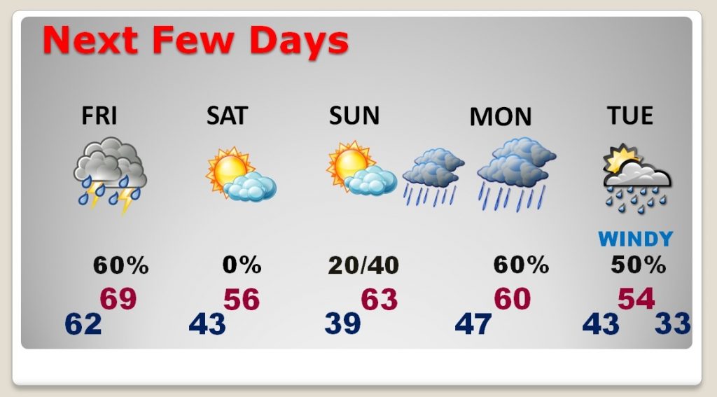
Wet at times today and Friday. Sharply cooler and breezy for Saturday. Chilly Sunday morning. Could be a late day shower on Veteran’s Day, but a better chance of showers and storms Sunday night and especially Monday ahead of a strong Cold Front. Windy and much cooler Tuesday. The high of 54 happens early. COLD on Wednesday morning with lower 30’s.
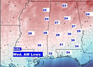
From the EURO model, here’s a snapshot on some potential Wednesday morning lows. 20’s across the northern half of the state…near 30 central and low 30’s south. THE REAL DEAL kind of cold for the first time this season. A taste of the Arctic.
