Happy Friday! Is this February? After 84 yesterday, we’ll be in the 80’s again today and tomorrow before a big change, as a storm system brings a strong line of storms to Alabama by Saturday evening and Saturday night. Parts of our state could see severe storms. I have the latest on timing and the new severe threat outlook from the Storm Prediction Center. Then, what’s next? Could see a strong cold front usher in much colder air during the first few days of March. We’ll take a peek ahead on your Friday morning personal weather briefing.
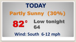
We’re in the 80’s again today with the risk of some spotty PM storms. The record for today is 85 from last year.
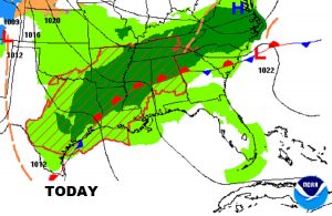
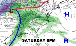
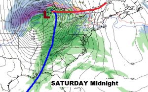
Potent storm system affects the state by late tomorrow into tomorrow night, as a line of strong to severe storms enters and tracks across the state.
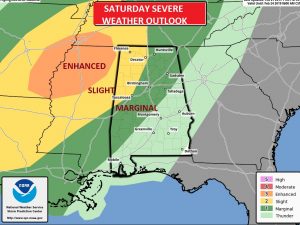
The Storm Prediction has trimmed the eastern extent of the Marginal Risk area for now, but that could certainly change. The stronger threat level for severe thunderstorms and tornadoes exists across northwest Alabama and points west and northwest.
After the front exits the area early Sunday, much of Sunday and Monday look pretty nice until another shower threat returns Tuesday & Wednesday.
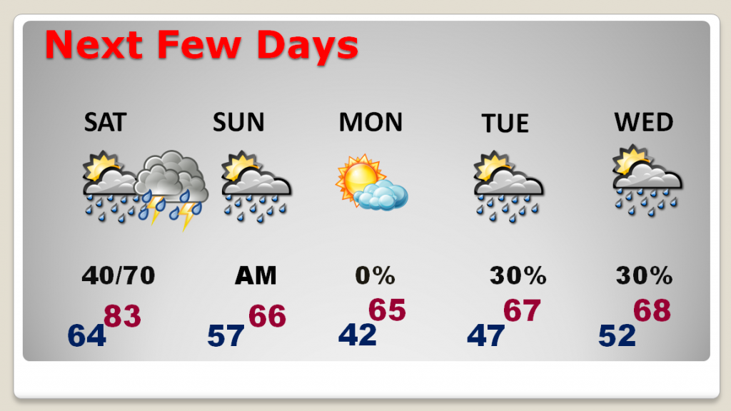
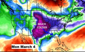
Colder air as we get into the first week of March. The models continue to advertise a big change. Stay tuned.