
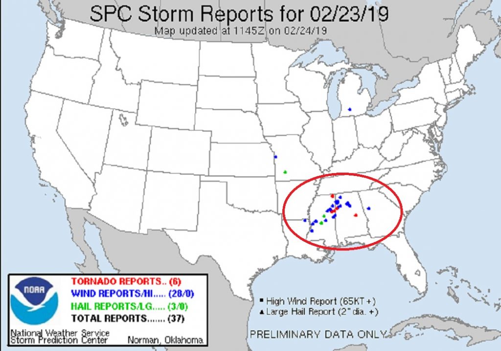
After a week of active weather, including rain and storms yesterday & overnight, the cold front has moved through and some nice weather is on the menu for the next couple of days. This will be a nice break for Alabama after flooding this week. Overnight, wind damage from a possible tornado was reported in Coosa county southeast of Rockford.
The weather this week will include a few disturbances brushes by the area, with the threat of showers at times. The strongest disturbance arrives Friday, ahead of a cold front. Could be some stronger thunderstorms perhaps.
6 Tornado reports past 24 hours and numerous wind damage reports.
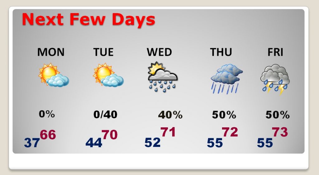
TODAY: Sunshine, breezy & cooler. After mid 80’s yesterday, today’s high will be 67. Gusty Northwest wind at 10-20+ with higher gusts. Clear and colder tonight. Overnight low 37.
NEXT FEW DAYS: Beautiful day Monday with sunshine, mid 60’s. A little warmer Tuesday with as a high near 70. Periods of showers, at times Tuesday night, Wednesday and Thursday. It appears the stronger disturbance of the week will affect the area by Friday/Friday night/Saturday morning. Could be thunderstorms. Too early to say if there will be a severe threat.
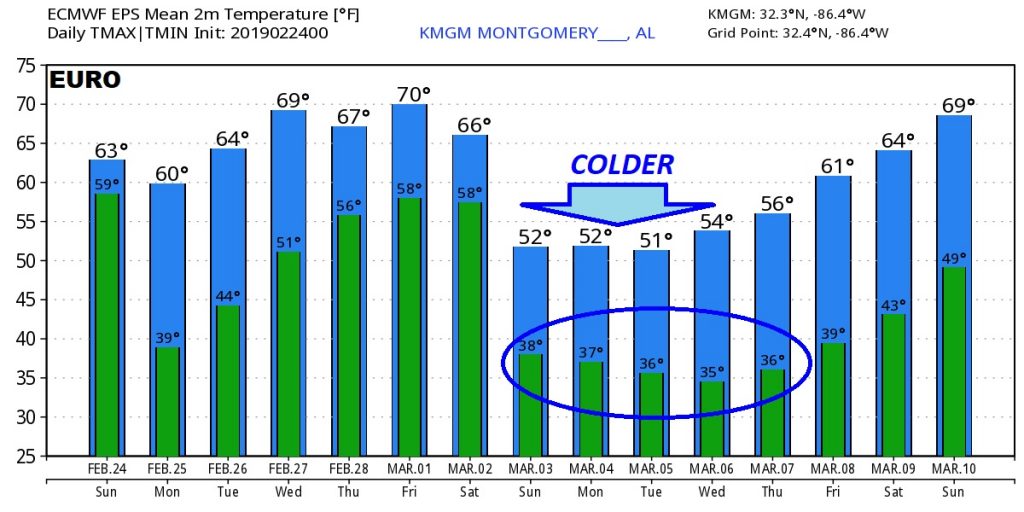
MUCH COLDER AIR: Next weekend, the EURO model continues to suggest a Colder airmass will move in. Looks like the heart of the cold air will be in place by around Sunday/Monday, March 3-4.
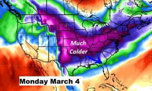
The extent of the cold and how long is not known yet. BUT, the Euro shows the big drop behind the cold front.
—
I’ll have a complete video update Monday morning at 4:45AM. I’ll go into much more detail about the week ahead. Have a great Sunday!
Rich