Good morning! It’s about 20-25 degrees warmer this morning. As the warm up continues we’re headed for the 70’s. All eyes on yet another weekend storm system which will bring another severe weather threat to Alabama. I have brand new information on the adjusted threat level from the Storm Prediction Center and the timeline. Plus, a quick peek at another storm next week and allergy sufferers will not like the pollen outlook for the next few days.
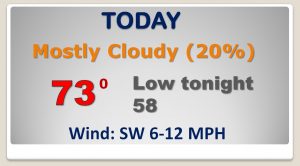
Warm-up continues today. Mostly dry. A few sunbreaks, but mostly cloudy. Highs in the 70’s
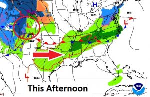
All eyes on the potent storm system approaching the Mississippi River Saturday. This storm will produce strong to severe storms, including tornadoes from the Mid Mississippi valley into the Gulf states. Second weekend in a row for a severe weather threat for a multi-state area.
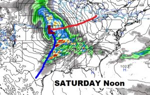
Latest SPC Saturday Severe Threat graphic shifts the strongest tornado threat a little to the northwest now. The Marginal Risk is as far east as a Chambers county Montgomery line, now. This risk continues until 7AM Sunday morning, on the new time. (CDT)
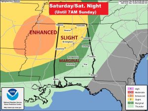
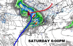
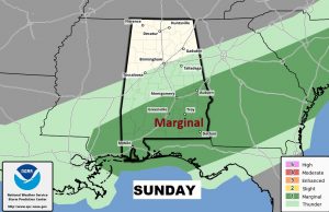
On Sunday the treat of strong to severe storms will continue across central & south Alabama, including most of our area. This is the same area under a severe risk last week during the tornado outbreak. But, this weekend, the risk level is not nearly as high.
70’s are in the cards through Monday with a risk of rain each day. Tuesday is the nicest day. Another storm system approaches by Wednesday into Thursday.
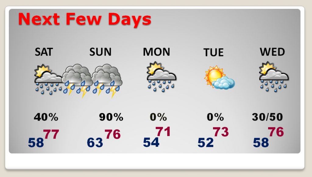
Don’t for get to set the clocks forward one hour late Saturday night before you go to bed.