
Welcome to Daylight time.
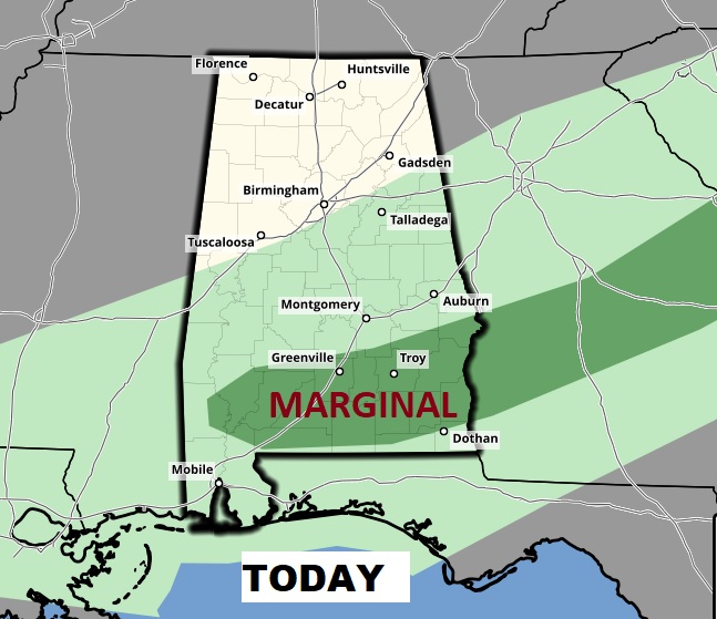
The slow moving frontal system, which produced 11 tornado reports yesterday, in 5 states, is moving southward. The front is weaker today, and threat of severe weather is “marginal”, at best, along and south front today, especially during the afternoon and evening as the ground heats up. It is possible that a few stronger storms could produce damaging wind gusts, generally near and south of a Columbus, GA to, Greenville line, across the south Alabama. The parameters for severe weather are not very impressive. Still, though, we will remain watchful.
TODAY: Scattered showers and thunderstorms, especially by this afternoon and this evening. Warm again. High today 70 to 72. Low tonight 56. (Yesterday’s high was 80) Sunrise on the new time: 7:02AM, Sunset at 6:49PM.
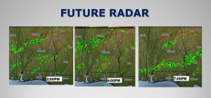
FUTURE RADAR: Showers and thunderstorms will “fire up” across south Alabama today along and south of the slow moving front. Some of the storms could become strong with damaging wind gusts. There could be a few warnings today. Keep our weather app handy.
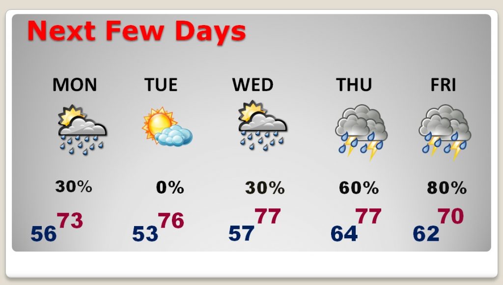
NEXT FEW DAYS: A weak disturbance could produce a few showers on Monday. Tuesday is dry. Risk of showers Wednesday, as the next storm system approaches. Best chance of rain is Thursday and Friday, as a significant storm system affects the area. It’s too early to say if it will be a system which produces severe weather. We’ll watch it.
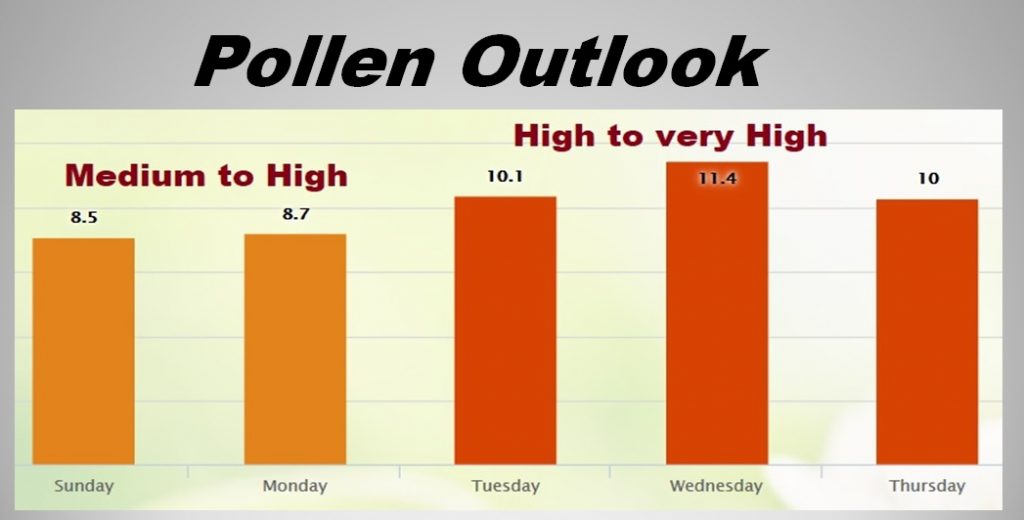
POLLEN FORECAST: Looks like a tough week ahead for allergy sufferers. The pollen will be in the medium to high range through Monday, and the high to very high range Tuesday through Thursday.
—
I’ll have a complete video update Monday morning, online by 4:45AM. I’ll go into much more detail about the week ahead, including a shot of much colder air by the weekend. Stay weather aware today. Have a nice day.
Rich