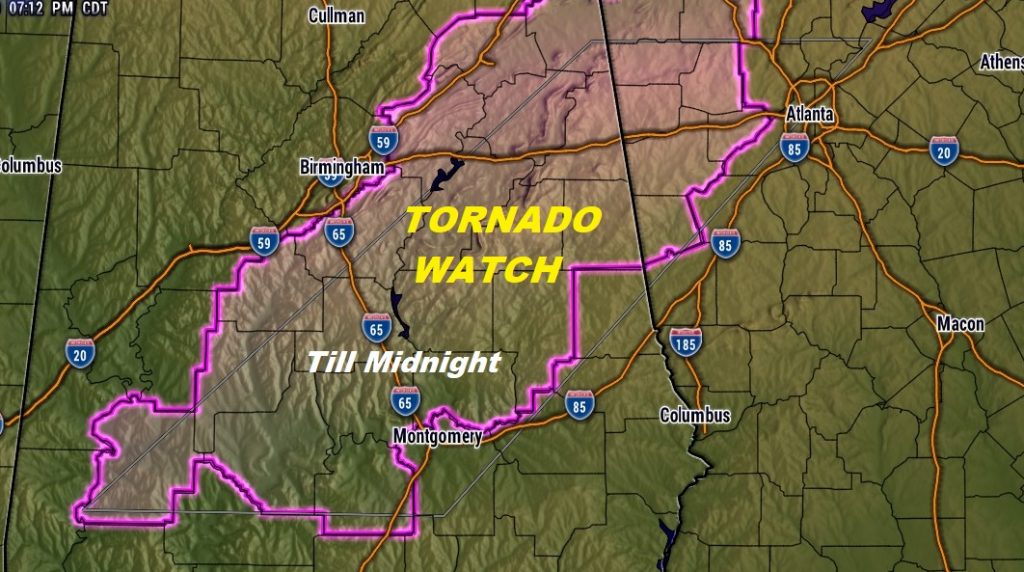
TORNADO WATCH FOR MUCH OF CENTRAL ALABAMA TILL MIDNIGHT…includes Autauga, Elmore, Coosa, Lowndes, Dallas, and Tallapoosa .
A big chunk of our state is in a Severe Weather Risk for today and tonight, as a powerful storm system approaches. I have the update threat risk from the Storm Prediction Center. We’ll look at some Future Radar scenarios. And, get ready for a sharply cooler weekend ahead. In fact, this cool spell could stick around for much of the week ahead. I have updated the numbers on the chilly nights ahead.
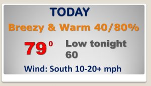
An Active frontal system affects the state today. A Breezy and warm day. We’ll tease 80 degrees. Thunderstorms get rolling this afternoon. We’ll be watching areas to the west and northwest of us closely where the strongest storm threat will be.
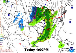
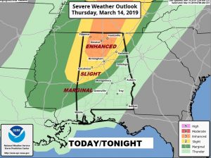
Storm Prediction Center for forecast raises eyebrows. ENHANCED risk across north Alabama, into Tennessee northward is where the most significant tornado threat, But the risk Marginal risk even cuts into central Alabama to near a Rockford NW Autauga county, Selma line through about 1AM or so. We’ll watch for adjustments in this threat area during the day.
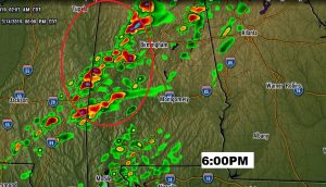
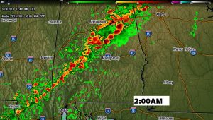
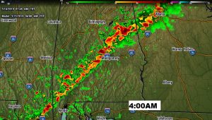
The 6PM Future radar shows a very aggressive HRRR model showing the threat for stronger to Severe storms west of us across west central Alabama towards 6PM. The NAM model advertises a squall line south of Birmingham at 2AM and down to near Montgomery by 4AM.
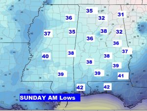
Get ready. A series of much below normal days and chilly nights are in the cards for much of the week ahead.
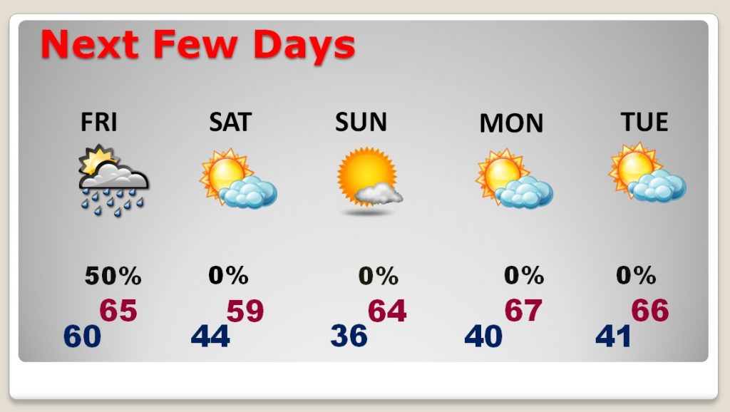
Coolest morning still appears to be Sunday morning.