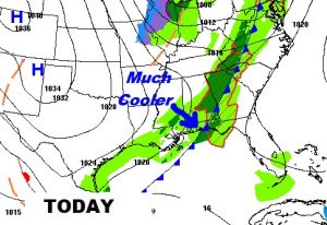
Many of you had scary night, with Tornado Sirens blaring, as folks headed for their safe places. NWS Survey teams will be out in several central Alabama counties this morning surveying damage, following a night of tornado touchdowns. More on the survey plan below. Apparently Titus was one of the areas where there was significant damage. No movie this morning. I was covering storms late. This blog will summarize, as we get ready for the front which will bring much cooler air to the state. Future radar below will show the secondary line we will be dealing with during the morning hours which marks the front itself. This line will not be severe. We will have several storm-free days ahead after today.
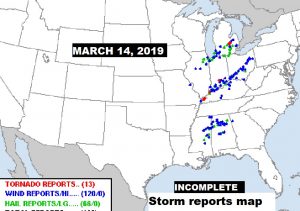
Incomplete storm reports Map from yesterday/last night from NWS:
TODAY: Risk of showers through mid day, tapering off during the afternoon. Otherwise, breezy and cooler, high 64. Northwest wind at 10 to 18. Cloudy and colder tonight. Low 43.
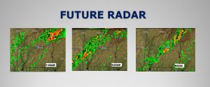
Future radar shows the secondary line we will be dealing with during the morning hours which marks the front itself. Risk of showers will begin to taper off this afternoon.
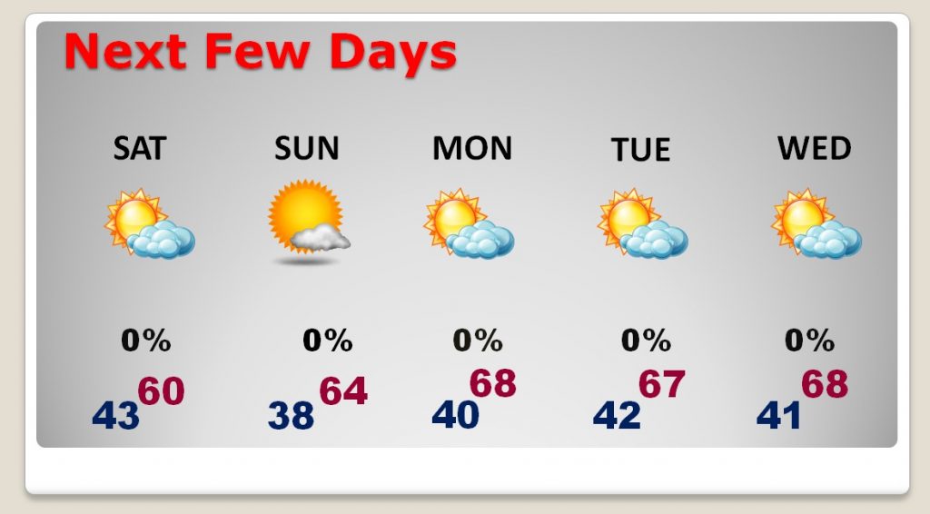
THE NEXT FEW DAYS: Rather cool to borderline chilly next few days. Well below normal. Saturday’s high barely 60. Low Saturday night 38. STORM-FREE next several days. Sixties for highs Tuesday through Thursday. Chilly nights ahead.
NWS SURVEY TEAM PLAN TODAY: From the National Weather Service:
MULTIPLE TORNADIC STORMS AFFECTED CENTRAL ALABAMA DURING THE
AFTERNOON AND EVENING HOURS OF THURSDAY, MARCH 14TH. LARGE HAIL AND
STRAIGHT-LINE WIND DAMAGE OCCURRED, ALONG WITH SEVERAL TORNADOES AS
CONDITIONS BECAME MORE FAVORABLE LATER IN THE EVENT.
SURVEY SUMMARY:
AT LEAST 9 AREAS OF INTEREST HAVE BEEN IDENTIFIED BASED ON TORNADIC
DEBRIS SIGNATURES ON RADAR AND/OR REPORTED DAMAGE. THE AREAS INCLUDE
PORTIONS OF THE FOLLOWING COUNTIES: MARENGO, PERRY, DALLAS, BIBB,
CHILTON, COOSA, AUTAUGA, ELMORE, ST. CLAIR, AND BLOUNT COUNTIES. DUE
TO THE NUMBER OF TRACKS TO INVESTIGATE, IT MAY TAKE MORE THAN ONE DAY
TO COMPLETE ALL ASSESSMENTS.
AT THIS TIME, STORM SURVEYS ARE BEING PLANNED FOR THE FOLLOWING
COUNTIES ON FRIDAY, MARCH 15TH:
*TEAM ONE: PRIMARY TARGET: BLOUNT COUNTY
*TEAM TWO: PRIMARY TARGET: ELMORE COUNTY
*TEAM THREE: PRIMARY TARGET: CHILTON COUNTY
**TEAMS WILL MOVE TO OTHER TARGET AREAS AS TIME ALLOWS**
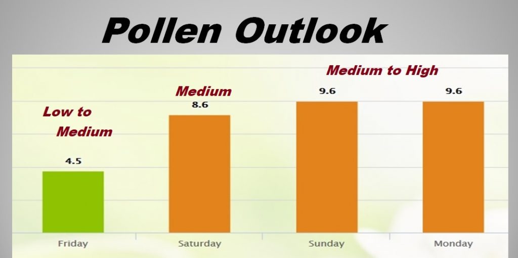
POLLEN UPDATE: Medium range today. Then back to medium to high tomorrow through Monday.
—
We’ve had a pretty intense 2019 so far with severe weather/tornado days, most prominent on January 19, March 3 and now March 14th. It will be nice to have several quiet days to decompress.
Hope you have a great day today. There will be another Blog Update early Saturday and Sunday by Dawn. Other updates will be published as needed.
Rich
