If you have outdoor plans today, it should be a great Spring day across central & south Alabama. Shorts and teeshirts will be in fashion. The frontal system approaching the state, will bring in showers and thunderstorms overnight tonight, but for many of us, the showers threat will be greatest overnight tonight. Expect a big change tomorrow. It will be windy and sharply cooler, by at least 20 degrees. Another period of cool days and chilly nights.
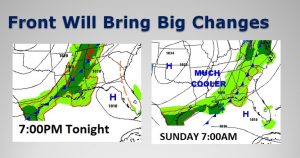
Here’s the Map set-up showing the front entering NW Alabama tonight, and reaching the coast in the morning.
TODAY: There should be a good but of sunshine during the day, mixed in with some increasing high clouds. Very warm. Highs averaging 80 to 82. Mostly cloudy tonight. Showers and thunderstorms will move in late tonight.
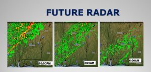
Future Radar shows how the line of showers and storms becomes much less prominent as it moves southeastward in the overnight hours. Don’t expect much rain, unfortunately. No severe weather is expected in our part of the state.
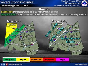
SEVERE WEATHER THREAT NW COUNTIES: Across northwest Alabama, storms could become severe this evening and tonight, mainly along and northwest of I-59/I-20. Damaging wind gusts and quarter size hail is possible, mainly from about 6PM to 11PM.
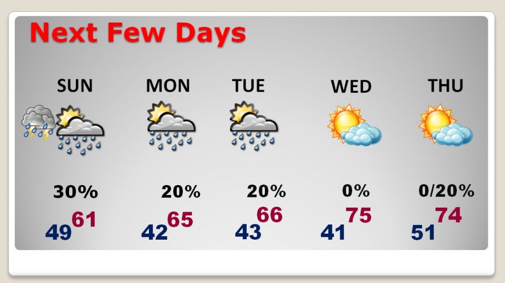
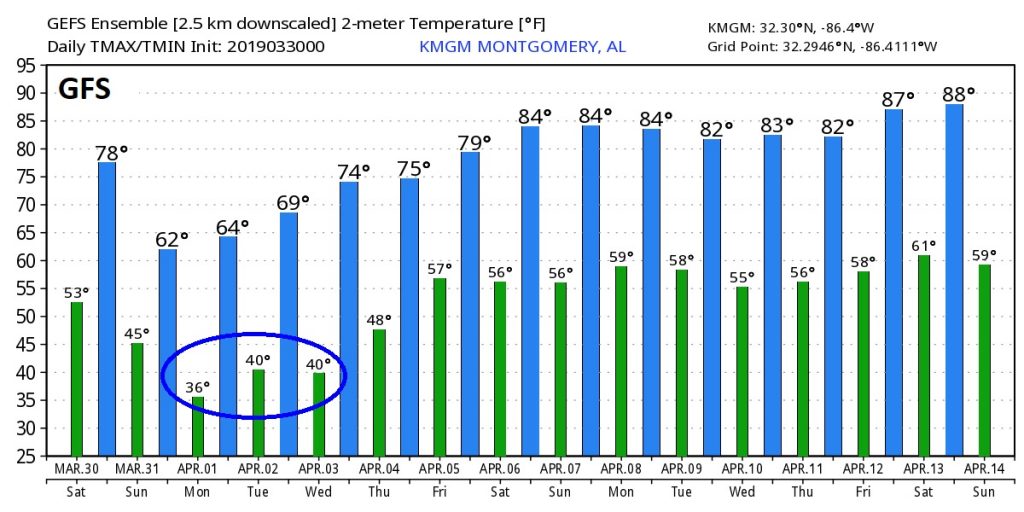
NEXT FEW DAYS: It will turn sharply cooler behind the cold front. Sunday will be windy and very cool with lower 60’s. Nights will become quite chilly again. Lower 40’s are expected Monday, Tuesday and Wednesday morning. Highs in the 60’s Another storm system will brush by, south of the state Monday evening/Tuesday with a small rain threat. It will warm-up again late week. Another rain threat returns by the end of the week and into the following weekend.
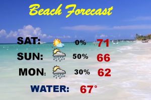
BEACH FORECAST: Today will be cool but nice at the Beach. After today, the Beach weather falls apart. Windy and sharply cooler. Showers threat tomorrow through mid-day Tuesday.
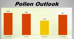
POLLEN FORECAST: What can I tell you? The news is still not good.
LOOKING AHEAD: This is just RAW temperature guidance off the GFS model. Besides showing the chilly mornings ahead this week. look what the GFS does to high temperatures starting NEXT weekend (April 6) through the following week. Could we be done with these rude bouts of sharply cooler air. Maybe.
– –
I’ll have another blog update on Sunday morning, early. Enjoy the nearly perfect weekend forecast!
-Rich
