Happy Friday! We have an active pattern over the next 5 days, along with warmer days. There have been some adjustments in the weekend forecast on rainfall probabilities, which are just a notch lower. We have a new update from Storm Prediction Center on which parts of the state could see some severe storms and when. Plus, we’ll look at who could see the heaviest rainfall totals in the next 5 days. I have updated the Beach Forecast. Spoiler alert: beach goers won’t be happy.
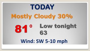
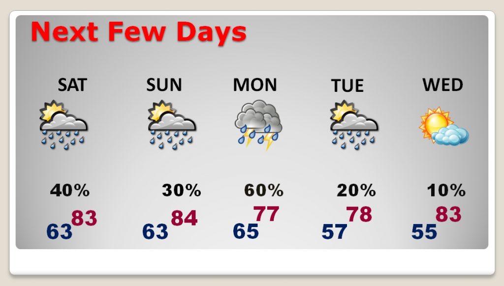
Random showers and storms will be roaming around today. Although your chances of encountering one are relatively small, you could still get under a very heavy downpour. Warm day.. 80+.
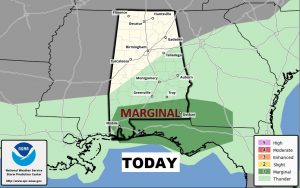
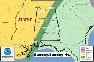
Greatest threat of storms reaching severe limits will be along the southern strip of counties.
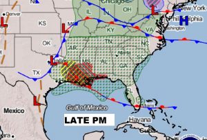
SPC has put a bug chunk of the state in a severe weather risk by late Sunday into Sunday evening. The threat area could be adjusted before we get to Sunday.
Wet at times next few days. Scattered showers and thunderstorms. Most concentrated storm threat Monday. Warm. Highs in the 80s’
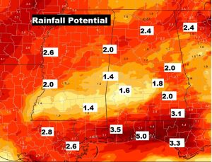
Healthy rainfall amounts across the region next few days. Heaviest totals in the southern counties and closer to the coast.
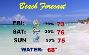
Not the best Beach Forecast this weekend.