NEW TORNADO WATCH (12:30AM 4/18/19) New Tornado Watch for much of east and southeast Alabama until 8AM.
Damaging winds up to 60 mph and tornadoes are possible in the watch
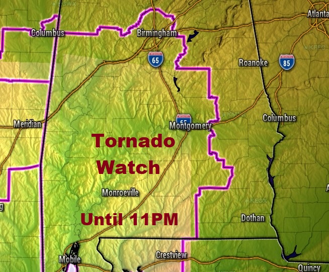
Severe thunderstorms with damaging wind gusts are also possible along with large hail quarter size or larger.
The threat of severe weather will continue through the night and will not exit SE Alabama until perhaps 5 or 6 AM Friday morning.
Obviously, the nigh-time severe weather/tornado threats are extremely dangerous. If you live in a manufactured home or mobile home, it’s best to leave for a more substantial structure. Many community centers in several counties will be open tonight. Even some churches.
Make sure you have at least a couple of reliable ways to receive a warning, including a weather radio, which can wake you up in the event of a warning. Our Weather App will also instantly alert you for a warning for your area. Do not rely on hearing a tornado siren.
FROM NWS:
Tornadoes and damaging winds up to 60 mph are possible through 5 am
for all of Central Alabama. Rainfall will be 1 to 3 inches overnight
and these rain amounts may lead to localized flooding. Ahead of the
line of thunderstorms, breezy conditions are expected with wind
speeds of 15 to 25 mph with gusts to 35 mph.
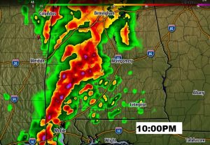
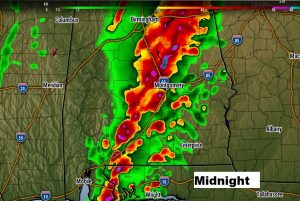
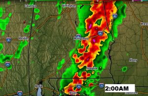
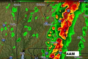
FUTURE RADAR: Here’s one model idea (HRRR) of the potential storm movement and timing of the movement tonight. Don’t tale this laterally. This is just for general guidance purposes. As you can see, it looks like a long night ahead.
AFTER THE STORMS – EASTER WEEKEND AND BEYOND:
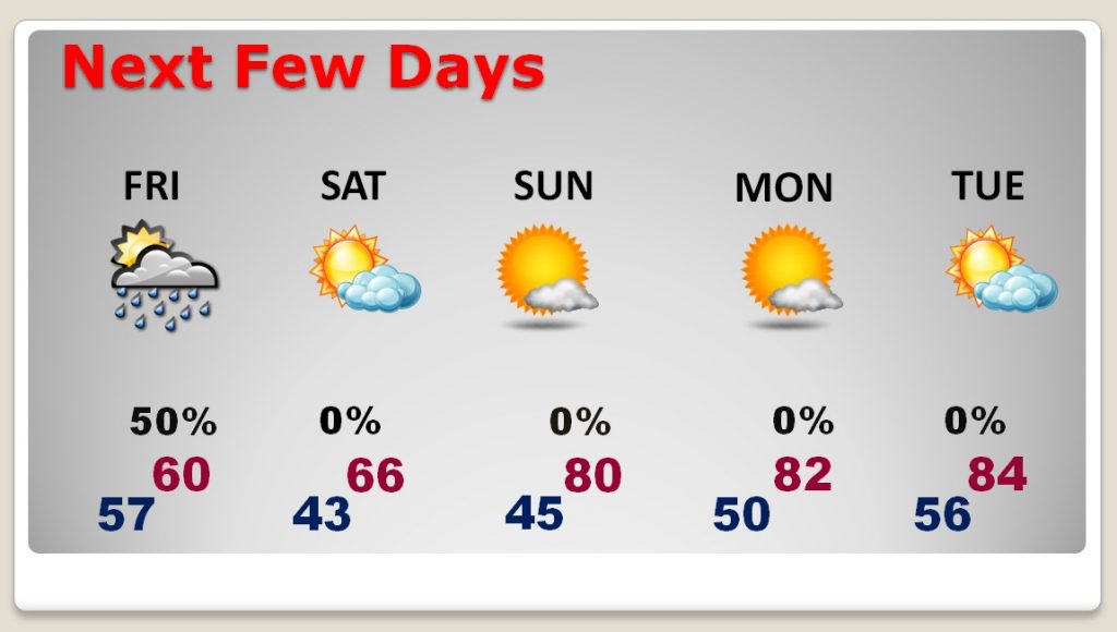
Friday will be a brisk, chilly day…windy & very cool. High perhaps near 60. Occasional showers. Friday night will be COLD…low 43. Cool and breezy Saturday. High 66. Chilly for Easter sunrise services, with middle 40’s…but, a nice day and a nice Easter recovery. High near 80. Tuesday and Wednesday look nice.