
Happy Easter! Sure, it’s chilly on this Easter Morning. With temperatures in the low 40’s at sunrise, we’re at least 10 degrees too cold. (Sunrise at 6:09AM) But, there will be a remarkable recovery during the day. It should be nearly perfect.
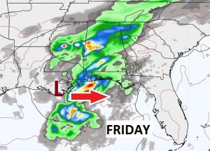
Get ready for a string of nice days, which will encompass most of the week ahead. The next storm system will affect the area by Thursday night into Friday. So far, I see no indication of a severe weather threat. I’ll keep you informed.
TODAY: A Chilly morning. Low 40’s for Easter Sunrise Services. Sunshine today. Remarkable afternoon recovery. Nearly perfect. High 77. Cool again tonight. Low 48.

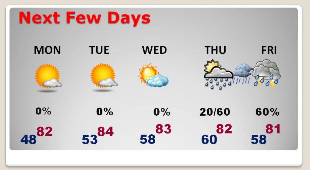
NEXT FEW DAYS: There’s a warming trend in our future. After a chilly start Monday, we’re headed for the lower 80’s Perhaps the mid 80’s Tuesday. The next storm system will affect the area with showers and perhaps some thunderstorms by late Thursday night into Friday. It does not look severe at this time.
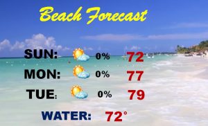
BEACH FORECAST: Moderate rip current risk today and tomorrow. Otherwise, the Beach Forecast is getting a little warmer after a chilly couple of days.
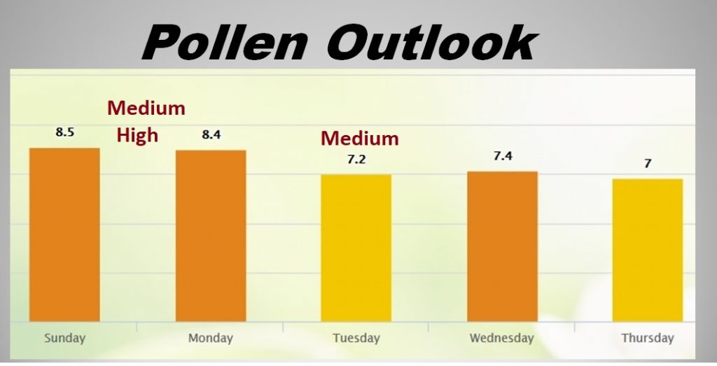
POLLEN FORECAST: Not as high as it was last week. Medium to high today and tomorrow. Medium on Tuesday.
—
I’ll have a complete video update Monday morning. We’ll focus in on the details of the week ahead. Happy Easter!
–Rich