
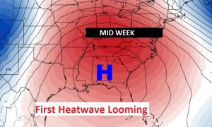
I know it’s just May, but on this Blog Update, I’ll tell you about the first heatwave of 2019, which is looming in the week ahead. We will be at least in the middle 90’s by mid to late week. And, that’s not all. The hottest temperature may actually occur over the Memorial Day Holiday weekend. See below for some possible holiday weekend highs. With upper High pressure building above us, pop up showers are unlikely. Here’s that upper level “heat bubble” by mid week.
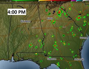
TODAY: Rain chances are not zero, but they are small…closer to 10%. High 89-91. Low tonight 65. Winds will be light. Here’s a Future Radar snapshot at 4PM from one of the high res model. It suggests the best chance of any showers will probably be over SE Alabama and into Georgia.
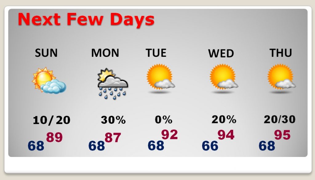
NEXT FEW DAYS: Getting hotter. A little more humid on Sunday and Monday. Upper 80’s. A weakening front will bring in small rain chances Sunday PM into Monday. Then, HOT Tuesday, through the end of the week with highs in the 90’s, perhaps middle 90’s and no rain.
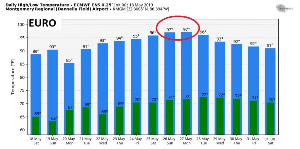
Raw Guidance from the global computer models, suggests that the hottest weather could happen over the Memorial Day Weekend. In fact the Euro Ensembles show highs peaking in the upper 90’s by the holiday weekend. The Euro operational run is even a little higher than that. The American GFS model is a little more reasonable.
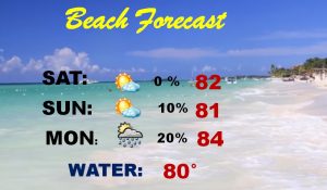
BEACH FORECAST: GREAT weather at the Beach next few days! Highs mostly in the low 80’s. BUT, beware. High rip current risk today and moderate on Sunday. Gulf water temperature now at 80.
– –
I will have another forecast update early on Sunday morning. I hope you have a great weekend.
-Rich