
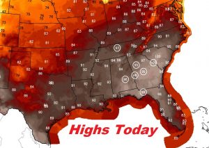
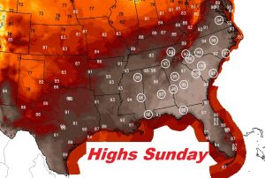
The heat is still building and it will peak over the Memorial Day holiday weekend. Highs will reach the upper 90’s. It’s not out of the question that we could reach 100 one of those days. We’ve never been to 100 in the month of May in 147 years of Montgomery weather records. But, if you have outdoor plans at the Beach, the Lake or your backyard, rain will not interrupt your plans for several days. Fortunately, humidity will not be crazy high like a July day. The Heat Index readings won’t be much higher than the actual temperature.
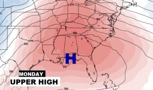
A large upper level heatwave high is like a dome for the next few days. It diverts storm systems around us, and keeps us HOT.
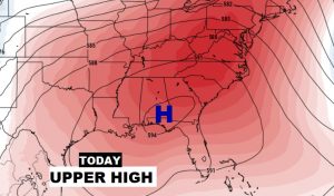
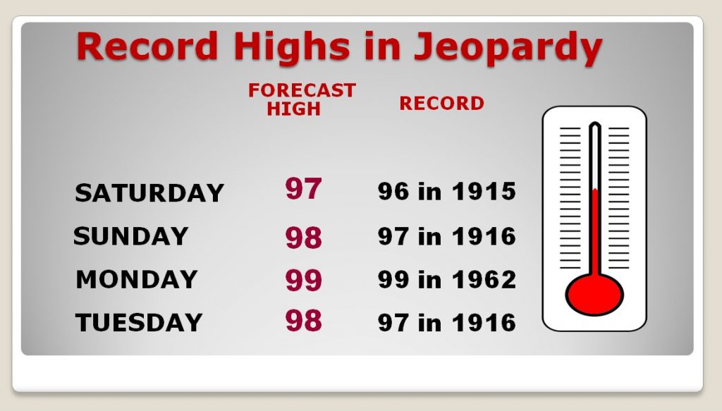
TODAY: Sunshine will dominate. Light wind, under 5 mph. High 97. (Record 96 in 1915) Rain chances very close to 0%. Low tonight 72.
Many records are in jeopardy across the Southeast US today & Sunday.
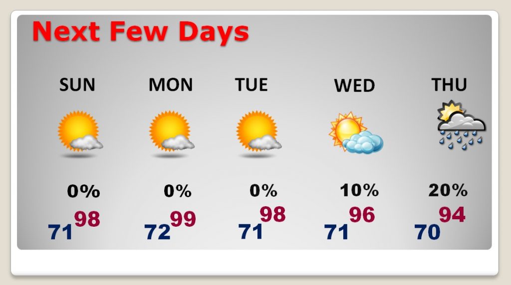
NEXT FEW DAYS: High and Dry. Highs in the upper 90’s. Stay hydrated. Lows at night in the lower 70’s Dry through mid week. Small chance of random showers return by Thursday and Friday.
Record highs are still in jeopardy for the next few days.
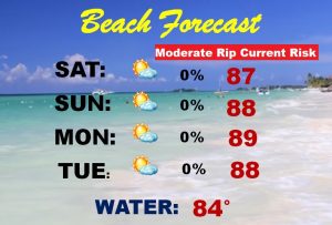
BEACH FORECAST: A great Beach forecast. Very warm, but it will be at least 10 degrees cooler than central Alabama. Highs in the upper 80’s. Be careful, it’s been a difficult rip current week. A moderate rip current risk continues today. Watch the flags on the beach. Gulf water temperature is now 84.
– –
I will have another forecast update on Sunday morning. I hope you have a great Memorial Day Holiday weekend.
-Rich