This steamy, very wet pattern, with tropical downpours, will continue at least through Monday, before storms start to thin out in number on Tuesday and Wednesday. Things look much nicer by Thursday and Friday.
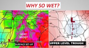
What’s causing the wet pattern? It’s a perfect set-up. Abundant tropical moisture is in place, particularly from East Alabama in through Georgia. A low pressure trough at the surface and aloft are acting in concert as a focus for the storms.
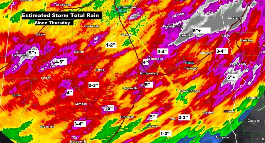
Rainfall amounts since Thursday have been uneven, but rather impressive in spots. Here’s Doppler Radar storm total estimates showing many pockets of 3-4″, and numerous areas over 5″. The Montgomery Airport is officially at 2.40″since Thursday.
TODAY: Extremely humid. A better than normal chance of showers and thunderstorms continues. Like yesterday, some spots will see some brief sunny intervals between showers. High in the mid to upper 80’s. Low tonight 71.
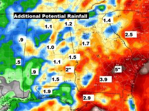
Heaviest rainfall totals will be over the eastern counties, where conditions are a little more favorable for tropical downpours. Here’s potential future rainfall.
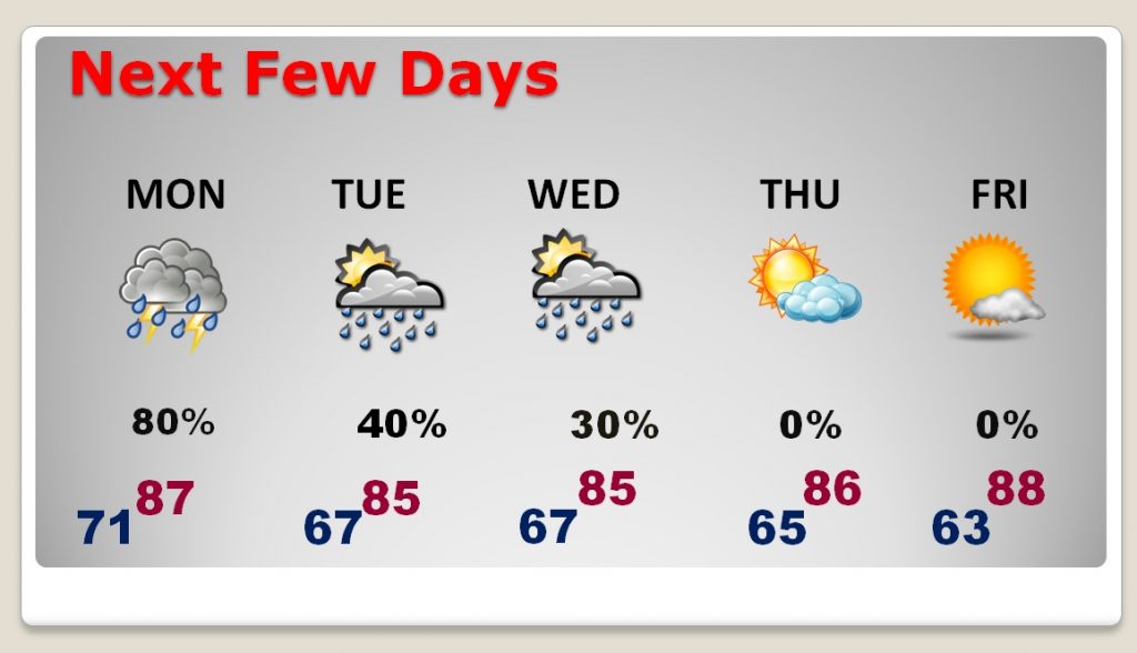
NEXT FEW DAYS: Wet forecast through Monday, but showers start to thin out in number by Tuesday and Wednesday. A couple of dry days will be nice by Thursday & Friday. More showers possible next weekend.
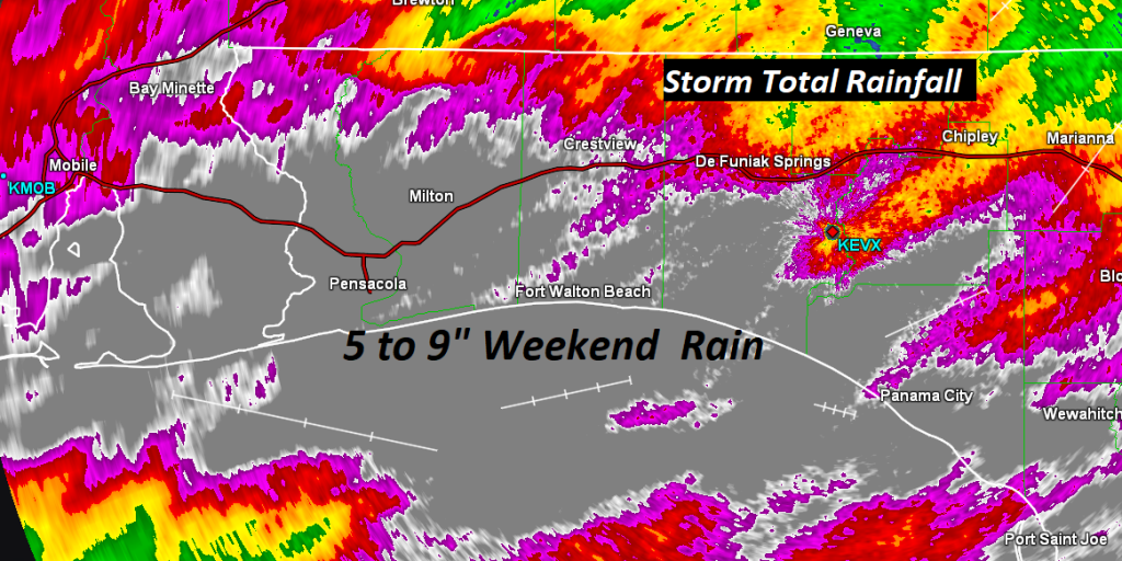
BEACH FORECAST: Needless to say, it has been a truly awful series of days at the Beach. Weekend rainfall amounts of 5 to 9” have been recorded. The showers and storms will be in ample supply again today, and Monday, but if you are planning a beach trip this week, things do get much better, finally, by mid to late week. A High Rip current risk continues today. It will be in the moderate range on Monday.
—
I’ll have a complete video update Monday morning, online by 4:45AM. Stay dry! Have a nice Sunday. I’ll see you in the morning.
–Rich
