
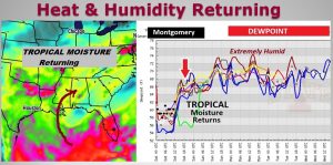
You’ll feel a difference today. Tropical moisture is migrating back into Alabama from the Gulf. Those lower humidity levels we’ve been enjoying, will soon be a thing of the past. Dewpoints in the 70’s, beginning on Father’s Day, will persist in through the foreseeable future. Although much of the state should be dry today, pop up storms will be return Sunday, and storms will increase and will be in ample supply each day through the week ahead.
TODAY: We’ll be close to normal for mid June today. Lots of sun. You’ll feel the increase in humidity. High near 90. Low tonight 71. I have the rain chances well under 20%. East wind at 4 to 8 mph.
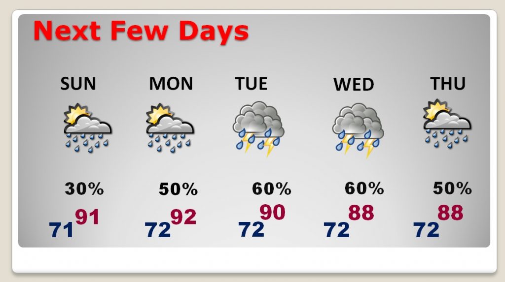
NEXT FEW DAYS: Scattered pop up storms could affect a few Father’s Day plans tomorrow. But, rain chances get a lot better Monday, and even better Tuesday through Thursday and beyond. Hot & Humid. Storms will be most numerous in the afternoon & evening hours.
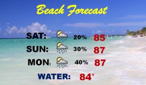
BEACH FORECAST: Isolated storms are possible today. Scattered storms return Sunday and Monday and become much more numerous in the week ahead.
Rip current risk….Low…however…life threatening rip currents often occur in the vicinity of inlets…groins…jetties…and piers. Always supervise those who cannot swim and remember to heed the advice of the local beach patrol and flag warning systems.
– –
I will have another forecast update tomorrow morning. The weather conference here in San Diego is now over. Today is a travel day. Have a nice weekend
-Rich