
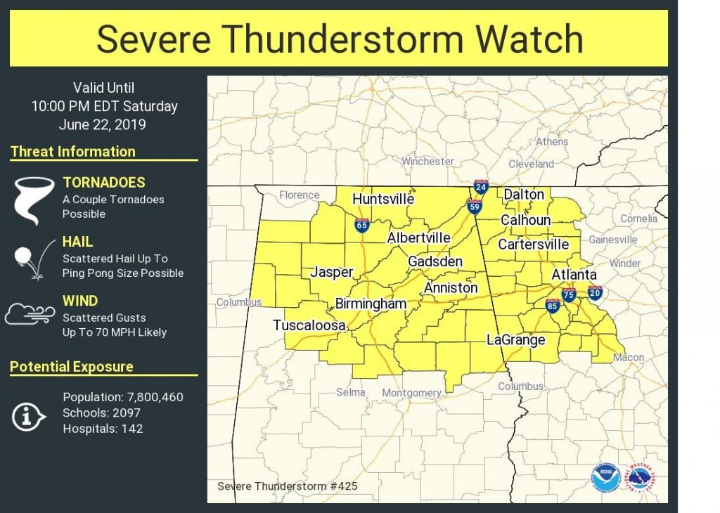
1:20 pm UPDATE:
A Severe thunderstorm Watch now covers north Alabama until 9PM. The watch extends as far south as Chilton, Coosa and Tallapooosa. Up to 70 mph wind gusts, and ping pong ball size hail are possible. A brief tornado can not be ruled out
EARLY MORNING UPDATE (5:45AM):
The big story today is the heat and humidity. Once again, we’ll be dealing with a heat index into triple digits. (Yesterday Montgomery’s heat index peaked at a dangerous 109, on the first day of summer) This kind of heat can also be the fuel for a few strong to severe storms. Some towns could see quite a show. Many towns will not see a storm. Keep reading…
—
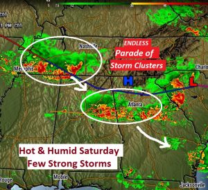
Here’s the set-up. The front stretched across north Alabama and Georgia, will continue to act as a ‘conveyor belt’ for some strong storm clusters to ride southeastward. These pesky storm clusters (MCS), can cause a lot of problems with localized severe storms. These storms could affect us, in isolated cases this afternoon and tonight. (A similar cluster of storms moved through North and east central Alabama overnight. Some of you a noisy thunderstorm in the wee hours)
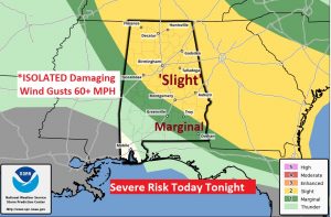
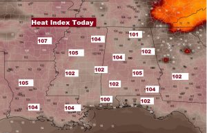
TODAY: Hot and Humid. High in the mid 90’s, again. The heat index will be 101 to 106. (100 begins the extreme caution range, 105 begins the Danger zone) Spotty thunderstorms will develop. (Probabilities will be roughly 30-40%) The stronger storms could produce damaging wind gusts of 60+ mph. A few severe thunderstorm warnings are possible. While, the greatest risk will be across the eastern counties, those of us in the central counties need to be watchful. The storm threat continues through about 10PM tonight. Our weather App will instantly alert you to a warning for your location, with push notifications.
The Dangerous Heat Indices will continue today across the Deep South.
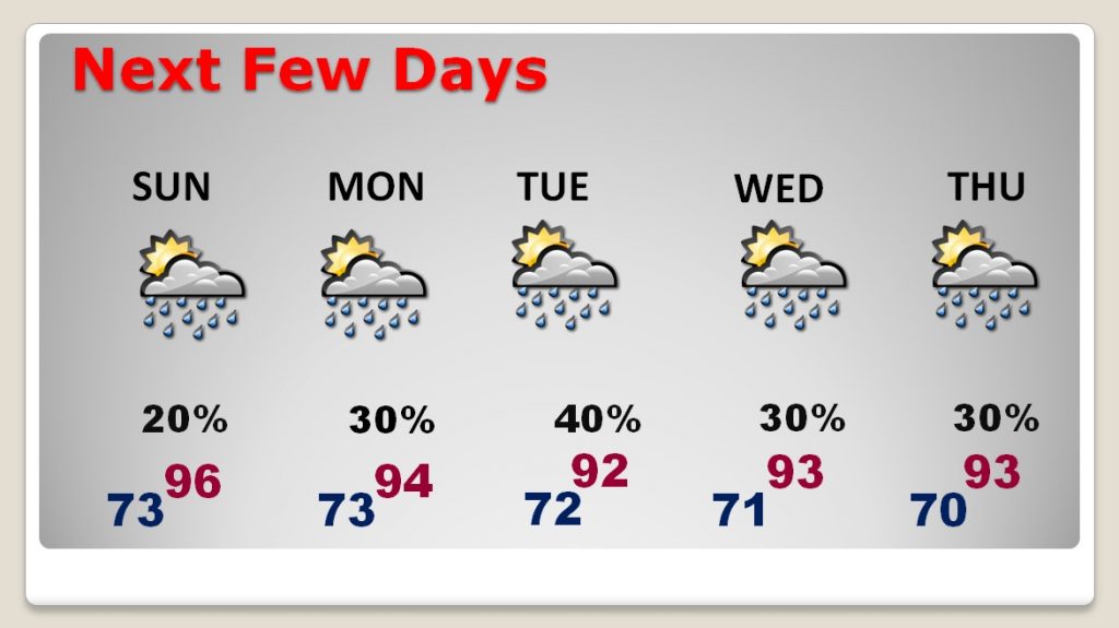
NEXT FEW DAYS: Sunday I think the storms will be few and far between. We’ll be back to the mid 90’s again, with triple digit heat indices. Not much change Monday through Wednesday…scattered PM storms and highs in the low to mid 90’s. We are now 93 days until the first day of Fall.
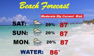
BEACH FORECAST: Moderate Rip Current Risk through the weekend. Highs in the upper 80’s. Heat index 100 to 105. Water temperature is 86.
– –
I will have another forecast update tomorrow morning. Have a nice weekend. Stay hydrated. Keep an eye on the radar on our Weather App. You can download it in the app store. Just search Rich Thomas Weather.
-Rich