
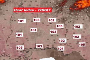
Today will not be as turbulent as yesterday across Alabama. It will, however, continue to be Very HOT. For the third day in a row, the Heat Index will be very close to the 105 Danger Range. (Yesterday, Montgomery had a high of 95, with a Heat Index of 107). Thunderstorms will be more widely scattered in nature today. Even though there won’t be many storms, in this kind of heat, a few storms could be quite strong. Rain chances will get a little better Monday and Tuesday, with storms in somewhat better supply.
TODAY: Hot & Humid. High middle 90’s Heat index at or close to 105 this afternoon. Widely scattered storms. Low tonight 75. Light wind.
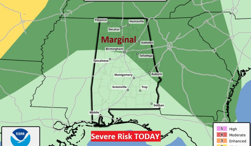
The Storm Prediction Center has a Marginal Severe Risk covering the far eastern counties, northeast & north Alabama. Damaging wind gusts possible in the stronger storms.
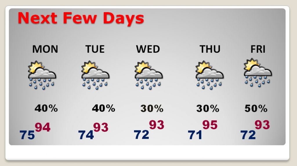
NEXT FEW DAYS: Rain chances get a little better early and mid week as a trough of low pressure approaches. Otherwise, continued HOT. Highs low to mid 90’s
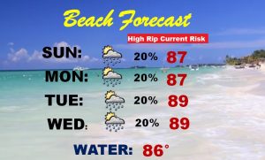
BEACH FORECAST: High Rip Current risk through Monday. Moderate risk Tuesday. Otherwise, the rain chance will be small. Highs in the upper 80’s Heat index 100-104. Gulf Water 86.
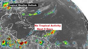
THE TROPICS: Good news. The Atlantic, the Caribbean, and the Gulf of Mexico remain very quiet, for at least the next 5 days.
—
It was certainly feast or famine yesterday. I had dinner in Elmore county, where there was 1.5 inches of rain. When I got home, the rain gauge at my house in East Montgomery showed 0.00. The airport had .03. Friends camping in Tallapoosa county dealt with a severe thunderstorm with 60 mph winds. That’s the kind of a wild Saturday it was. Scattered wind damage was reported around the state, especially in the northern half.
I’ll have a complete video update Monday morning, online by 4:45AM. Stay hydrated in this heat. Have a nice Sunday. I’ll see you in the morning.