Good morning! More kids will be heading back to school today, but meanwhile, summer heat rolls on. Today and tomorrow the Heat Index will be approaching some dangerous territory. Meanwhile, we’ll be radar-watching, as thunderstorm clusters line up to the northwest if us. Some storms in our state could reach Severe Limits. On this video, I’ll take you through the details through the west of the week and through the weekend. Our rain chances will fluctuate over the next few days.
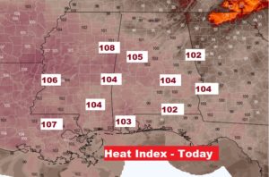
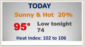
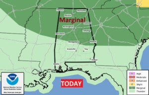
Hot & Humid today with the Heat Index Near the 105 Danger Range. Big heat produces Big Storms. SPC says some storms in our state could reach severe limits. Marginal Severe Risk from I-85 northward.
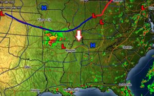
That approaching front will be a player in our forecast…increasing the rain chances Friday evening through the weekend.
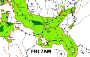
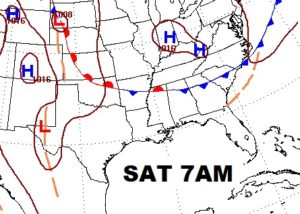
Scattered storms Today and Thursday will become more numerous Friday and over the weekend.
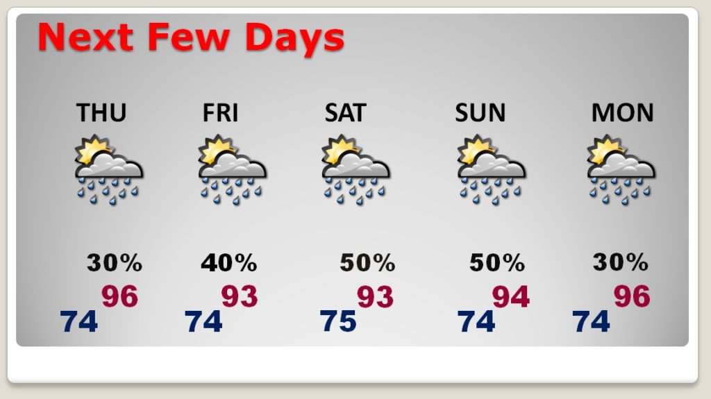
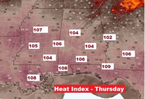
Crazy heat. Look at the heat index Thursday. Dangerous heat index.