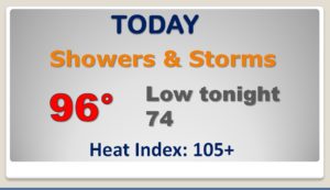
Good morning! A southward moving front will be the main player in our state today. The BEST chance for concentrated showers & storms will be along and south of I-85. The front will bring ‘limited relief’ after it passes south to near the coast. It will still be HOT behind the front, but depending on where you live, the humidity and the heat index will be lower. It will be an improvement for many areas except southeast Alabama where the awful humidity will linger. How long could this “brief relief” last? I will dissect the forecast details through the weekend and we’ll talk about possible Gulf tropical mischief.
HEAT INDEX continues along and south of I-85 today. Active weather day as the front moves southward. Best chance of strong to severe storms along and south of I-85 today. Otherwise another very HOT day.
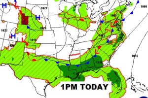

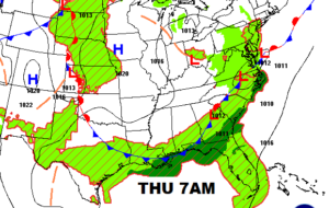
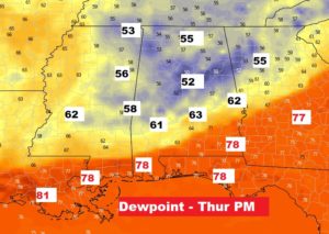
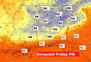
The front moves into extreme southeast Alabama. Behind the front there will be limited relief depending on where you live. Dewpoints will be lower from central Alabama northward which means the humidity will not be as awful for 2-3 days.
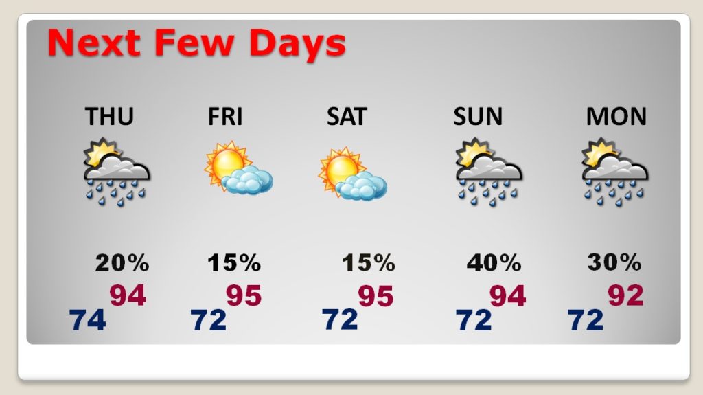
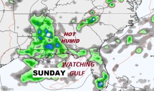
By Saturday evening, some of that awful humidity will be creeping back northward. On Sunday, it’s back to business as usual.
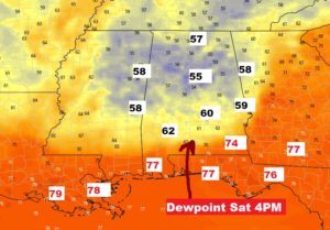
I’ll keep the rain chances small Thursday, mainly in SE Alabama. Rain chances under 20% on Friday and Saturday. STILL HOT. Highs well in the 90’s everyday. Just slightly more tolerable humidity for 2-3 days, until Sunday when terrible humidity is back and all of this is just a memory.