I keep hoping this is just a bad dream. The bad dream will continue for several more days, I’m afraid. There were some isolated showers in east Alabama yesterday. There could be a couple more today, maybe. After that, though, the upper high gets stronger and the rain chance evaporates for the rest of the week. Friday was Day 3 of the Record High streak. Incredibly, that string could reach 9 or 10 days! And, the drought is getting worse. The rainfall prospects are awful for the week ahead. Details below.
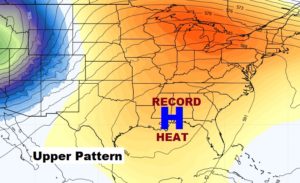
Here’s the upper level heatwave high, which won’t budge. It is responsible for the record heat and the dry pattern.
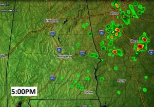
TODAY: I’ll put in a 10% rain chance here in Central Alabama, and maybe as much as 20% near the Georgia border. Otherwise, blazing heat. Not much of a breeze. High: upper 90’s to near 100. (Record 96 from 1986). Low tonight 71. Here’s a future radar snapshot at 5:PM this afternoon.
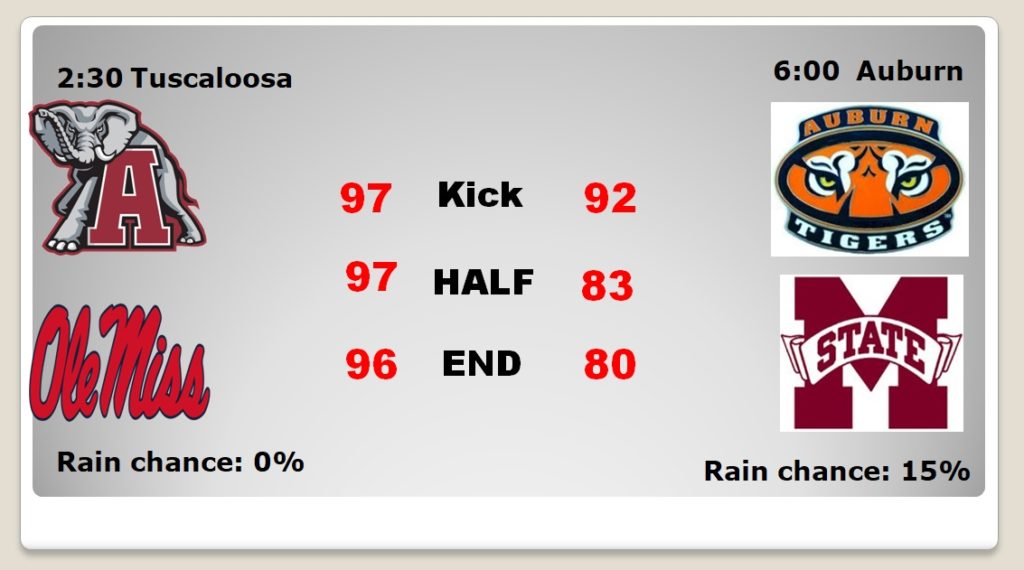
FOOTBALL WEATHER: There are two big SEC games in our state today, involving the state of Mississippi. The heat will be relentless in Tuscaloosa as Ole Miss comes to town for a 2:30 kick, with upper 90’s during the game. The numbers are slightly better for the Auburn /Mississippi State game, but not fun. It’ll be in the 90’s, for that 6:00 kickoff in Auburn. I’ll put the Auburn rain chance at 15% in the first half. Stay hydrated! I’ll be watching on the couch, with the A/C on high.
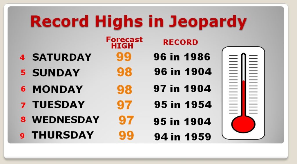
RECORD HIGH STRING: Today is Day Three of what could be an incredible 9 or 10 day string of back to back Record High temperatures. Talk about re-writing the record book! These records will stand for many, many years.
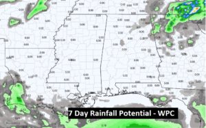
DROUGHT GROWS WORSE: With 83% of the state now involved in some level of drought, the news for the next seven days is dismal.
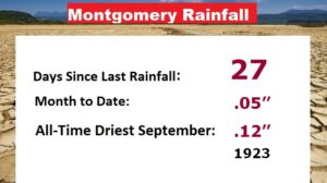
We are almost certainly going to break the all-time Driest September Rainfall Record in Montgomery. This is now Day 27 since the last measurable rain.
Here’s the current Drought Monitor. Notice the Severe Drought which covers parts of Coosa/Tallapoosa counties, and down in the Wiregrass counties too.
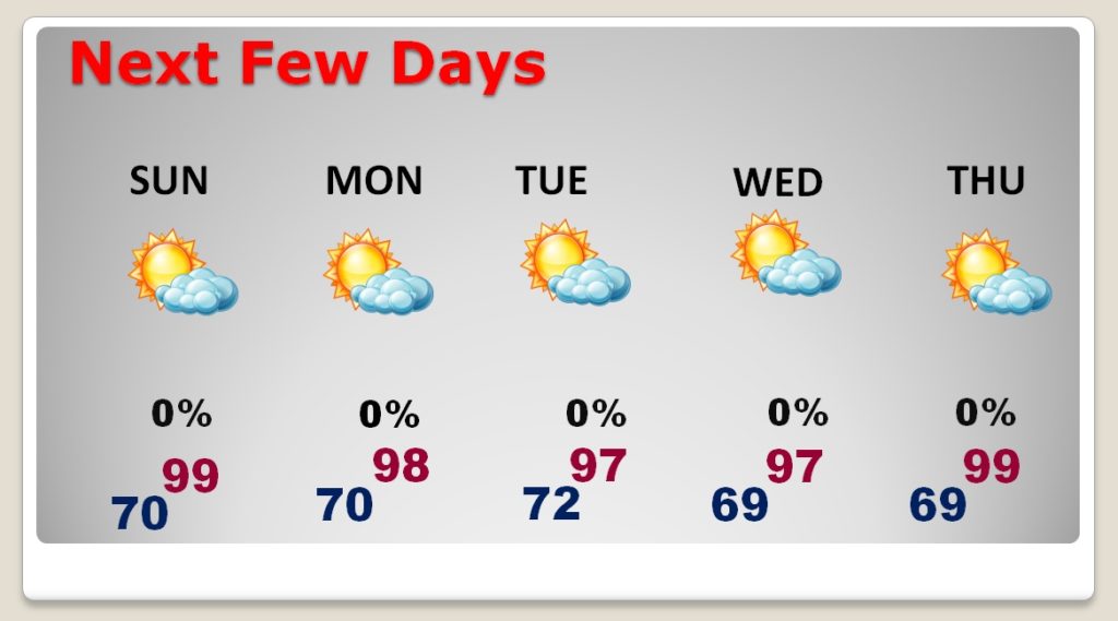
NEXT FEW DAYS: Read it and weep. Hot and Dry for several days with very little day to day change.
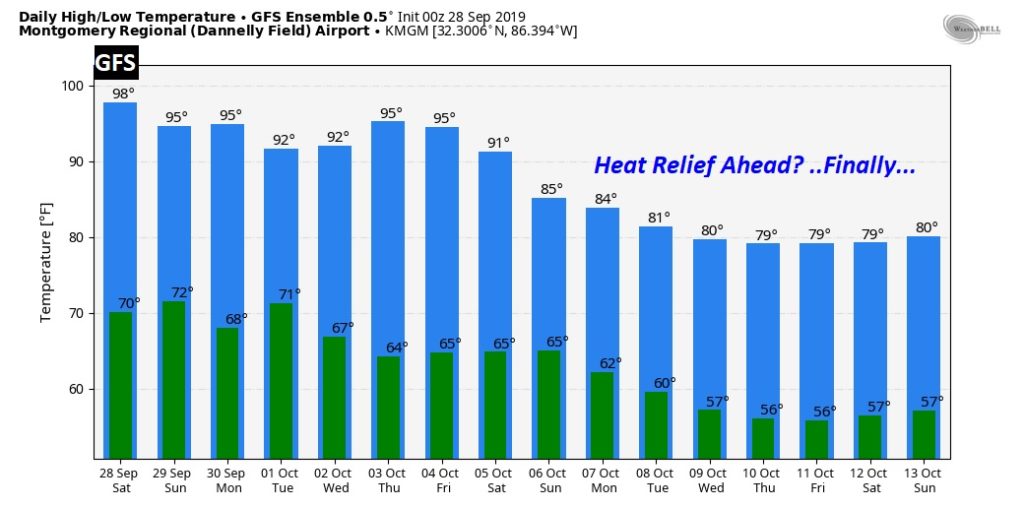
LONGER RANGE RELIEF?: I can’t tell you when it will rain again, but I can give you a nugget of hope about some nicer temperatures beginning the second week of October. Two of the big global models agree…the Euro and the GFS. We’ll see. Keep your fingers crossed.
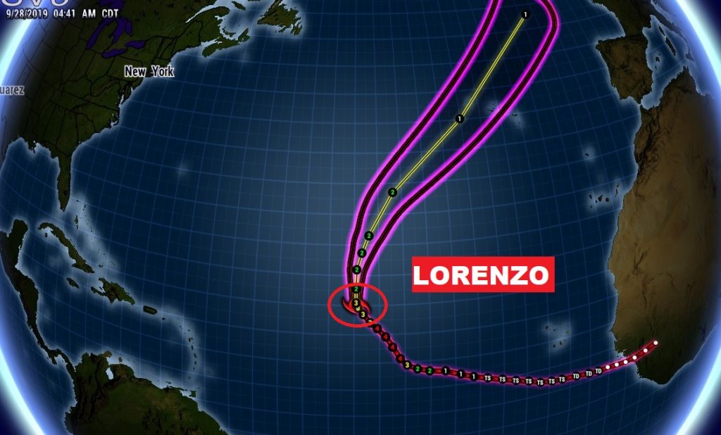
TROPICAL UPDATE: Karen is no longer a tropical system. Lorenzo is a large, powerful, major hurricane in the eastern Atlantic. At the moment, it is the only player on the board.
I will have another Blog update tomorrow morning. Have a nice weekend! Pray for rain.
-Rich
