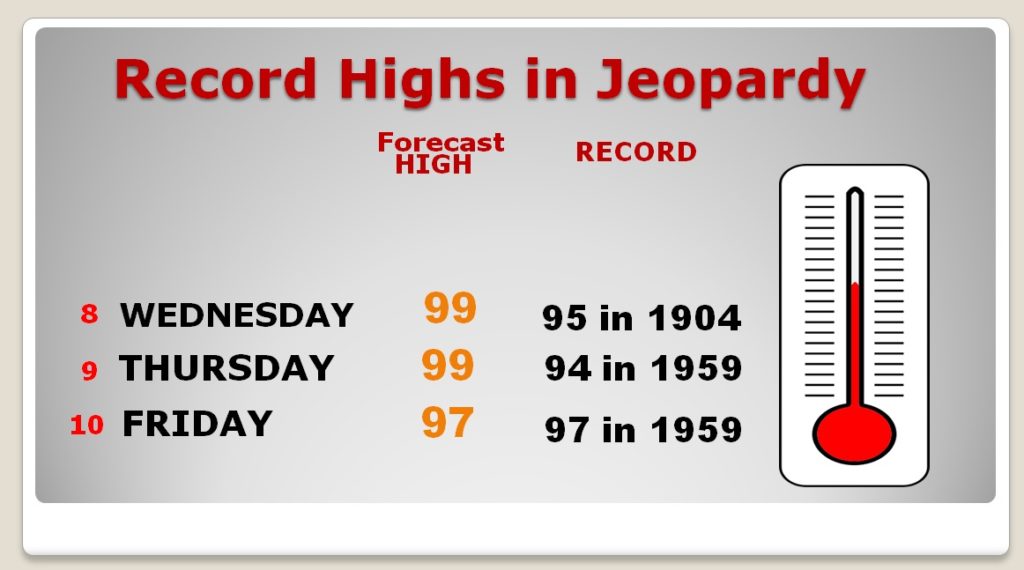
Good morning! The Extreme Heat Streak continues. Yesterday, with 101°, it was the hottest day in October weather history. More record highs will fall today, tomorrow and probably Friday, too, before that streak ends. Hang on! Things will get better. The weekend won’t be quite as hot. And there may even be some spotty showers before the weekend is over. But, all eyes are on an approaching cold front, which will bring band of showers to the state Monday, followed by the big change to much cooler. We’ll look at timing, how much could fall, and how cool will it get after the front. I have a lot of good information on your Wednesday morning video.
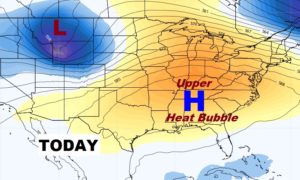
More Record Heat Today. Records will be set from Texas to New England. We’ll easily tease 100 again.
 se
se 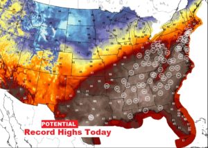
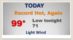
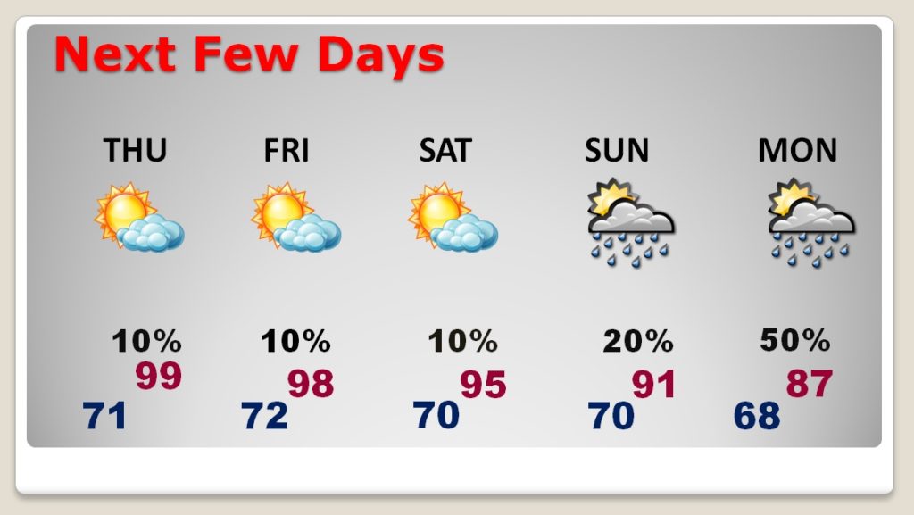
Stupid-hot through Friday as records continue to fall. Still dry. Spotty storms over the weekend as the highs come down a little. A Band of showers moves into the state with the cool front Monday. The Record High stream continues through Friday.
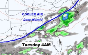
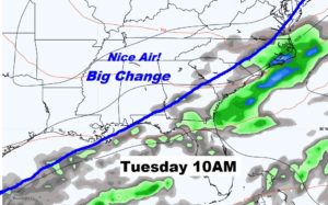
Frontal system enters the state Monday and moves southward through the state Monday afternoon, Monday night into Tuesday morning. The band of showers with the front becomes a little less prominent by the time it reaches south central Alabama. NICE air follows the front. A big change….
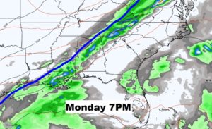
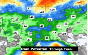
This front will probably not even pout a tiny dent into the drought. Central Alabama rainfall potential perhaps only .20″, with lesser amounts in southeast Alabama. Not good.
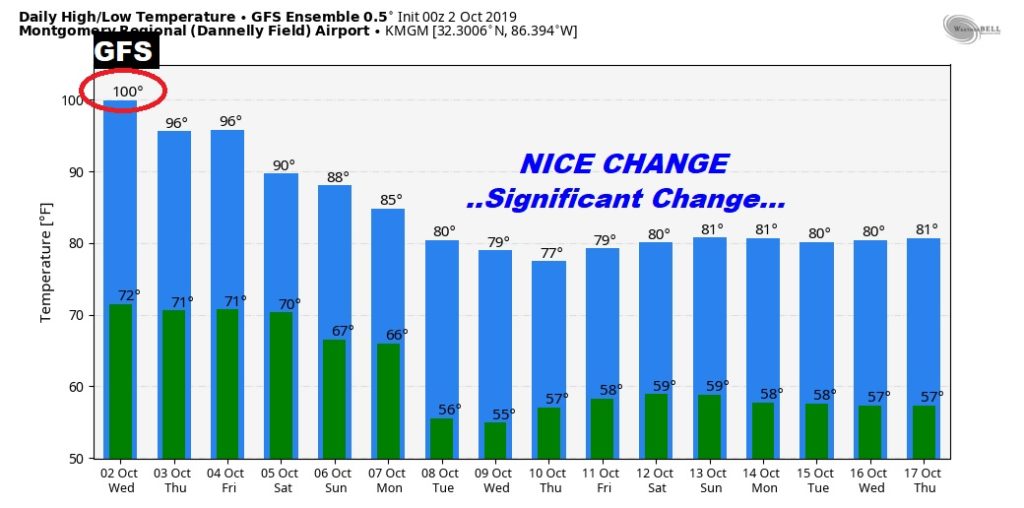
Are you ready for some MUCH cooler air? Get ready. Tee-minus five days now… Here’s the RAW GFS ensemble numbers as a sample.
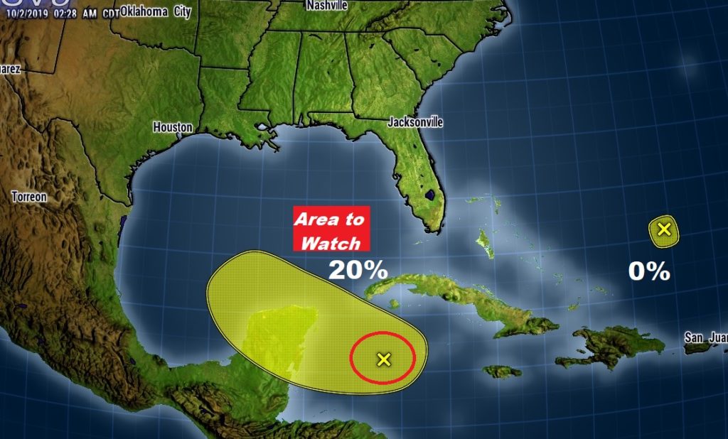
Still monitoring that Area to Watch in our backyard….