The news I have for you this morning is very encouraging. Rain is creeping back into the forecast today and tomorrow. But, we may be in for potentially significant rainfall event Monday night through Wednesday morning. The rain will end as a strong cold front slices through the state. The air behind this front will set the stage for some very chilly nights. Get ready! The next few days will quite different than anything we’ve seen since the Spring.
Set-up today shows Gulf moisture riding up and over cooler air at the surface. That’s called overriding. Scattered showers.
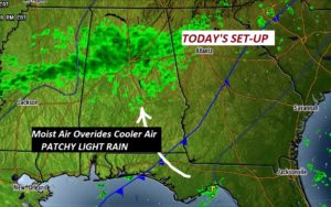
TODAY: Mostly cloudy. Risk of scattered showers, today and tonight. Comfortable. High 76. Low tonight 61. West wind 5 to 10 mph.
TALLADEGA: 50/50 chance of showers during the cup race. High 72. The race begins at 1.
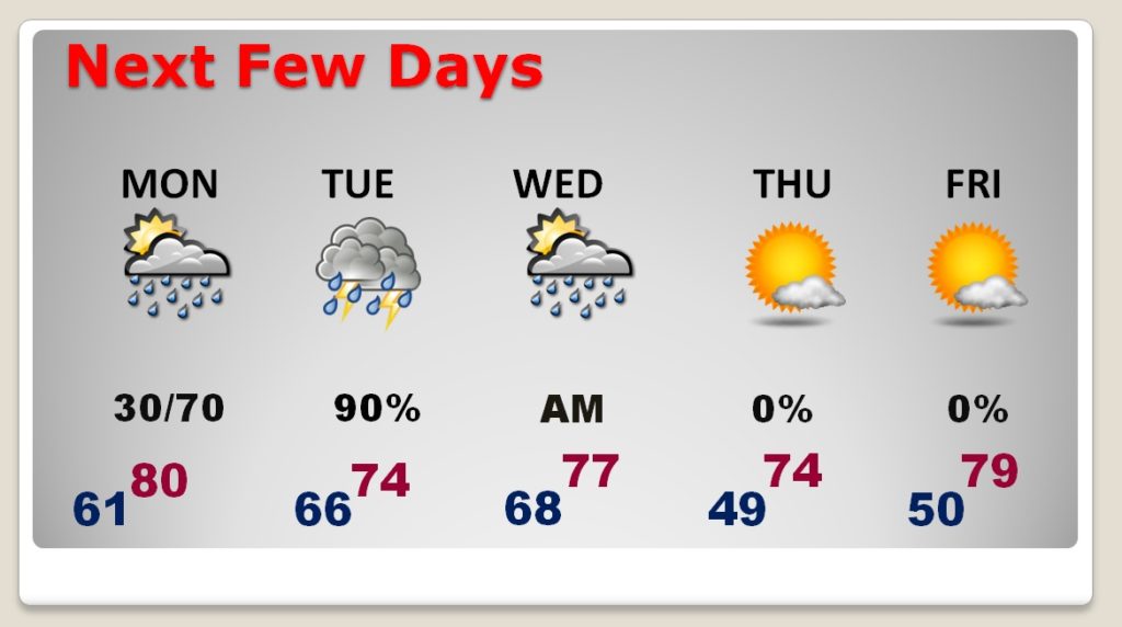
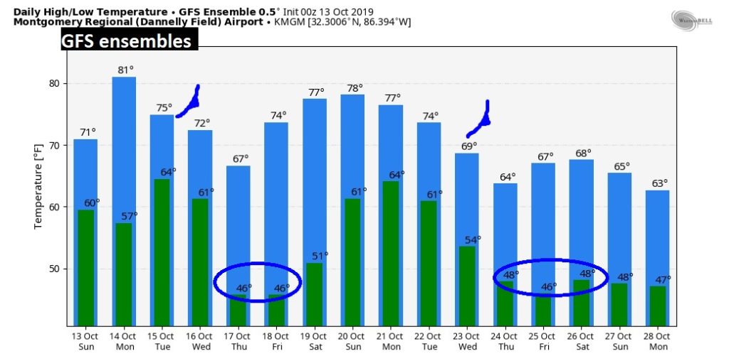
NEXT FEW DAYS: Well, this graphic has been this drama-filled for 6 months. The highlights are – potential for a significant rainfall totals Monday night through Wednesday morning. At this point, I am not expecting severe weather, but there may be some thunder involved. Then, a strong cold front will usher in some much cooler air. Get ready for chilly nights Wednesday night through Friday night. We’ll be watching the Gulf developments to see if Impacts our forecast for next weekend.
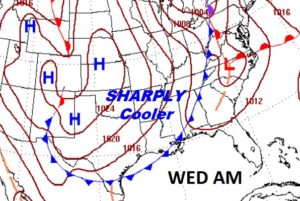
Here’s the position of the strong cold front Wednesday morning that will shut off the rain.
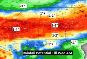
SIGNIFICANT RAINFALL?: Most of us should see 1 to 3” of rain. But, where the heaviest rainfall corridor will set-up is up for debate. The EURO and the GFS models are shifting southward with that band. (a lot of us would love to see that!) The NAM is still farther north near the I-20 corridor, with the heavier band. So, I decided to show you this particular map, because it displays the best blend of model solutions.
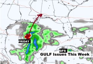
TROPICAL ISSUES?: I don’t want to make a big deal about this at all. But, it is in “our backyard”, so I will briefly note that the GFS tries to develop a tropical low in the western Gulf later this week and track it toward the northern Gulf coast. I’ll leave it at that. Should we worry about that? I don’t see why.
LONGER RANGE: Besides the strong cold front Wednesday, we see another significant cold front somewhere around October 22/23rd. We are getting into a much more active part of our year. Jackets ready?
—
I will have a video update for you first thing tomorrow morning at 4:45AM. Have a nice Sunday! I miss Braves baseball already. And, I could care less about the NFL anymore. Maybe I’ll sample the race from Talladega.
–Rich
