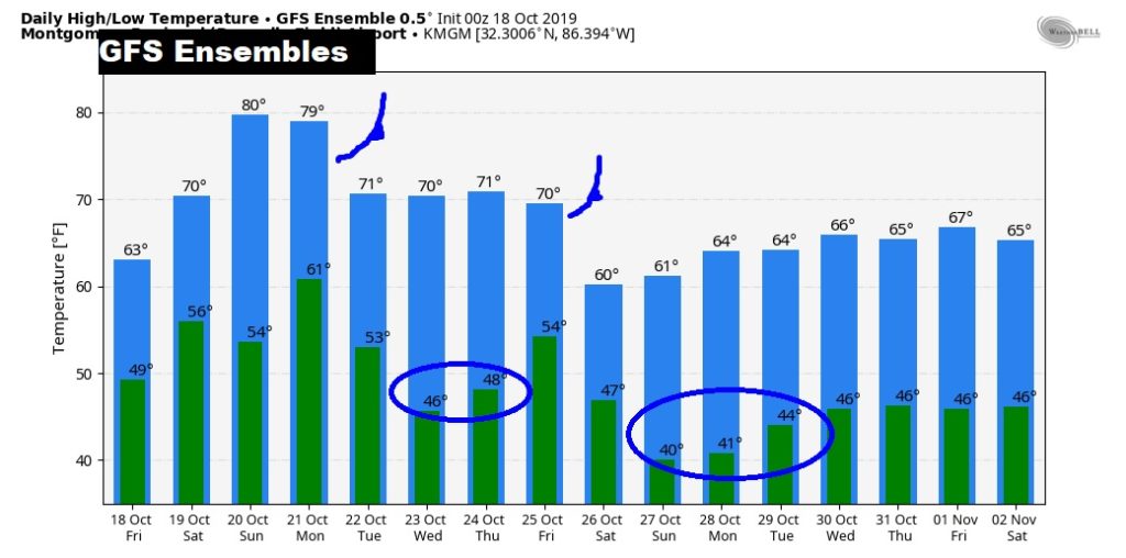
4:00PM UPDATE:
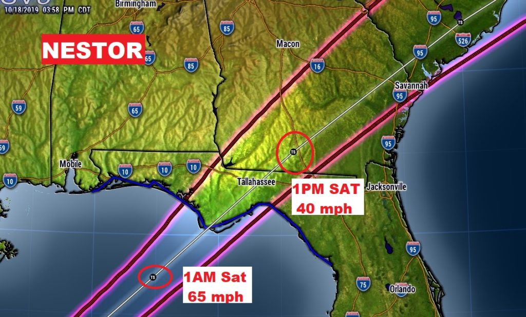
1:00PM UPDATE: NESTOR IS BORN
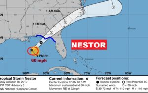
10:00AM UPDATE – POTENTIAL Tropical Cyclone 16
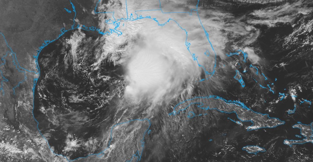
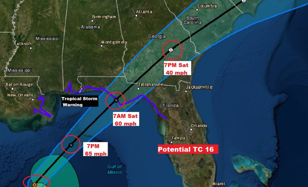
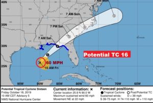
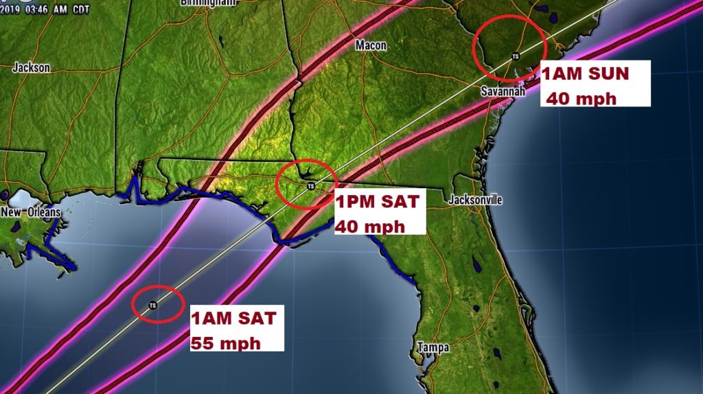
It doesn’t have an official name yet. It’s still classified Potential Tropical Cyclone 16…but it is getting stronger. Winds are now 60 mph, located 395 SW of Panama City moving northeast quickly at 22 mph. NHC says it has a 90% chance of reaching tropical storm or sub-tropical storm Nestor before landfall early Saturday morning on the northwest Florida coast. The system could get a little stronger today before landfall. Then it will move northeastward in through south Georgia and into the Carolinas by Saturday night. Here’s a close up of the NHC forecast cone, with times and intensity. The center line happens to be close to Panama City at 7AM Saturday morning.
EARLY MORNING UPDATE:
Tropical Storm Warning continues on the coast this morning as that Gulf Storm System (Potential Tropical Cyclone 16) gets better organized and heads for a collision with the north central Gulf coast, perhaps early tomorrow morning. For us showers and breezy conditions will begin late tonight and perhaps a good but of the day tomorrow. On this video, I’ll break down the time line. We’ll look at Future Radar and the latest track on this quick moving storm. And, that’s not all. A strong cold front will sweep through Alabama Monday night. Will there be any strong to severe storms? That’s the first of two powerful fronts next week. We have much to discuss.
Latest 4AM Cone and Update from NHC on Potential Tropical Storm 16 (Future Nestor?)
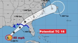
Close up of cone details. Tropical storm warning from the MS/AL line eastward.
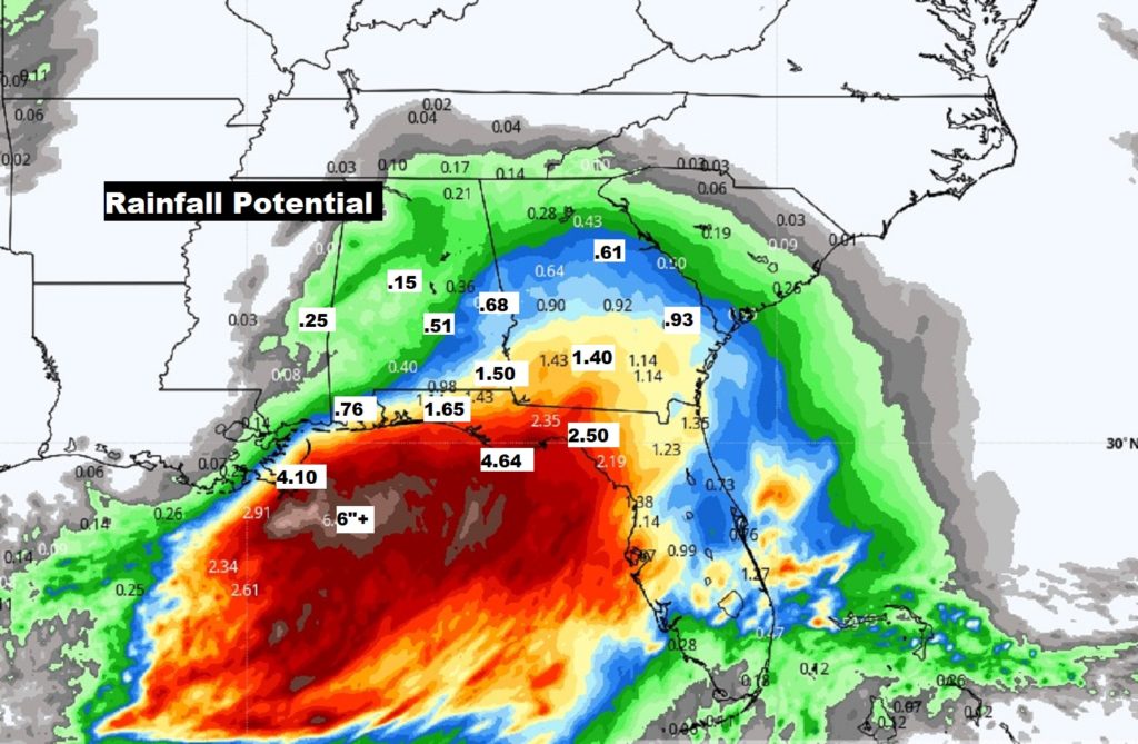
Potential Rainfall varies quite a bit from 4.6″ on the coast to 1.5 in SE Alabama to maybe .50 in Montgomery.
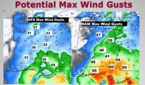
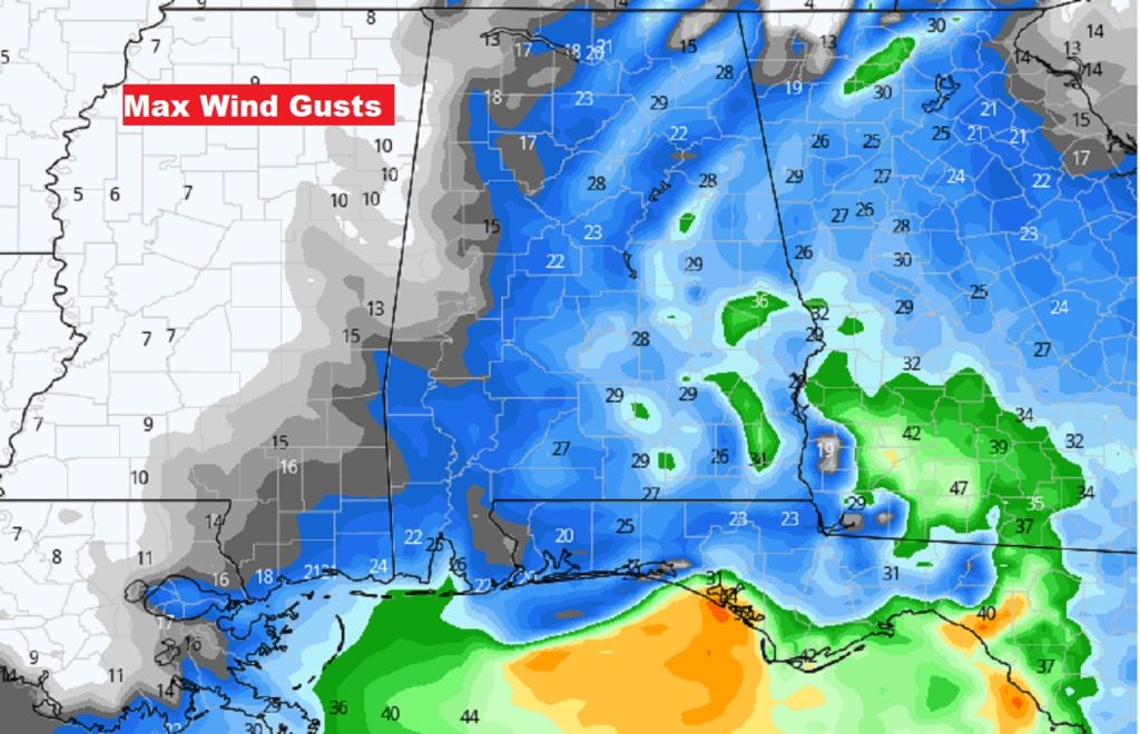
Potential maximum wind gusts. Those green areas in east and SE Alabama are over 30 mph.
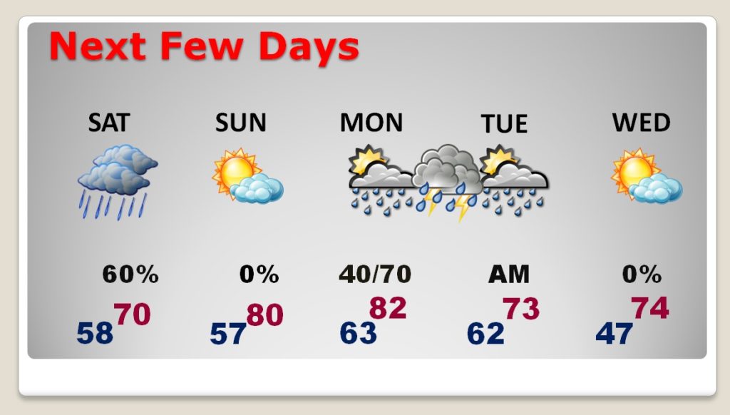
Rain ends sometime Saturday afternoon. Nice Sunday. Strong storms late Monday/Monday night with a cold front. Then much cooler.
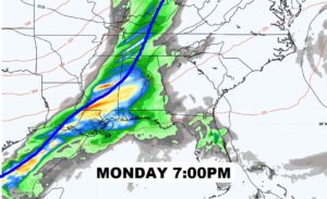
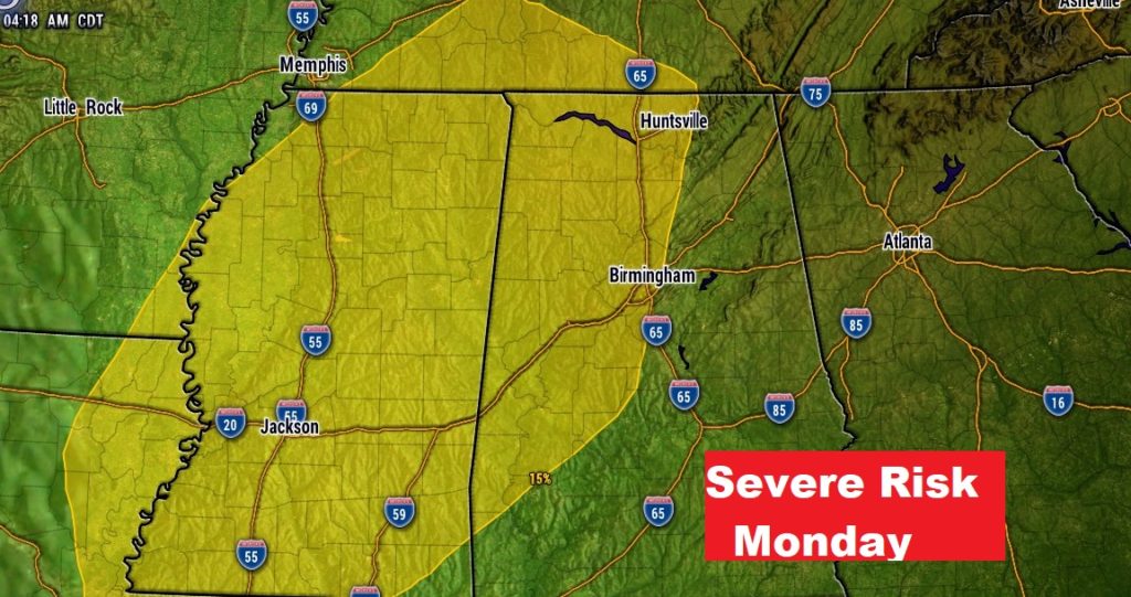
Cold front will bring a line of strong to severe storms to Alabama by Monday evening.
Monday’s Severe Risk.
Another Strong cold front arrives Next Friday Oct. 25th.
