
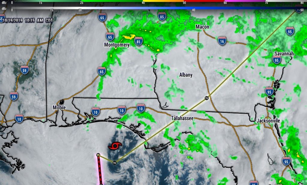
10:00AM UPDATE: Nestor is now Post Tropical. It has lost all of its remaining tropical characteristics, with winds of 50 mph, expected to cross the NW FLA coast this afternoon, now moving ENE at 9. Nice rain bands northward into A
Alabama #alwx
EARLY MORNING UPDATE:
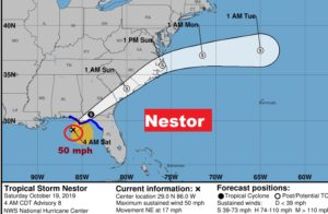
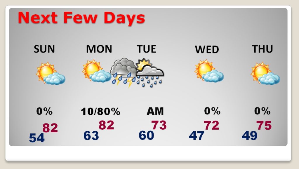
Nestor barely has any tropical characteristics remaining. It’s a very lopsided system with most of the active weather on the east side. At 4AM, Nestor, with it’s 50 mph winds, was located 75 miles SW of Apalachicola moving NE at 17. It will cross the panhandle this morning, and into Georgia this afternoon. The impact on Alabama’s weather will be minimal. Scattered showers, mostly in east Alabama and winds gusting at times 20+ MPH here in central Alabama. A little higher in SE Alabama. Sunday we get a nice weather break, but the next weather threat comes Monday night with a strong cold front sweeping through the state. Severe storms and maybe brief tornadoes are possible. We’re getting into that season.
TODAY: Scattered showers, mainly before 1PM. Breezy. Northeast wind at 10 to 15 gusting 20+. Cool. High 70. Cloudy early tonight, then clearing. Low 54.
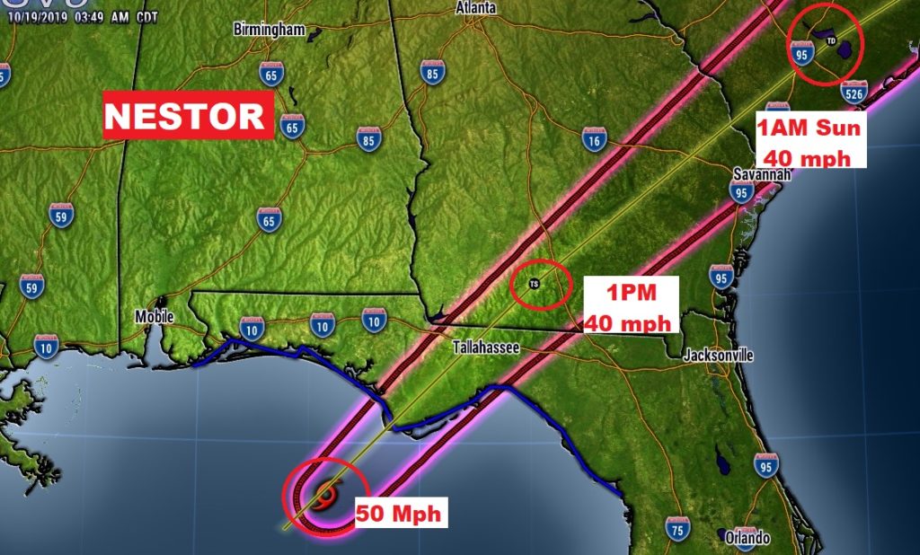
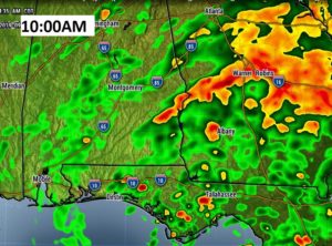
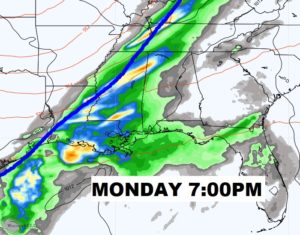
Here’s a Future Radar snapshot at 10:00AM. The most active “squally” weather is in east and SE Alabama, where you would expect it.
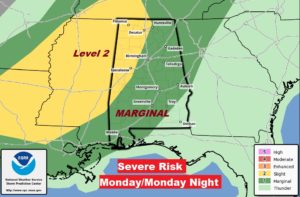
MONDAY NIGHT SEVERE THREAT: The greatest threat for strong to severe storms will be Monday and evening and Monday night. Most of us are in a Marginal Severe risk right now. That could be upgraded to a Level 2 Slight Risk before the front arrives. Damaging wind gusts possible. Brief tornadoes can’t be ruled out. Get used to these occasional severe risks. We’re getting into that time of the year.
.
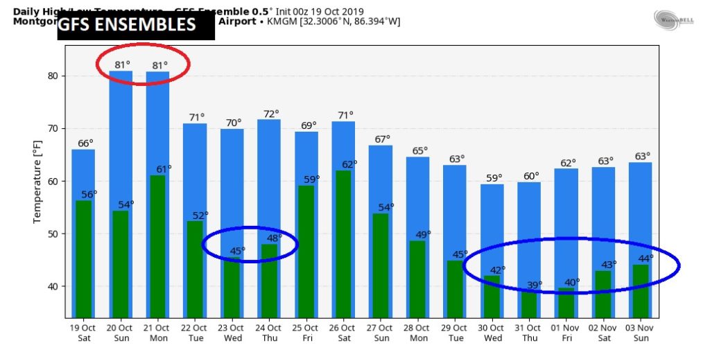
NEXT FEW DAYS: Nice day Sunday. Most of Monday should be dry, too. Low 80’s Sunday & Monday. Severe storm threat Monday night. Showers end Tuesday night as the strong cold front moves into SE Alabama. Chilly nights after the front. Dry for much of the rest of the week.
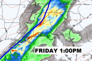
THE NEXT THREAT: Another potent storm system and strong cold front will affect us by next Friday. Could possibly be another severe weather producer. Too early to say. MUCH cooler air will follow.
—
I will have another Blog update tomorrow morning. Have a nice weekend!
-Rich