2:00PM UPDATE:
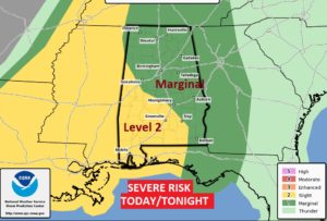
NWS Office in Birmingham is now highlighting an area later this evening from about I-85 southward and east of I-65 for the possibility of stronger storms later this evening as severe weather parameters improve. Damaging wind gusts are the main threat. Tornado threat is not zero.
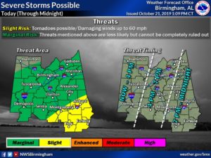
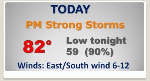
Good Morning! We have a busy day and night ahead, as a strong Cool Front approaches the state. Thunderstorms ahead of the front could become quite strong, and possibly severe. All of the state is in a Severe Risk. The threat is a little higher in south and west Alabama. On this video, I’ll walk you through the details on what to expect and the time line. Some chilly nights are back on the menu this week. How chilly…and which nights? And, we’ll talk about a late week storm system which could affect some weekend plans.
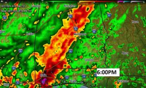
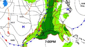
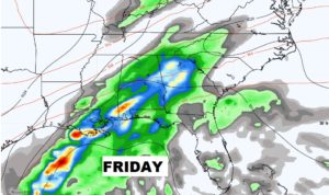
Band of strong storms later today and tonight. Some storms possibly severe by late this afternoon into this evening. Here’s a Future Radar snapshot at 6PM.
Showers and storms by this afternoon and tonight as the strong cold front moves through.
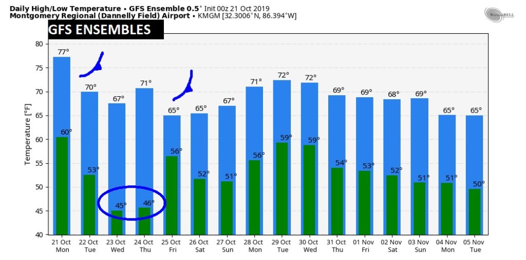
Morning clouds Tuesday give way to afternoon sun. CHILLY on Wednesday and Thursday morning. BEST day of the week Wednesday. Increasing clouds Thursday. Chance of rain Thursday night. Rain and thunderstorms Friday. The weekend is up to debate. One model has the rain threat remaining all weekend. One model clears the rain out. We’ll have to take a middle ground approach for now.
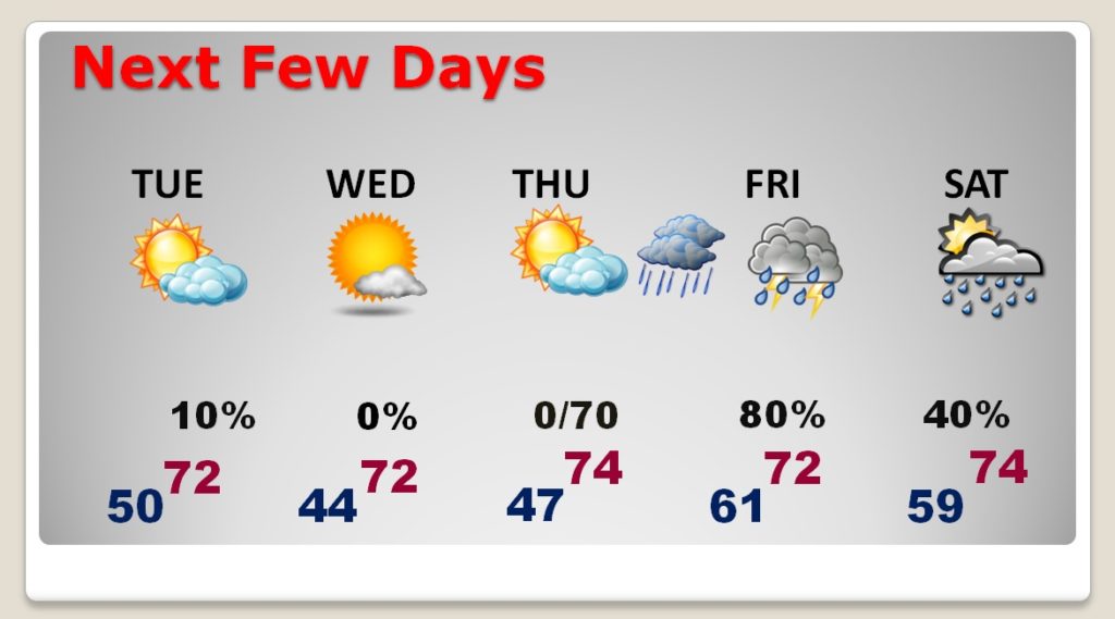
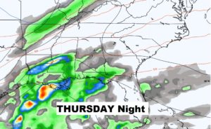
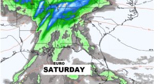
Rain returns Thursday night into Friday. The EURO model keeps us wet during the weekend. The GFS is radically different. It takes the rain away. We’ll see.
GFS Raw temperature guidance for the next 16 days. We don’t look at specific numbers. We’re just looking a trends.