
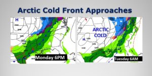
Get ready for a simply beautiful Sunday. Nice afternoon warm-up. But, significant weather change are on the way. Veterans Day will be comfortable, but spotty showers could pop up by afternoon. Rain is likely Monday night as an Arctic Cold front Approaches. The front reaches the are late Monday night, but rain will persist. Tuesday, will be a Windy, Raw, Cold Winter’s day. A shocking change. Get ready for a change of wardrobe. Coats, Hats, gloves, scarves kind of cold. The first freeze for many of us will be Tuesday night as we head for the 20’s. Wind chills will fall to the Teens.
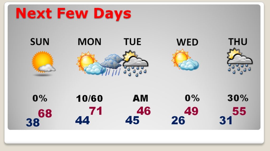
TODAY: After a frosty start, we should see a remarkable warm-up by afternoon. Sunshine will dominate. High in the upper 60’s to near 70. Clouds will begin to increase tonight. Now as cool. Low 43.
NEXT FEW DAYS: Veterans day will be dry in the morning. Rain is likely Monday night as an Arctic Cold front Approaches. The front reaches the are late Monday night, but rain will persist, well behind the front through Mid day Tuesday. Tuesday will be bitterly cold for November. Our high for the day will hover near 44, but you’ll swear its much colder with the strong northwest winds behind the Arctic Cold Front. We’ll be in the mid 20’s by Tuesday morning, but the wind chill will drop to the teens. There will be a second freeze Tuesday night/Wednesday AM. For now, I have removed from the Thursday outlook. A weak Gulf disturbance may stay just south of the area.
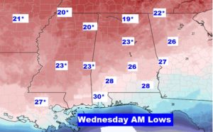
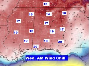
Here’s a look at lows by Dawn Wednesday morning. Record lows will be common across the Deep South. For many of us, it will be the first freeze. Wind chills could fall to the teens by Wednesday morning.
—
I will have a video update for you first thing tomorrow morning at 4:45AM. We have MUCH to talk about. Have a great Sunday!
–Rich