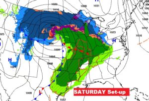
Happy Thanksgiving! Our holiday forecast couldn’t be better. But, many, many Americans are dealing with harsh weather, as a series of powerful storm systems march across the nation. We, fortunately, are in a “nice spot” between the storm systems, for now. We are keeping close tabs on that next storm. I’m afraid we will have to deal with a Severe Weather Threat Saturday evening, and overnight Saturday night. December begins Sunday. A cold front arrives Sunday. It will turn sharply colder late Sunday and Sunday night. Monday will be a cold, raw day. Change of wardrobe again, but hopefully for just a couple of days.
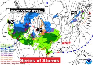
Coast to coast…here’s the complicated storm set-up on this Thanksgiving.
TODAY: Beautiful! Sunshine will dominate. We start in the 40’s at sunrise, and end up in the middle 60’s this afternoon. (Normal high is 65, low 41) Mostly clear tonight. Low 45. Enjoy! This is a treat, compared to the weather elsewhere.
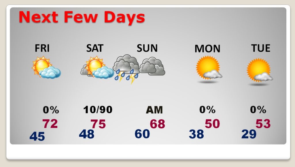
NEXT FEW DAYS: Our great weather continues on Black Friday. A warming trend will take us into the low 70’s Saturday, we’ll be in the middle 70’s as clouds increase. The severe threat will be Saturday evening and overnight. Sunday will be a day of falling temperatures. Sharply colder for Sunday night and Monday. Cold Tuesday.
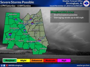
SEVERE WEATHER THREAT: Right now it appears the window for Saturday evening’s Severe Weather Threat could begin as early as 6PM. The threat will continue in the overnight hours through about 6AM in the east and southeast counties. All modes of severe weather are expected.
The Severe Weather Threat area from the local Birmingham NWS office shows the threat area covering all but for eastern and NE Alabama. I think this is a more realistic assessment. Brief tornadoes are possible, along with damaging wind gusts to 60 mph.
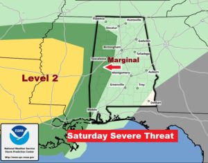
Right now, the Saturday severe weather threat graphic from the Storm Prediction Center (through 6AM Sunday), only includes the western counties. It’s very possible (if not likely) their risk area will be expanded as we get closer to this event. Stay tuned. We’re monitoring.
Here’s the Saturday Storm-set-up. Once again this powerful storm system will have a huge impact on holiday travel.
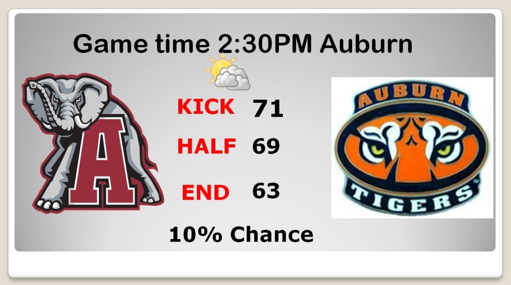
IRONBOWL GAME FORECAST: It’s a great gameday forecast! For those tailgaters, the morning low in Auburn will be 48°. We will see a nice recovery during the day, with a sun/cloud mix. I think the high could reach the low 70’s I’ll keep rain the rain chance in the 10% range. Fortunately, it appears that next big storm system will not arrive until Saturday night. Winds will be southerly 6 to 12 mph. A phenomenal forecast, when you think about Irowbowl game weather history.
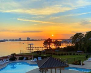
HAPPY THANKSGIVING: Hello from the Alabama Gulf Coast! I have booked a famous Thanksgiving Buffet meal down here today. I hope, wherever you are, you and your family and friends have a wonderful Thanksgiving! Enjoy this beautiful weather. Many areas of the nation are suffering through very harsh weather. Here’s a snapshot of sunset here in Orange Beach on Thanksgiving Eve.
I hope you and your family have a very happy Thanksgiving. I’ll have another Blog update in the morning, as we monitor that weekend storm system. Enjoy this beautiful holiday.!
–Rich
