Good Morning…on a sub-freezing early December morning. Although today will be chilly, the wind will not be as much of factor. On this video, I’ll bring you up to date a bit of a warming trend in our future. I have an update on that next storm system late week. Will it affect the weekend? And the next Arctic Blast looks pretty impressive. It’s only about a week away. Looks like a huge temperature plunge is in our future again.
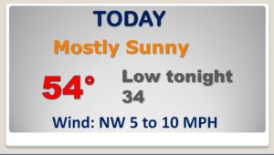
Today will be way below normal for December, but we’re looking ahead to slow moderation starting tomorrow
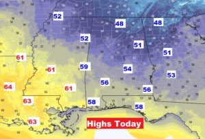
Today’s highs across the region…
We’ll warm back to the mid 60’s by Thursday. Chance of rain late Thursday night into Friday. Another chance of rain Sunday.
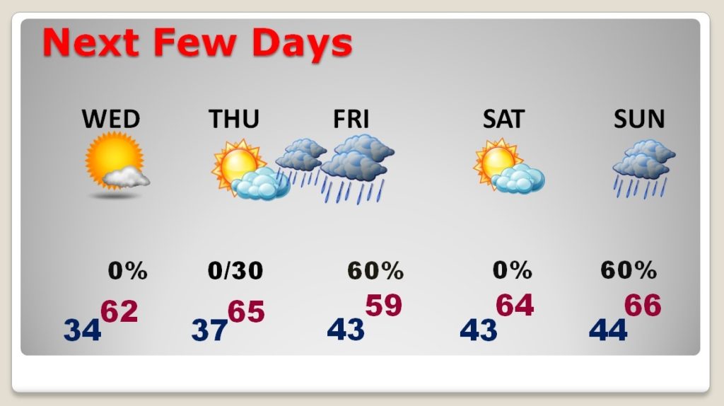
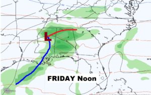
Showers are likely Friday…but no severe weather.
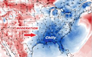
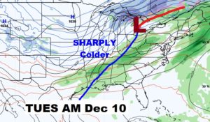
Important frontal system sweeps across the state a week from today, with showers & storms ahead of it and drastically colder air behind it.
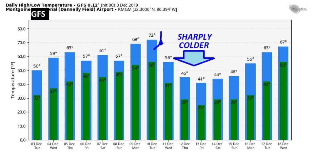
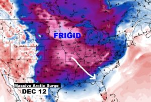
Look at the alleyway of Arctic Air barreling straight down from Canada and headed for the Gulf coast. Wednesday December 11th will be a day of plunging temperatures. Here’s s snapshot of Thursday morning December 12th.
This ia raw model temperature guidance. Don’t focus on specific numbers, but look huge drop by the middle of next week. Looks like this time it could stick around for a few days… We’ll see.