Good morning! Temperatures are near freezing at Dawn, but sunshine will help warm us up well into the 50’s by afternoon. And, the warm-up continues on Monday. It should be a great start to the week. Except for a mid-week “set-back”, much of the week ahead will be mild to warm. But, now, the next big storm system has our attention, already. Already the Storm Prediction Center has us in a Severe Weather Risk by Saturday. It’s significant when they issue a risk so many days in advance. It certainly has our attention. More below.
TODAY & TONIGHT: After the morning fades, we should see a nice recovery. Sunshine will dominate. High 56-59. (Close to normal) Not as breezy as yesterday. West wind 5 to 10. Clear & chilly tonight. Low 36.
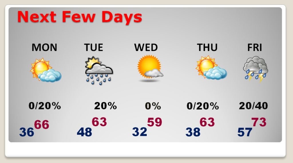
NEXT FEW DAYS: Monday will be nice. Sunny and warmer, well into the 60’s. The next cool front will briefly bring us cooler air by mid-week, but temperatures will quickly rebound late week. We’ll be in the 70’s Friday, with the initial round of showers ahead of that next big storm system.

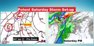
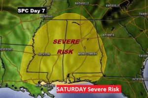
SATURDAY SEVERE WEATHER THREAT: It’s a pretty big deal when the Storm Prediction Center issues a Severe Weather Risk 6-7 days in advance. It’s very rare. Alabama will be a warm & humid airmass Friday and Saturday, as a significant storm system approaches. Right now, based on current long-range models, it appears Saturday and Saturday could be prime-time for a severe weather threat, including tornadoes. As this week transpires, on my morning videos, we’ll focus on the storm systems as details and timing of the next ‘big ticket’ storm system become clearer. Stay tuned. Here’s the map set-up on Saturday and Saturday afternoon.

The Storm Prediction Center issues a rare Day 7 outlook for Saturday. When we get three days out, various threat levels will become will be issued.

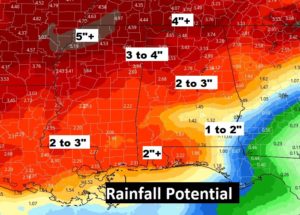
Once again, like last week, rainfall amounts could be significant.

—
I will have a video update for you first thing tomorrow morning. It should be online by about 4:45AM. Have a nice Sunday!
–Rich
