
Happy Leap Day! The weekend news is simply great! The morning chill will fade into a nice afternoon recovery. We’ll be close to seasonal normal. Sunday will be warmer as we tease 70.
The Warming trend continues Monday through Wednesday, but the trade off will be the risk for scattered showers returning. In fact, a series of disturbances will drift through the area. That will set up the potential for excessive rainfall totals across Alabama and the Deep South this week, again. But, will we be dealing with a Severe Weather Threat by Wednesday? That threat is unclear at the moment. It’s dependent on many factors which are still unclear.
TODAY AND SUNDAY: Sunshine will help the morning chill fade. The average high for this date is 65. Today I think we’ll be near 63. Not bad! Nice Day. Chilly tonight…low 38. (Normal 42) Warmer Sunday. GREAT DAY, on the First Day of March. High near 70. Enjoy this great weekend.
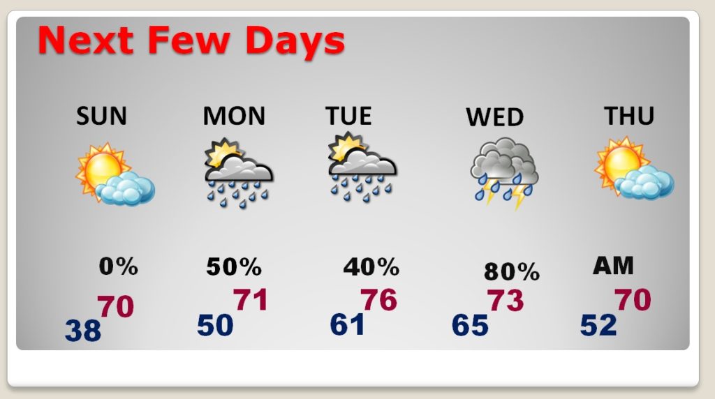
NEXT FEW DAYS: The warming trend will continue. Tuesday appears to be the warming day with mid 70’s. Scattered showers Monday and Tuesday. Greatest risk of heavier rainfall and potential thunderstorms Tuesday night, Wednesday until Thursday morning. More on that below.
HEAVY RAIN POTENTIAL – SEVERE WEATHER RISK?: The details of the week ahead are complicated, as a series of Low pressure disturbances and fronts swing through the area. Look at the rainfall potential map below. Rainfall amounts could be rather significant on this first week of March.

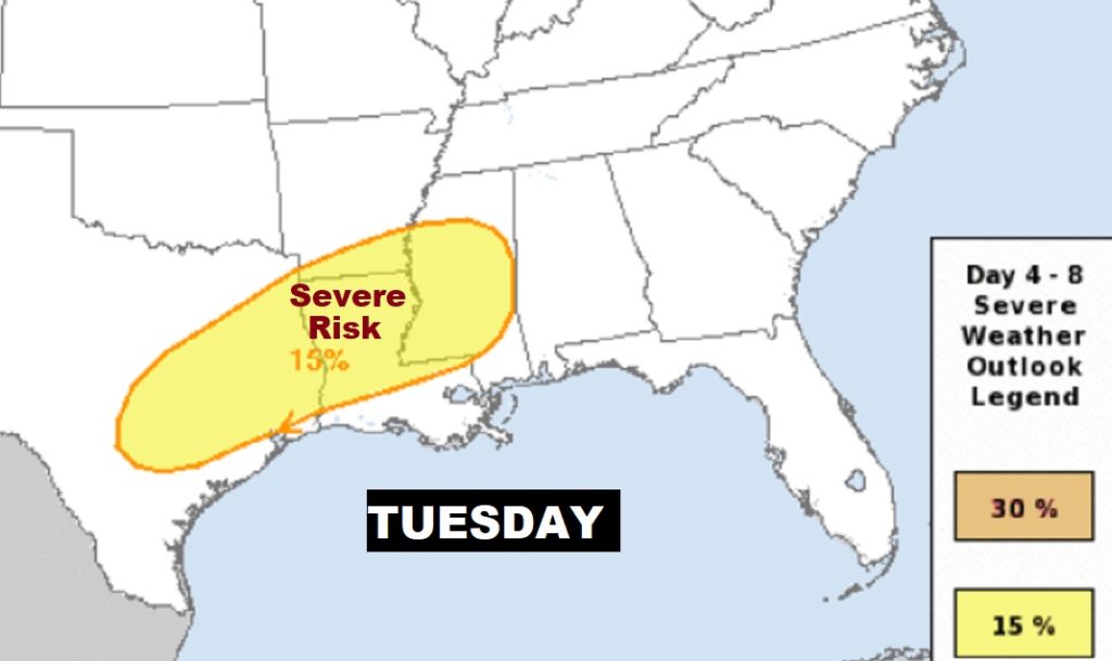
But, what about the Severe Weather Threat? Currently, the Storm Prediction Center has outlined a severe weather risk just west of us for Tuesday. But, they are unsure about the parameters in our state on Wednesday at this time. IF we do see severe weather, the best chance appears to be daytime Wednesday into Wednesday evening. We will continue to closely monitor that potential as we get closer to mid-week. Right now severe weather is a MAYBE.
Here’s the set up on Wednesday and Thursday. The front that moves through early Thursday will end the rain threat.
—
I’ll have another Blog update for you in the morning. Have a nice Weekend. Happy Leap Day!
-Rich